Early Los Angeles City Views (1900 - 1925)
Historical Photos of Early Los Angeles |
 |
|
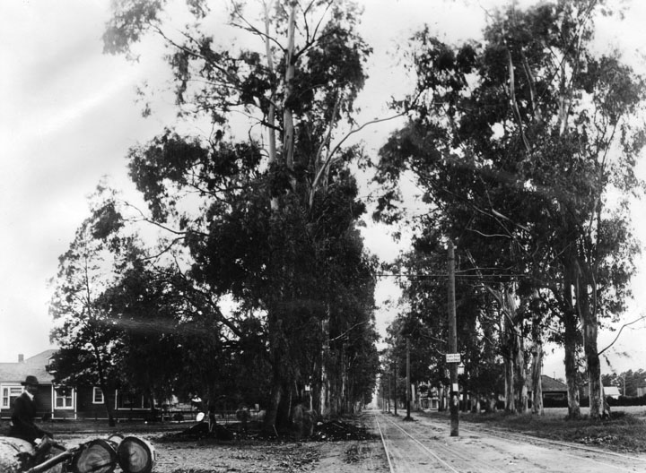
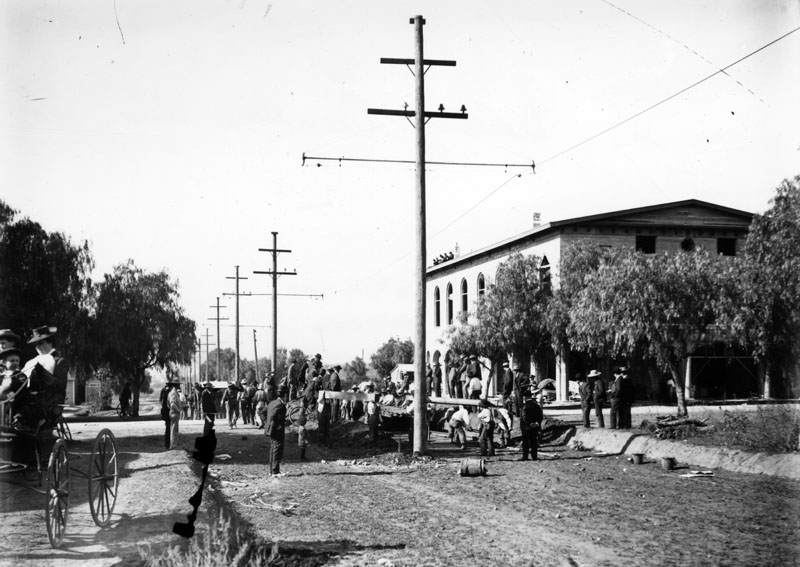
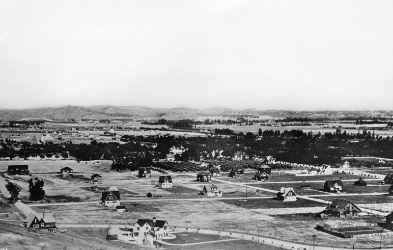
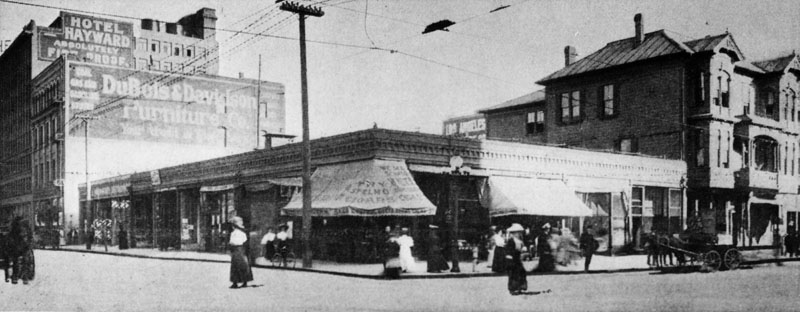
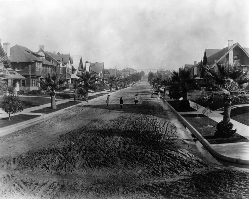
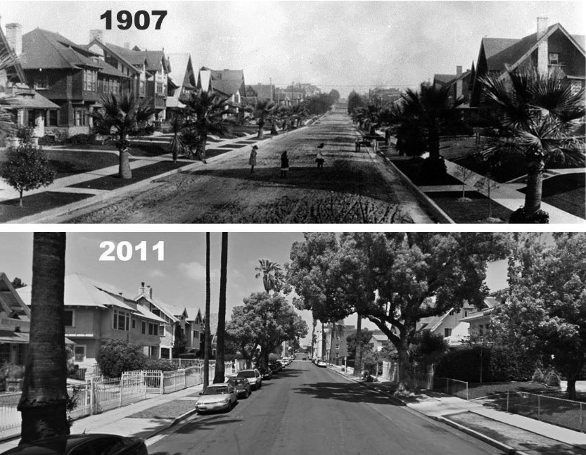
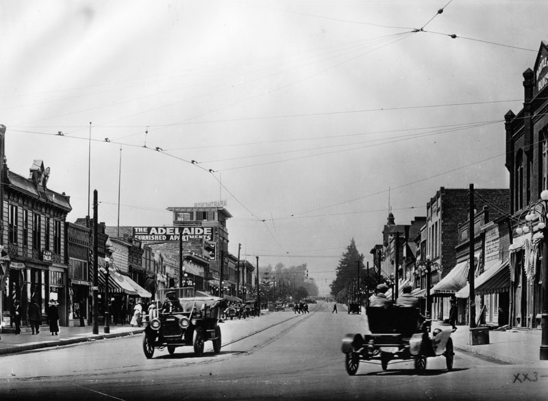
| (1902)^ - Tree-lined, unpaved Santa Monica Blvd. at Western looking west in 1902. House on the left is on the southwest corner. A few houses are shown along with a man sitting on a log. Santa Monica Blvd., with a pole line running down its center, looking very narrow in comparison to how it looks today. Click HERE to see contemporary view. |
Western and Sunset
.jpg) |
|
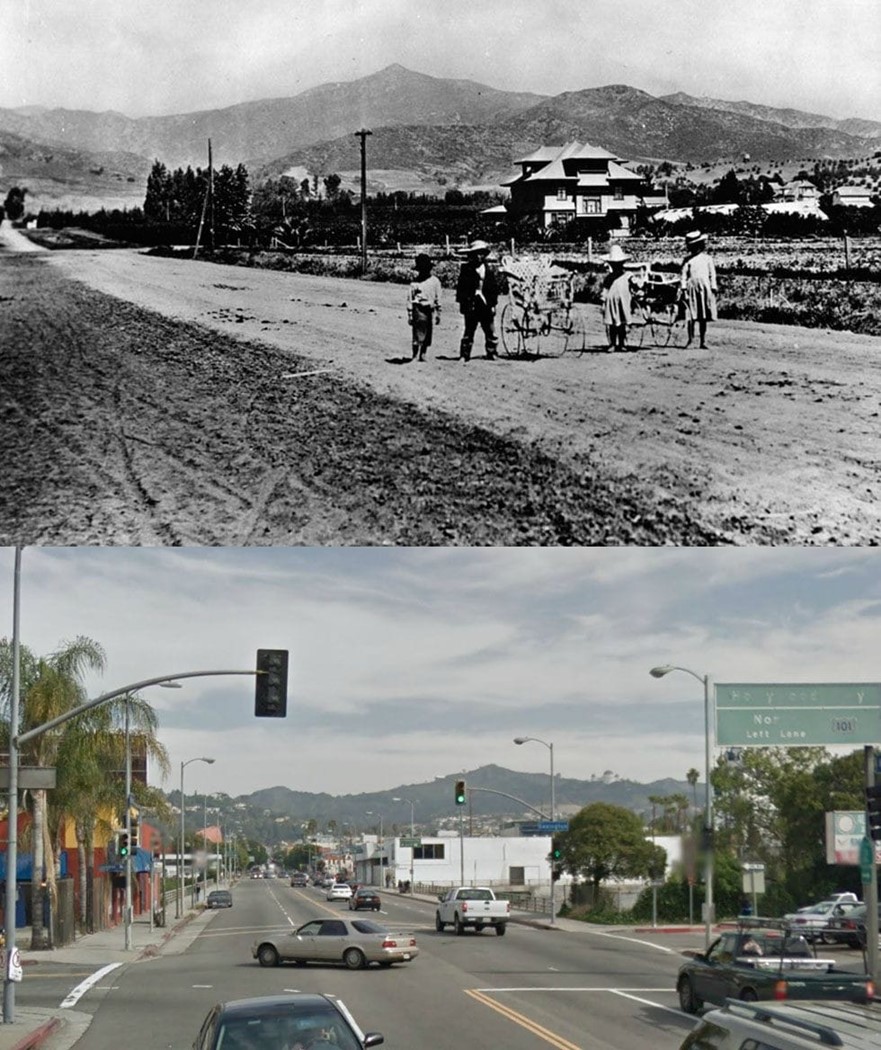
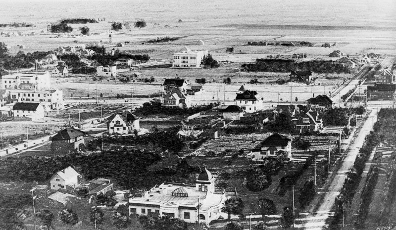
| (1905)* - View of Western Avenue south of Sunset Boulevard. The ornamental house seen in the background belonged to the Hampton family. Four children, two boys and two girls, stand along the road (Western Avenue) posing for the camera with Mt. Hollywood seen in the background. Click HERE to see contemporary view. |
Historical Notes The highest peak in the background is Mt. Hollywood with an elevation of 1,657 feet. |
Then and Now
 |
|
| (1905 vs. 2018) - View of Western Avenue south of Sunset Boulevard. |
Click HERE to see more in Early Views of Hollywood (1850 - 1920) |
* * * * * |
Eagle Rock
 |
|
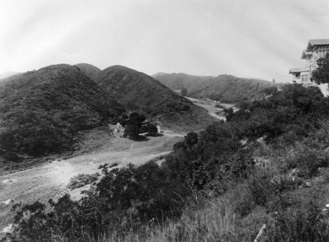
| (ca. 1906)^ - Panoramic view looking northeast into the Eagle Rock Valley, as it was known in the 1900s. A large boulder appears protrude out from the hills (upper right) in the background. |
Historical Notes Eagle Rock derives its name from a massive boulder at the district's northern edge (visible in the upper right). The boulder contains an indentation that creates an eagle-shaped shadow everyday around noon. In the 1880s Eagle Rock existed as a farming community with grand Victorian farmhouses and many exquisite Craftsman homes in charming neighborhoods.^ |
 |
|
| (Early 1900s)^ - Panoramic view looking east into the Eagle Rock Valley where farming predominates in the landscape. |
Historical Notes In 1906 Eagle Rock became an independent city and was incorporated in 1911 with a population of approximately 600; in 1914 it also became home to Occidental College, designed by famed architect Myron Hunt. In 1920, population had grown to 2,250. Just one year later, in 1921, this figure had leaped to 3,800. In the 1950s, newer streets were extended into the hillsides and larger homes boasting views of the city were built. Since then, the city has been experiencing gentrification as young urban professionals discover this gem between Glendale and Pasadena, minutes away from downtown Los Angeles. By 2005 Eagle Rock's population was approximately 27,875.^ |
 |
|
| (ca. 1905)^ - The Gates Ranch in Eagle Rock. |
Historical Notes The Gates Ranch ran from Yosemite Drive and Eagle Rock Blvd. to about Chickasaw, and east to the hills past Maywood, and beyond Maywood along Yosemite Drive. The ranch raised mostly strawberries. |
 |
|
| (1915)^ - Panoramic view of Eagle Rock valley, as it was known in the 1900s, looking south and east from the hills in back of Hill Drive. Colorado Boulevard, a major east-west thoroughfare, can be seen running along the middle of the photo. The streets running in a north-south direction are possibly (l to r): Dahlia Dr., Townsend Ave., Vincent Ave., Mt. Royal Dr., La Roda Ave., and Argus Drive. |
 |
|
| (1910)* - Birdseye view of Eagle Rock. |
 |
|
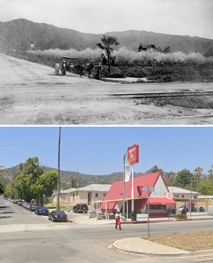
| (1911)^ - Photo taken at the intersection of La Roda Ave. and Colorado Blvd., looking north toward Scholl Canyon. One man and two women stand at the corner next to a horse-drawn carriage; a plum tree orchard with trees in blossom is visible behind them. The very spacious dirt roads show the east/west direction of trolley tracks in the foreground. |
Historical Notes A "Dinky" ran from Glendale to the center of Eagle Rock for nearly twenty years on double tracks, later "Toonerville Trolleys" ran on single tracks.^ |
Then and Now
 |
|
| (1911 vs 2022)* – Looking at the NE corner of La Roda Ave. and Colorado Blvd. in Eagle Rock where an Original Tommy’s Hamburgers stands today. |
 |
|
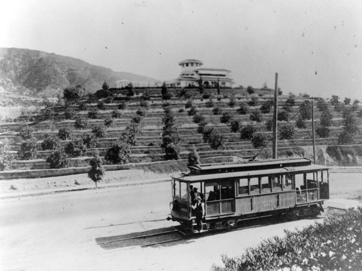
| (1914)^ - View of the "Dinkey" that ran from Glendale to the center of Eagle Rock for nearly twenty years. |
Historical Notes This photo shows the earlier double track type; later cars ran single track, "toonerville trolleys." The Bessolo residence is in the background.^ |
 |
|
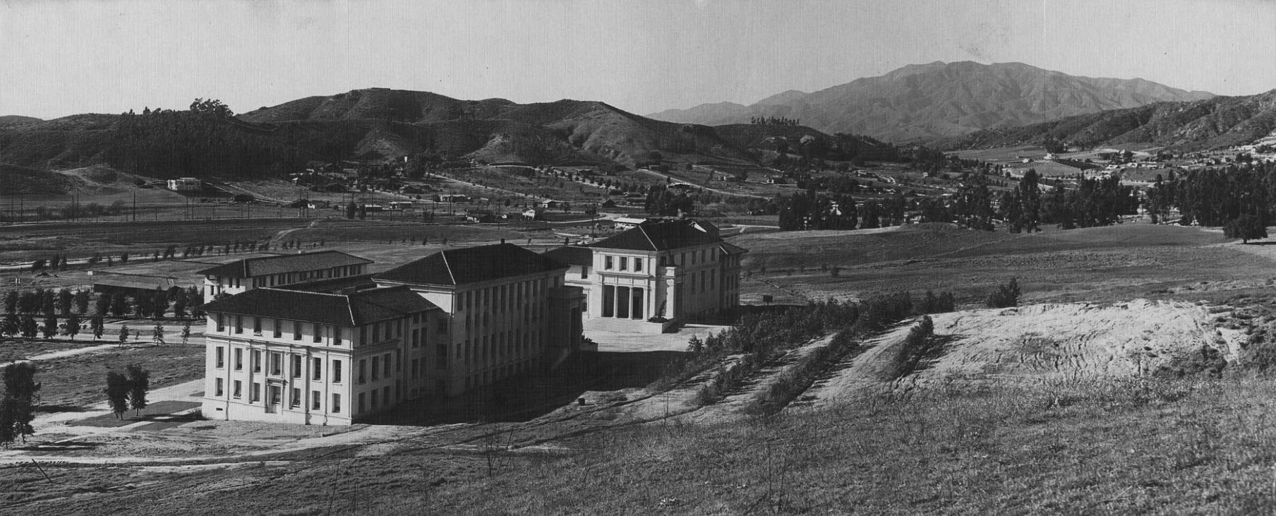
| (1916)* – Panoramic view looking NW showing the Occidental College campus. |
Historical Notes The new Eagle Rock campus was designed by noted California architect Myron Hunt, also known as the planner of the Caltech campus and as designer of the Huntington Library and Art Gallery and the Rose Bowl. This was Occidental College's 3rd campus location. 1st location was Boyle Heights (1888). 2nd locatiion was (1898-1914). Click HERE to see more. |
 |
|
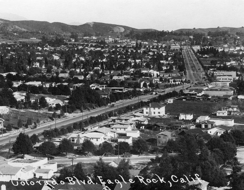
| (1920s)^ - Panoramic view looking northeast along Colorado Boulevard, which is a major east-west thoroughfare that runs through Eagle Rock; commercial buildings and residential homes are on either side. |
 |
|
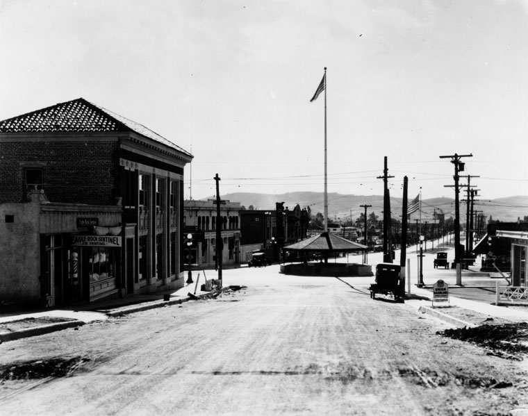
| (1920s)^ - View of the "Merry-Go-Round" Pavilion at the intersection of Colorado and Eagle Rock boulevards. |
Historical Notes In 1921 a circular pavilion nicknamed "The Merry-Go-Round" was built in the center of the city at the intersection of Colorado and Eagle Rock Blvd (seen toward the right, where the street bends). This structure was to shelter and protect streetcar travelers; it was razed in the 1930s as automobile traffic became heavier.^ |
 |
|
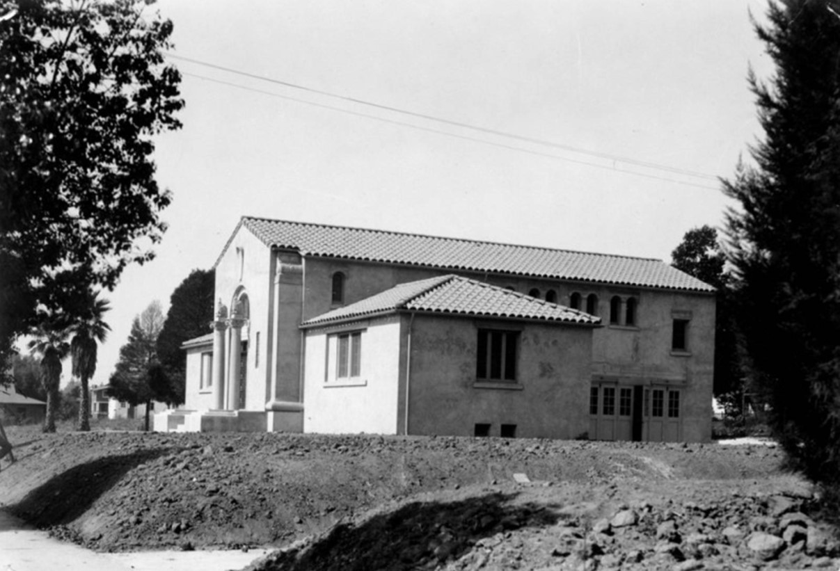
| (1922)* - Eagle Rock City Hall, probably at time of completion in 1922 because the grounds are not yet landscaped. |
Historical Notes The arrival of Owens Valley water via the Los Angeles Aqueduct and the concurrent depletion of the young city's wells ultimately led the city fathers to agree to annexation by Los Angeles in 1923. Eagle Rock is one of the few cities incorporated by Los Angeles to still have its original pre-annexation City Hall (2035 Colorado Blvd.) and Library (2225 Colorado Blvd.) still standing. Click HERE to see Contemporary View. |
 |
|
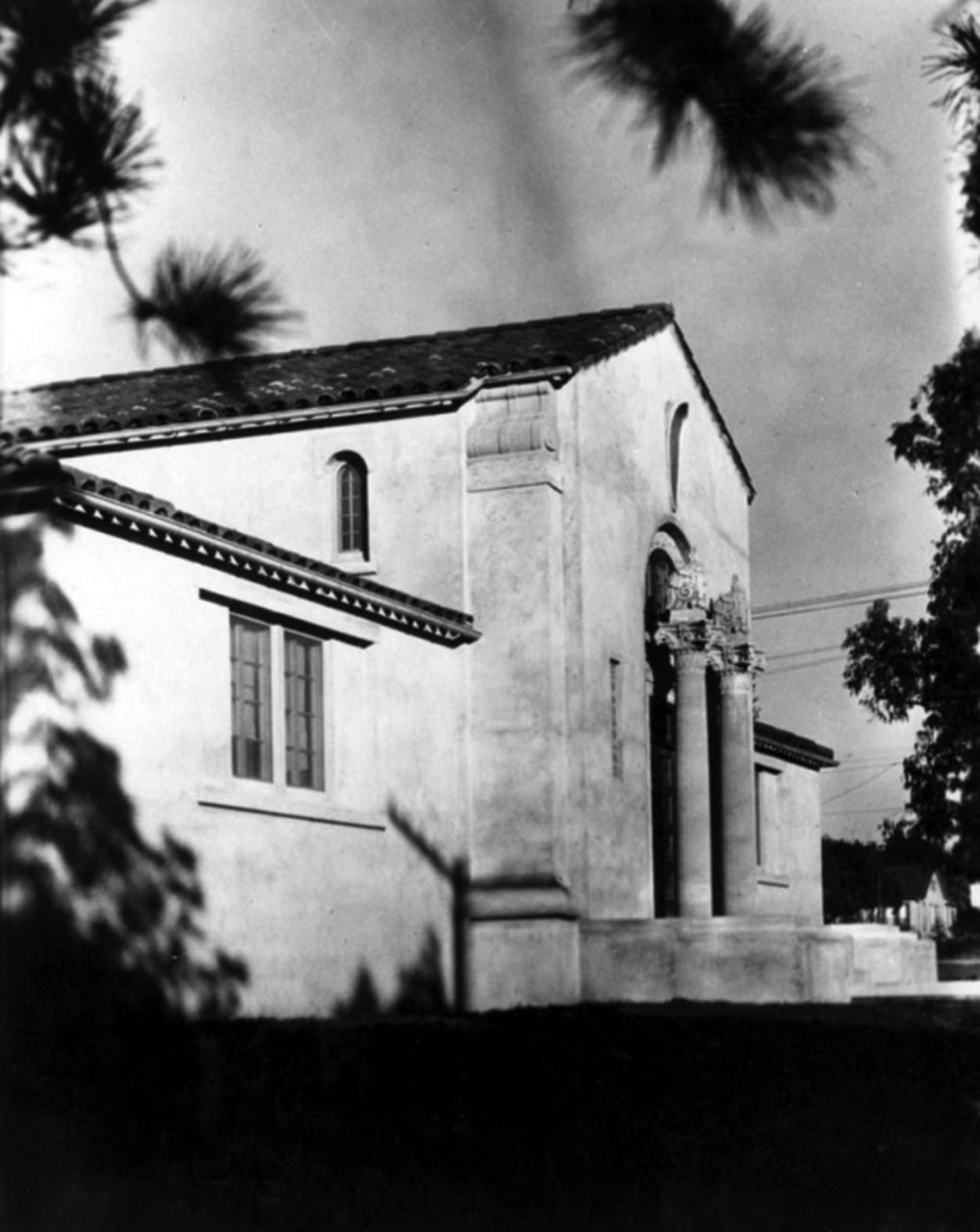
| (1923)* – Eagle Rock City Hall, showing detail of facade and front entrance. It was built in 1922 and was designed by architect William Lee Woollett. |
 |
|
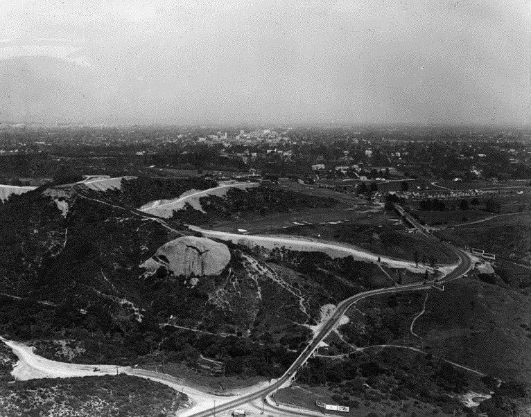
| (1925)^ - View looking east east toward Pasadena showing the outline of a flying eagle on the face of a massive boulder that locals call "The Rock". Created from local hot springs millions of years ago, this impressive rock looms above the valley below, creating an eagle-shaped shadow every day around noon. |
Historical Notes In the mid to late 1770s, Native Americans inhabited the caves at the base of The Rock, formerly known as La Piedra Gorda (which translates to "Fat Rock"). 100 years later, in 1874, desperadoes used these same caves, including the infamous bandit Tiburcio Vasquez, who was said to have used The Rock as a hideout and to store his loot. |
* * * * * |
Glendora
 |
|
| (1906)^ - Several men stand and watch as numerous others work diligently digging holes, stringing trolley wire, and laying ties and rails for the Pacific Electric "Red Cars" that would arrive into Glendora a year later, in December 1907. |
Historical Notes The PE tracks entered Glendora from the west and generally paralleled those of the Santa Fe until reaching Grand Avenue, at which point they veered north and followed Electric Ave. (now Mountain View) to the Station. Glendora residents purchased the land for the right-of-way for $35,000; the PE served the city until service was discontinued in 1951. Glendora was founded on April 1, 1887 by George D. Whitcomb and was officially incorporated as a City in 1911. In the mid-1930s, nearly all of the city's 4,500 acres of land were cultivated for citrus fruit; by the late 1950s agriculture had given way to large-scale residential development.^ |
 |
|
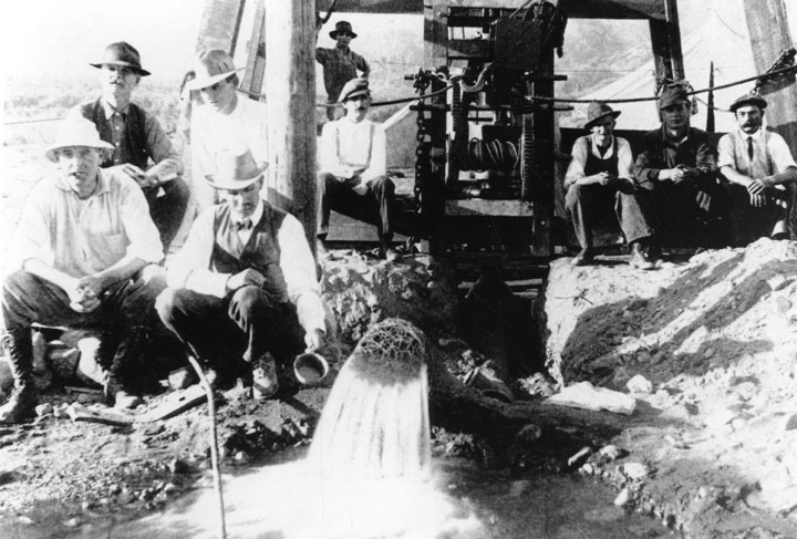
| (1915)^ - A party of men sets down to look at the first municipal water well after the incorporation of Glendora. Located at Sierra Madre and Lorraine Avenues. |
Historical Notes Water was the major problem in early-day Glendora. The above photo shows the city's first well, brought in in 1915. It was located at the intersection of Lorraine Ave. and Sierra Madre Ave. and was 450 feet deep.^ |
* * * * * |
Hollywood
 |
|
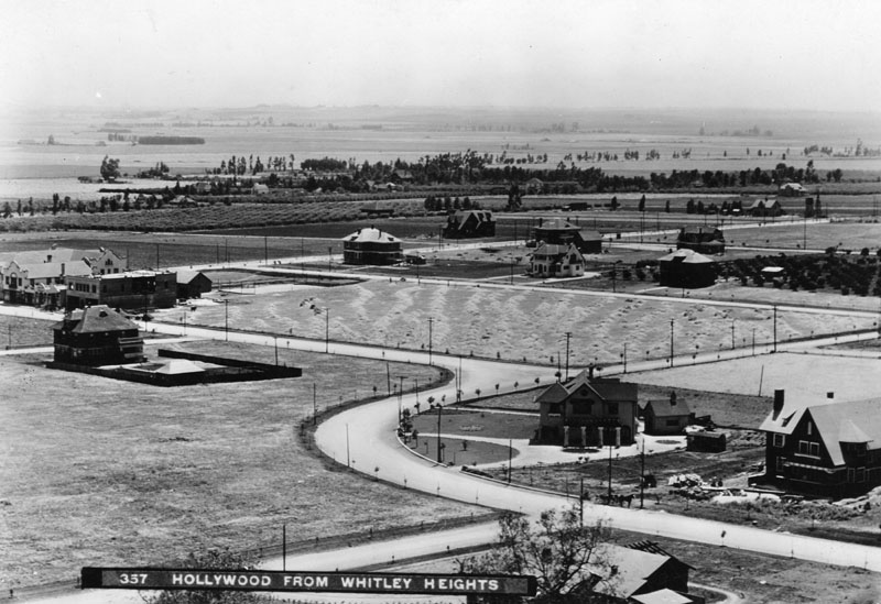
| (ca. 1903)^ - Panoramic view of Hollywood from Whitley Heights circa 1903, looking southwest toward Highland and Franklin Avenues. The neighborhood is dotted with homes. The curved configuration of Highland between the East and West sections of Franklin Ave still exists today. The larger structure, seen on the left side of the photo, is the famous Hollywood Hotel. It is situated on the Northwest corner of Hollywood Blvd. and Highland Ave. |
Historical Notes Whitley Heights was named after Hobart Johnstone Whitley. H.J. Whitley was a real estate developer who helped create the Hollywood subdivision in Los Angeles and is known as the "Father of Hollywood". He and his wife, Margaret Virginia (Gigi) Whitley named the town while on their honeymoon in 1886.*^ Today, the Hollywood and Highland Center, current home of the Academy Awards, sits where the Hollywood Hotel once stood (left side of photo). |
 |
|
| (1906)^ - Early view of Highland Avenue north of Hollywood Boulevard in 1906. Some buildings are visible with hills in the background. |
Historical Notes This is one of the earliest views of Highland Avenue entering Cahuenga Pass. |
 |
|
| (1906)^ - View is looking east from the hill towards Hollywood Boulevard and Cahuenga Avenue. |
 |
|
| (1907)^ - Panoramic view of Hollywood in 1907, looking southeast from Franklin Avenue near Orange Drive. Hollywood High School is in the center of the photo, facing Highland Avenue, with vacant lands beyond. The Hollywood Hotel is at left, facing Hollywood Blvd. Orchid Street is at left. Quite a few houses are seen, and electric power poles line the streets. |
Historical Notes In September 1903, a two-room school was opened on the second floor of an empty storeroom at the Masonic Temple on Highland Avenue, north of Hollywood Boulevard (then Prospect Avenue). Hollywood was incorporated as a municipality in November 1903.*^ The original school building (above) opened in 1905 and consisted of the consolidated school districts of Hollywood City, Laurel, Coldwater, Lankershim, Los Feliz, Cahuenga, and The Pass. In 1910, Los Angeles and Hollywood consolidated and the high school was turned over to the L.A. Board of Education.* Click HERE to see the complete list of Notable alumni.*^ |
Click HERE to see more in Early Views of Hollywood (1850 - 1920) |
* * * * * |
Engine Co. 18
 |
|
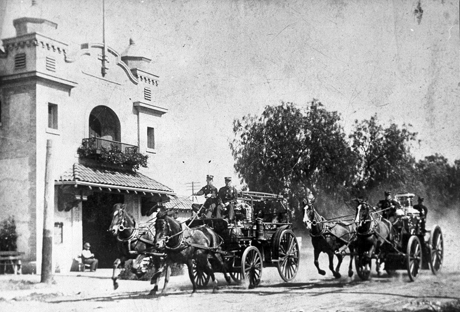
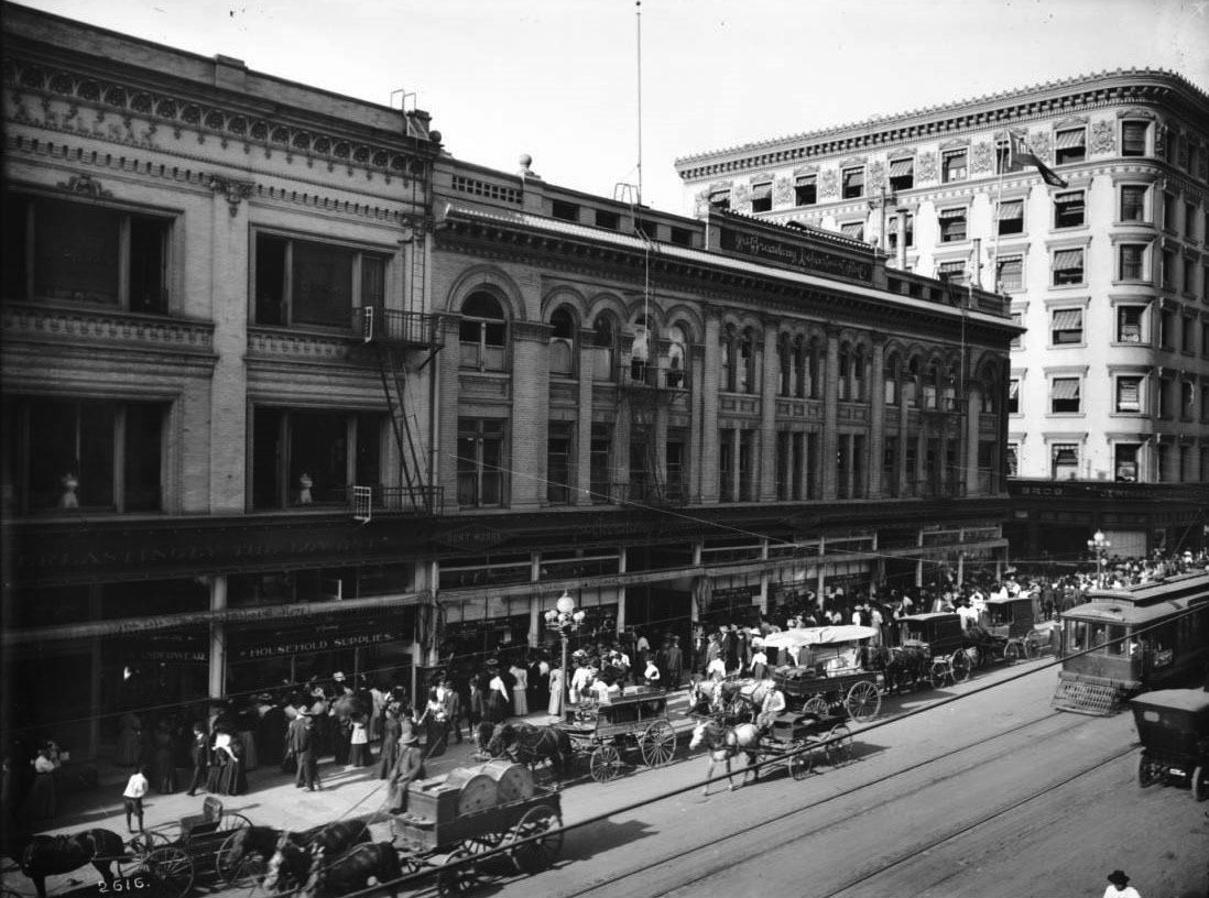
| (ca. 1906)* - Engine Company 18 making a run past the Fire House at 2616 South Hobart Street. |
Historical Notes Built in 1904, Engine House No. 18 was designed in the Mission Revival style by noted architect John Parkinson, whose later works included Los Angeles City Hall, Union Station and Bullocks Wilshire. Fire Station No. 18 was dedicated LA Historic-Cultural Monument No. 349 in 1988 (Click HERE to see complete listing). It is also listed on the National Register of Historic Places. The Exceptional Children’s Foundation purchased Engine House No. 18 in 2011 with the goal of converting the cultural landmark into a fine arts training center for adults with special needs and a community creative space for the residents of South Los Angeles. The new facility was scheduled to be opened in late 2013.*^ |
.jpg) |
|
| (Early 1900s)^ - View of Engine House No.18 located at 2616 South Hobart Street, West Adams. |
Historical Notes In 1915, Engine House No. 18 was one of a dozen stations closed because of budget cutbacks resulting from the "two-platoon ordinance" passed by the Los Angeles City Council in 1915. The station re-opened in 1920 and remained an operating fire station until 1968.^##* Fire Station No. 18 was dedicated LA Historic-Cultural Monument No. 349 in 1988 (Click HERE to see complete listing). It is also listed on the National Register of Historic Places. The Exceptional Children’s Foundation purchased Engine House No. 18 in 2011 with the goal of converting the cultural landmark into a fine arts training center for adults with special needs and a community creative space for the residents of South Los Angeles. The new facility was scheduled to be opened in late 2013.^* |
Then and Now
 |
|
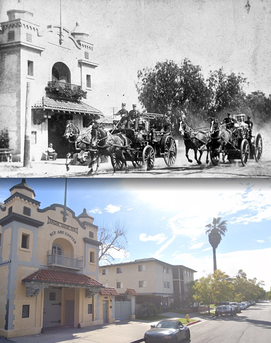
| (1906 vs. 2022)* - Engine Company 18 making a run past the Fire House at 2616 South Hobart Street, today the ECF Art Center. |
* * * * * |
Main and 4th Streets
 |
|
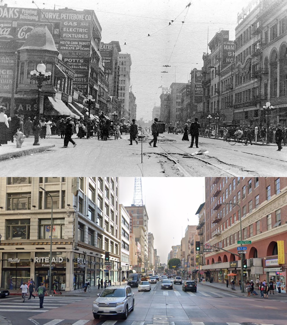
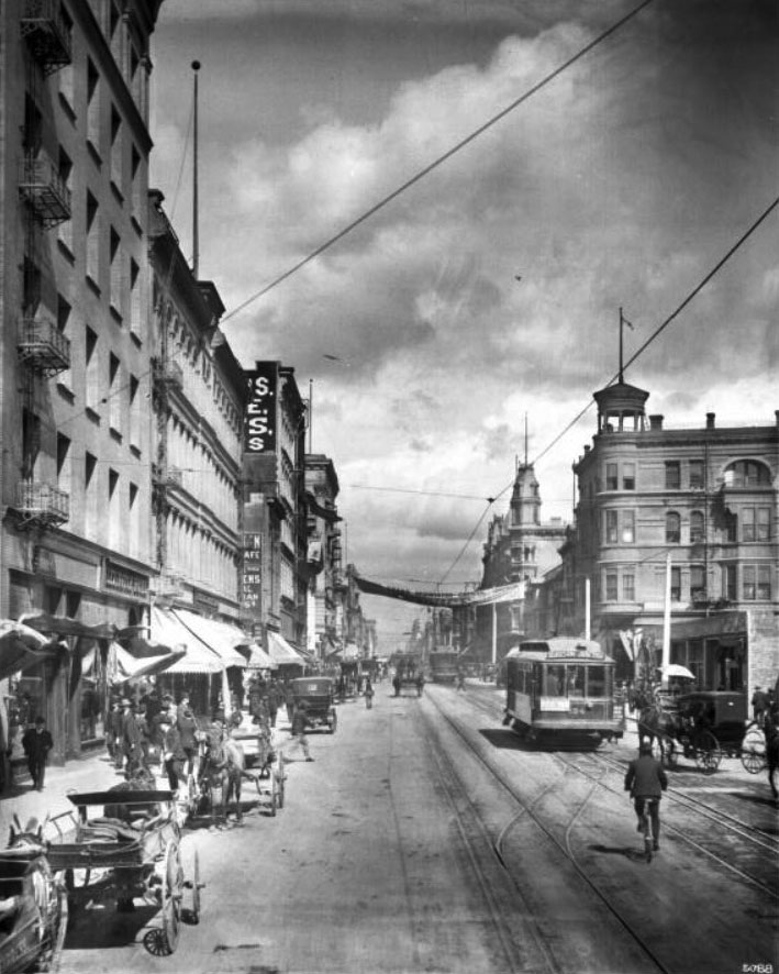
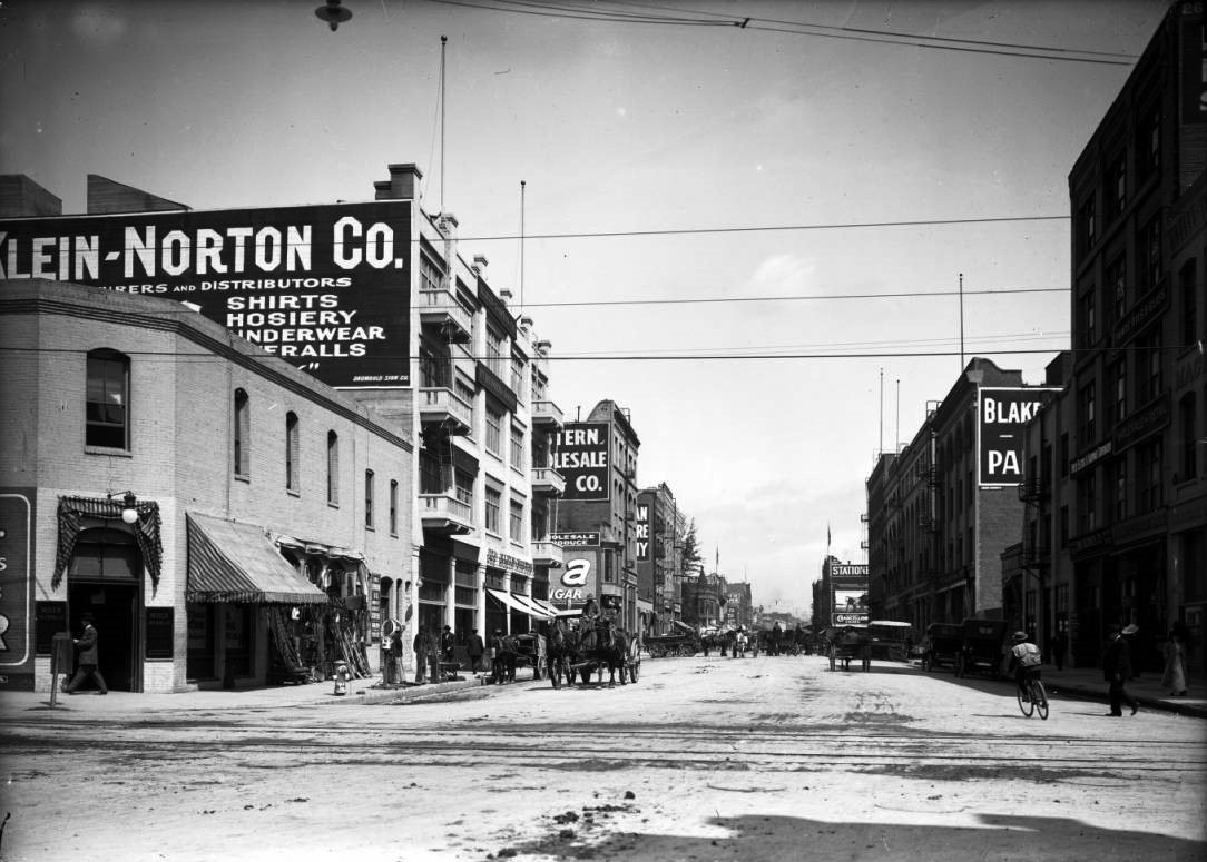
| (ca. 1906)^ - 4th St. looking west from Main St., showing a busy street scene. |
.jpg) |
|
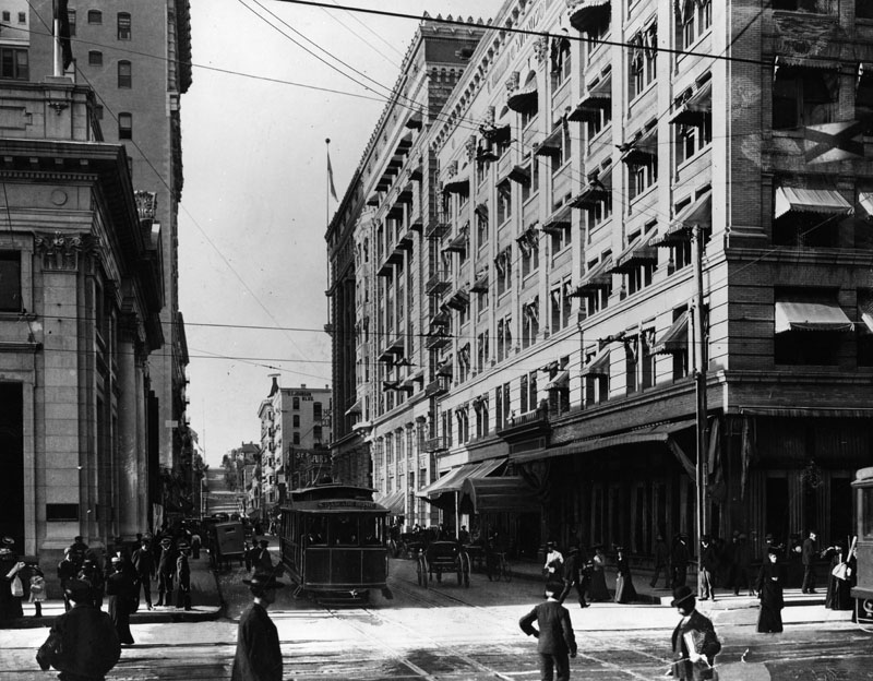
| (1906)^*# - View looking west on 4th Street at the intersection with Main Street. Two men are seen in an open-air car as it travels north on Main Street through the intersection. The Neo-Classic Greek Farmers and Merchants Bank can be seen on the left (S/W Corner) with the Van Nuys Hotel on the right (N/W corner). |
Historical Notes Click HERE to see more Early Views of Main and 4th Streets (1887 - 1906). |
Then and Now
 |
|
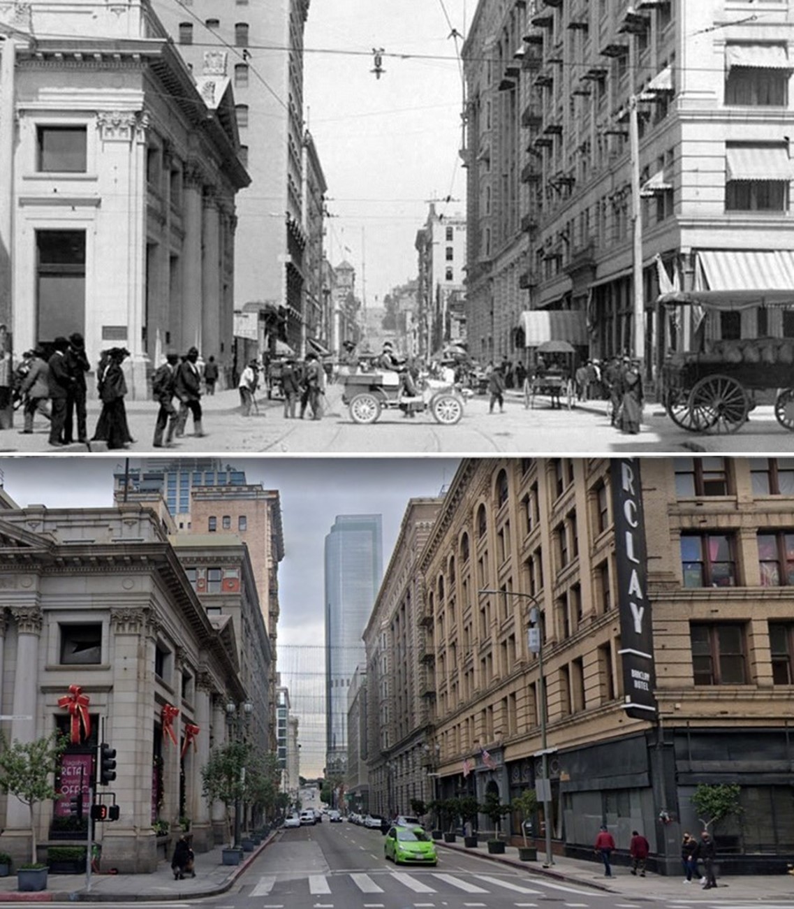
| (1906 vs. 2021) – Looking west on 4th Street at Main Street. The Classic Revival style Farmers and Merchants Bank is on the left (S/W Corner) with the Beaux-Arts style Van Nuys Hotel (today Hotel Barclay) across the street on the right. |
Then and Now
 |
|
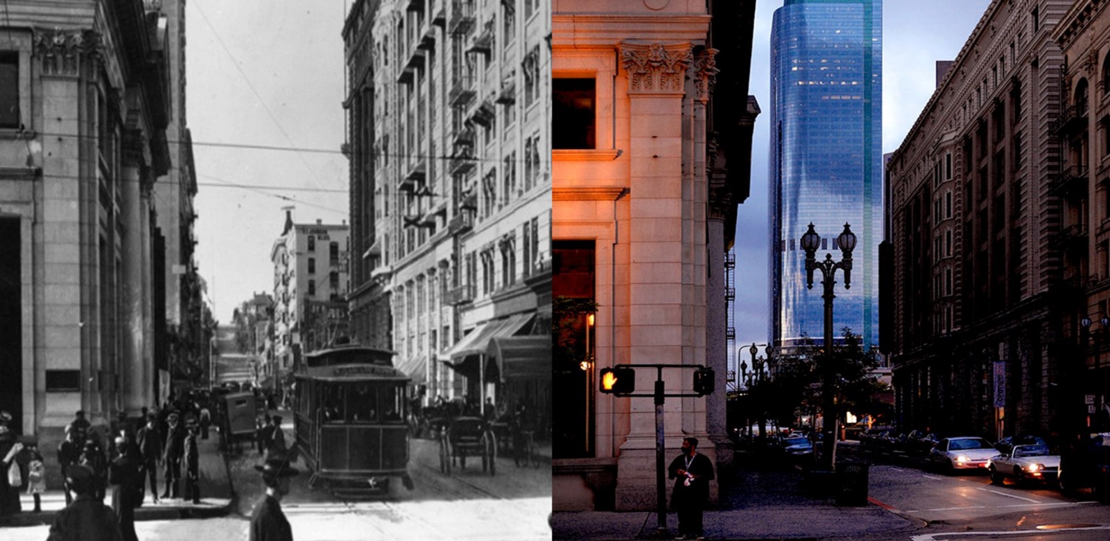
| (1906 vs. 2022)* - View looking west on 4th Street at the intersection with Main Street. |
Main and 5th Streets (NW Corner)
 |
|
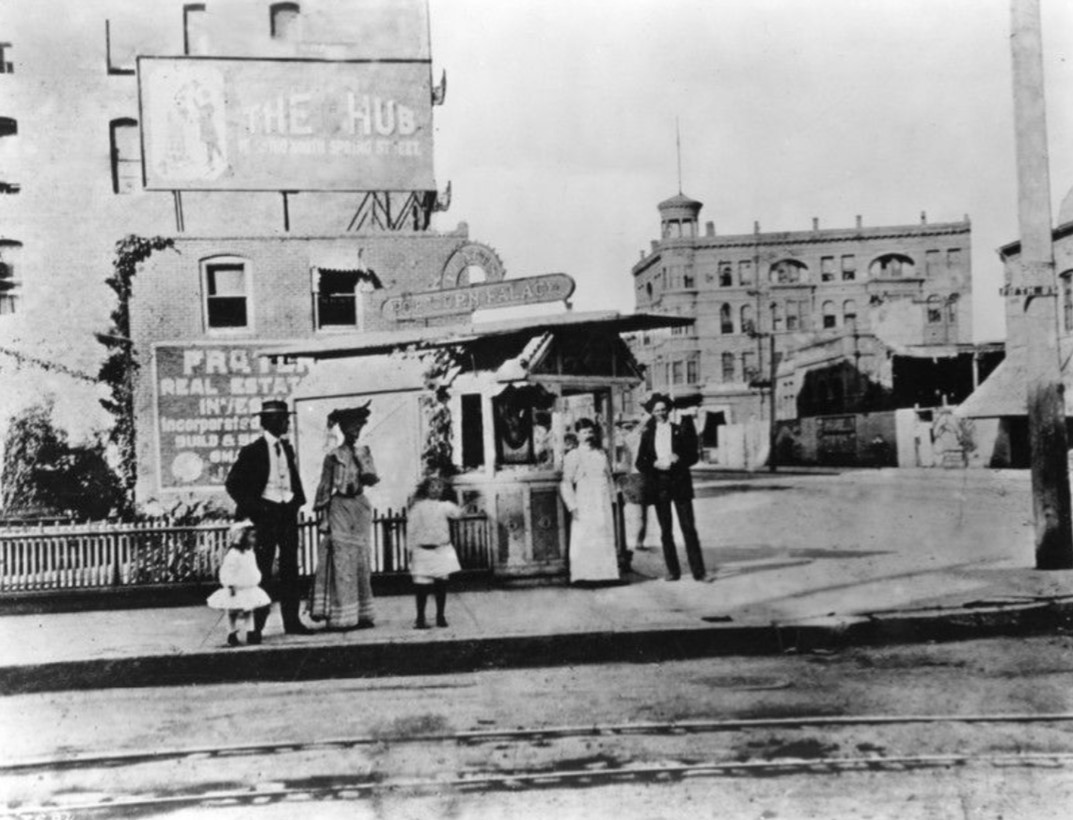
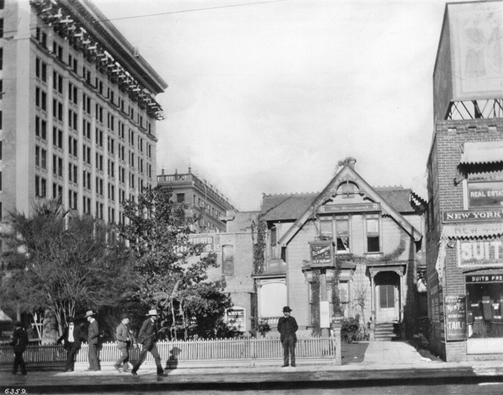
| (ca. 1903)* – Looking at the NW corner Main Street and 5th Street showing a group of people standing outside of Platt's Popcorn Palace with the Main Street Savings Bank Building can be seen in the distance. This NW corner is the site of what would become the Rosslyn Hotel. |
 |
|
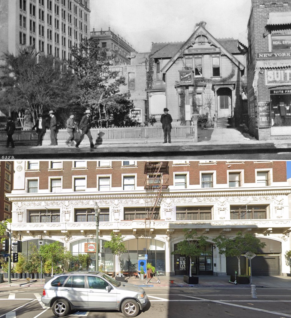
| (1907)* – Looking at the NW corner of Main and 5th Street showing a two-story Victorian house with a sign that reads "The Beaumont Café and Restaurant.” The Rosslyn Hotel would be built on this corner in 1913. |
Historical Notes The Beaumont Café was formerly the site of the home of John H. Jones, who lived there until 1900 in a house that was built in 1869. |
Then and Now
 |
|
| (1907 vs. 2021)* – Looking at the NW corner of Main and 5th streets where the Rosslyn Lofts building stands today. |
Broadway and 5th Street
 |
|
| (ca. 1906)^^ - View looking north on Broadway, between 4th Street and 5th Street. The Belasco Theatre is in the lower-right foreground. In the distance can be seen City Hall and, further back, the Broadway Tunnel. |
.jpg) |
|
| (ca. 1907)^^ - View looking north on Broadway from mid-block between 4th and 5th streets. Note the GIANT lady's shoe on top of the building on the northwest corner of Broadway and 4th. Another interesting detail is the banner across the street, looking up Broadway. The banner reads: "VOTE FOR OWENS RIVER JUNE 12" |
 |
|
| (ca. 1910)^ – Panoramic view looking south on Broadway at 5th Street. The Pantages Theatre can be seen on the east side of Broadway in the distance. Note the ornate streetlights running down both sides of the street. |
Then and Now
 |
|
| (1910 vs. 2021)* - Then and Now – Looking south on Broadway at 5th Street. |
 |
|
| (ca. 1907)^^ – View looking down toward the southeast corner of Broadway and 5th Street. Broadway “Painless” Dentists occupies the 2nd floor of the corner building. |
 |
|
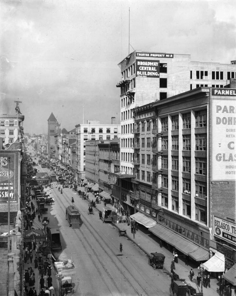
| (ca. 1910)^^ - View looking north on Broadway toward 5th Street showing the 3-story Broadway Department Store on the SW corner. The street is crowded with horse-drawn wagons and the sidewalks are filled with pedestrians. |
 |
|
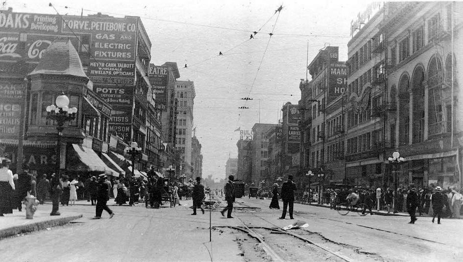
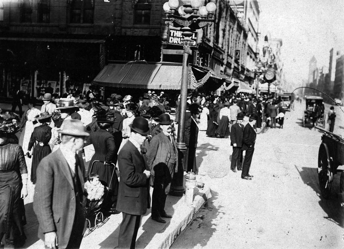
| (ca. 1908)* – Street view looking north on Broadway from 5th Street showing pedestrians, automobiles, streetcars, a baby in a carriage, fire hydrant, lamppost, storefronts and buildings. The Owl Drug Co. store is on the corner, at left and City Hall can be seen in the distance. |
Historical Notes In the early 1900s, some American cars were manufactured with right-hand drive (RHD), including the Ford Model T. This was largely due to the influence of European models, many of which also had right-hand drive and were driven on the left-hand side of the road. However, as the US road system became more standardized and traffic patterns evolved, left-hand drive (LHD) became more popular and eventually became the standard configuration for US-manufactured cars. By the 1920s, left-hand drive had become the norm in the US. |
 |
|
| (ca. 1908)*^#^ - Street scene of a very busy intersection at South Broadway and 5th Street. Crowds of people are seen strolling up and down Broadway with horse-drawn wagons and early model cars sharing the street. The Broadway Department Store is out of view to the left (SW corner) |
 |
|
| (ca. 1910)^+^ - Postcard view looking north on Broadway from near 5th Street showing crowds of people, cars, and streetcars filling a busy street. The clock of Brock & Feagans jewelry store is visible on the left. City Hall is seen in the distance. |
Historical Notes Broadway was the major corridor for shopping and entertainment in the Downtown Los Angeles from the late 19th century to the mid-20th century. George E. Feagans was a jeweler from Illinois, and he established Brock & Feagans in the 1880s with a partner. After the partnership broke up, Feagans opened a new store in the Alexandria Hotel located at 5th and Spring streets. |
Broadway and 6th Street
 |
|
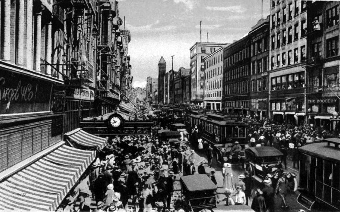
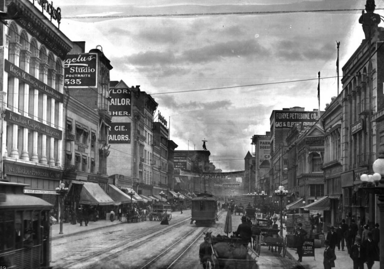
| (ca. 1906)^^ – Street view looking north on Broadway from 6th Street. The street is crowded with people, horse-drawn carriages, and street vendors. Streetcars are moving down the street passing the many buildings and shops. A banner hangs across the street advertising a "Midwinter carnival...oriental exposition in Venice". |
 |
|
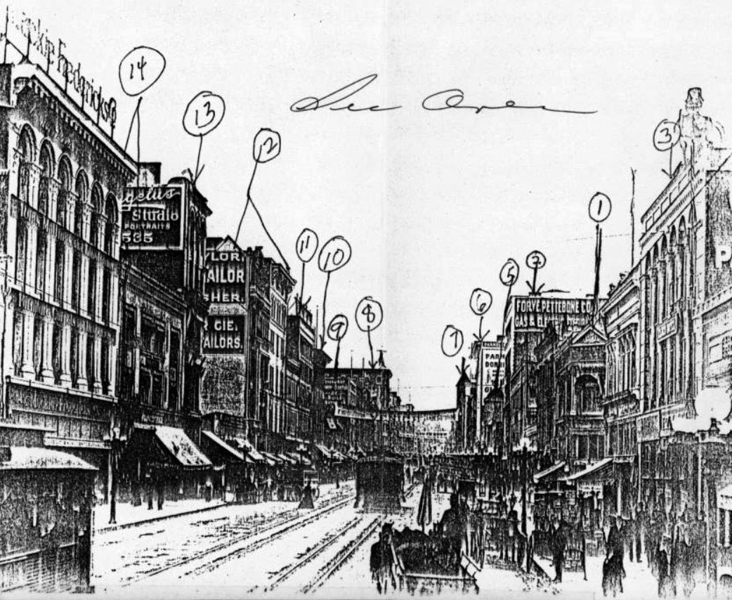
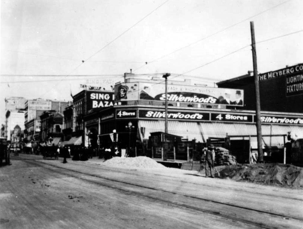
| (ca. 1906)^^ - Same as previous photo but annotated with numbers to identify recognizable buildings. To the far right behind the lampost is a partial view of Silverwoods located on the NE corner of Broadway and 6th streets. |
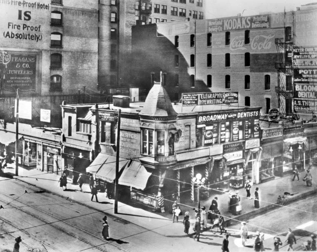
Historical Notes Recognizable Buildings: 1. Mercantile Place - now site of Arcade Building. Probably no part of original building is the same as Boyle Workman in his book states that it was torn down to make room for the Arcade Building. 2. Forve Pettebone Co. - Building still there. Although painted over, the sign can still be distinguished. Now called '512 So. Broadway Building.' 3. I feel fairly certain this is the same building. It is now occupied by Dr. E.D. Hubert, Dentist, above, and by Tom McAn Shoe Store on the ground level. 4. Building changed. Until recently, Silverwood's occupied this site. 5. No longer there - now site of Chester Williams Building built in 1927. 6. Could not positively identify but think it is the '430 So. Broadway Building.' 7. Old Los Angeles City Hall between 2nd and 3rd on Broadway. Built in 1888-9 and used until present City Hall built in 1928. 8. I am quite certain this is the Nelson Building. All the ornamentation has been removed, but the shape of the building, number of windows, etc. is exactly the same. 9. The west side of Broadway from Fifth to Fourth Street. Could not definately recognise any building in this block although some may just have newer fronts. I believe the building where Ted's Discount is now located might be the same. The Broadway Dept. Store was located in the same location at the time of this picture, but the building they recently vacated was rebuilt in 1926. Another building in this block at the time of the picture was the E. Wilson Block with the Broadway Hotel. 10. Fifth Street Store - now the '312 West Fifth Street Building' - Thrifty Drug Store occupies the ground level. 11. Los Angeles Examiner - looks like both (10) and (11) have been torn down to make room for the present building built in the early 1920's [Bldg. built 1924]. 12. I could not identify any of these buildings. However, it is quite possible new fronts have completely disguised them as they all looked very old. 13. Fairly certain this building is still there and now houses a Linen Store and a Karl's Shoe Store. 14. Again could not identify these buildings but could be same remodeled. --California Historical Society |
 |
|
| (ca. 1908)^ - View of the southeast corner of Broadway and 6th Street. The corner was occupied by a saloon for many years. In 1909, the Walter P. Story Building was constructed at this site. |
Historical Notes In 1894 Nelson Story bought the property at 610 S. Broadway from J.B. Lankershim for $48,000. He built the Walter P. Story Building on this sight in 1909 as a gift to his son Walter. It was one of the first skyscrapers in Los Angeles and still stands today as The New Story Building.*^ |
 |
|
| (ca. 1909)^^ – View looking north on Broadway toward 6th Street. At right, a man with a shovel can be seen in front of an empty lot on the SE corner of Broadway and 6th Street where the Walter P. Story Building would be built. Silverwood's Department Store is seen on the NE corner. The road is unpaved and the tracks and wires for cable cars are visible. |
Broadway and 7th Street
 |
|
| (ca. 1906)^#** - View looking south on Broadway. The Hotel Lankershim can be seen on the southeast corner of Broadway and 7th Street. A crowd of people stand on the curb watching as if a parade is about to start. An early model car is seen straddling a streetcar rail on an unpaved Broadway. |
Historical Notes The 9-story Hotel Lankershim was completed in 1905 as an imitation of the Hotel St. Francis in San Francisco--far superior to any other hotels in L.A. at the time. It had 200 servants, 250 rooms, and 160 baths. Before the hotel was begun in 1902, there was a vineyard. The 7th and Broadway site was the home and vineyard of Judge Wilson Hugh Gray.*#*^ |
| (ca. 1910)^- Horse-drawn wagons, streetcars, autos, and pedestrians all share the road in front of the Hotel Lankershim at the intersection of Broadway and 7th Street. |
Historical Notes James Boon Lankershim was the son of Isaac Lankershim, a German-born Californian landowner who owned 60,000 acres in the San Fernando Valley. James joined his father's company, the San Fernando Farm Homestead Association, together with his brother in law, Isaac Newton Van Nuys, focusing on real estate while Van Nuys focused on wheat. In 1905, he built the Lankershim Hotel on the southeast corner of Broadway and 7th Street. He also built the San Fernando Building on the corner of 4th Avenue and Main Street, where his name is embedded in the tiles at the entrance.*^ The building architect, Robert B. Young, also designed several other hotels including the Hollenbeck, the Lexington, and the Westminster.^^* |
 |
|
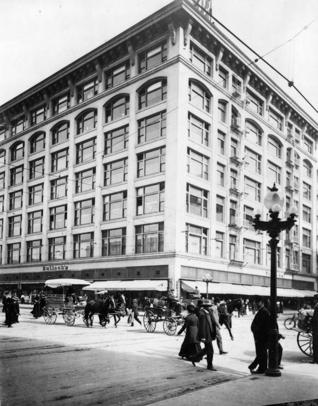
| (ca. 1908)^^ - View of Broadway, looking south toward Seventh Street. A majority of the buildings are above 4 stories tall. Notable building is the Bullock's Department Store building (at right) on the corner of Seventh Street and Broadway. |
 |
|
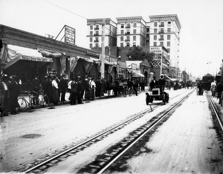
| (ca. 1910)^^ – View looking down Broadway, south from 7th Street, and showing a variety of carts, streetcars and buildings. Pedestrians, Pacific Electric Streetcars, horses and carriages, and Model T Fords crowd the corner of South Broadway and West Seventh Street in Downtown Los Angeles. Utility lines crisscross the street overhead, and streetcar tracks divide the roads. A large building at right, with a corner tower with an onion-shaped roof is the Vogel Block (1893-circa 1920, replaced by Loew's State Theatre); the large building with Rossiter sign, across Broadway to the left, is the Lankershim Hotel (built in 1905); the building in the extreme foreground at left is the Hotel Corona; the large white building with two flags on its top (in the close background at center) is the Hamburgers Department Store (south-west corner with 8th Street, where it had moved after leaving the Phillips Block). |
 |
|
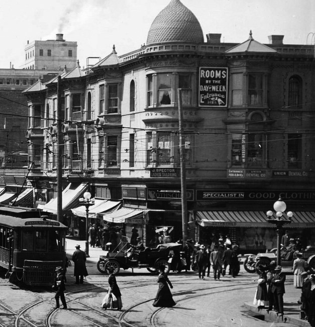
| (1910)^^ - Close-up view of the southwest corner of Broadway and 7th Street showing the Vogel Block with its onion-shaped tower. Sign on the side of building reads: “Rooms by the Day or Week”. |
Historical Notes The Vogel Block would be demolished in 1921 to make room for Loew's State Theatre (currently United Building). |
Then and Now
 |
|
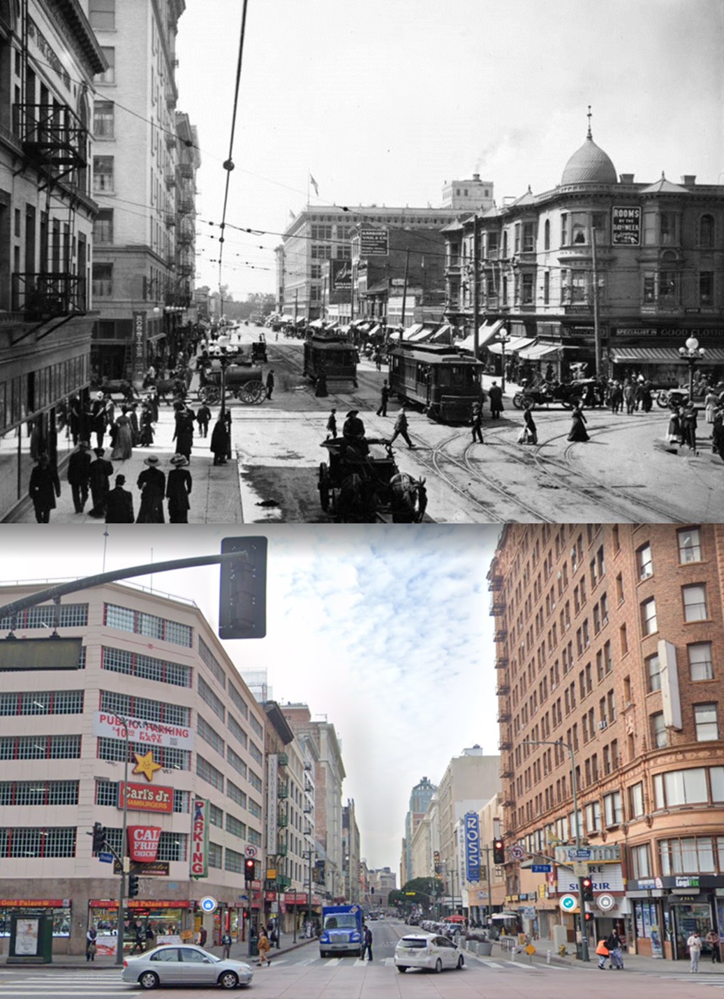
| (1910 vs 2022)* - Looking south on Broadway at 7th Street showing the 1905-built Lankershim Hotel on the SE corner (demolished in the mid-1980s and today a parking structure) and the 1893-built Victorian style Vogel Block building on the SW corner (replaced in 1920 with the Loew's State Theatre, currently United Building). |
 |
|
| (1907)^^ – View looking north on Broadway toward 7th Street with the Lankershim Hotel on the right (SE Corner) and Bullocks Department Store on the left (NW Corner). The street is alive with streetcar and pedestrian traffic. Early model cars and horse-drawn carriages are parked along the curb. |
 |
|
| (1910)^ - Horse-drawn carriages and pedestrians share the road at the intersection of Broadway and 7th Street. Bullock's Department Store can be seen across the street on the NW corner. |
 |
|
| (ca. 1910)^#^ - View looking north on Broadway from 7th Street. The Walter P. Story Building at 610 S. Broadway appears to be the tallest building on the east side of the street. City Hall is seen in the distance. In the foreground by the ornate streetlight is another electric car, built by Baker Motor Vehicle Company. |
Historical Notes Women favored electric automobiles because they did not require cranking and had no exhaust fumes. Electrics could travel up to 20 MPH and had a range of 20 to 50 miles on one charging of the batteries. Several manufacturers produced electric vehicles including Riker, Woods, Detroit Electric, Columbia and of course, Baker. |
(2011)#^#^ - View of Jay Leno waving toward the camera as he drives his 100 year old Baker electric vehicle.
|
.jpg) |
Historical Notes Baker Moter Vehicle Company was a manufacturer of Brass Era electric automobiles in Cleveland, Ohio from 1899 to 1914. The first Baker vehicle was a two seater with a selling price of $850. One was sold to Thomas Edison as his first car. In 1906 Baker made 800 cars, making them the largest electric vehicle maker in the world at the time. By 1907, Baker had seventeen models, the smallest being the Stanhope and the largest the Inside Drive Coupe. There was also the $4,000 Extension Front Brougham with the driving seat high up behind the passengers mimicking a Hansom cab. Baker also introduces a range of trucks with capacity of up to 5 tons. In 1913 Baker was overtaken in sales by Detroit Electric and in 1914 merged with fellow Cleveland automaker Rauch and Lang to become Baker, Rauch & Lang. The last Baker cars were made in 1916, but electric industrial trucks continued for a few more years. #^#^ |
 |
|
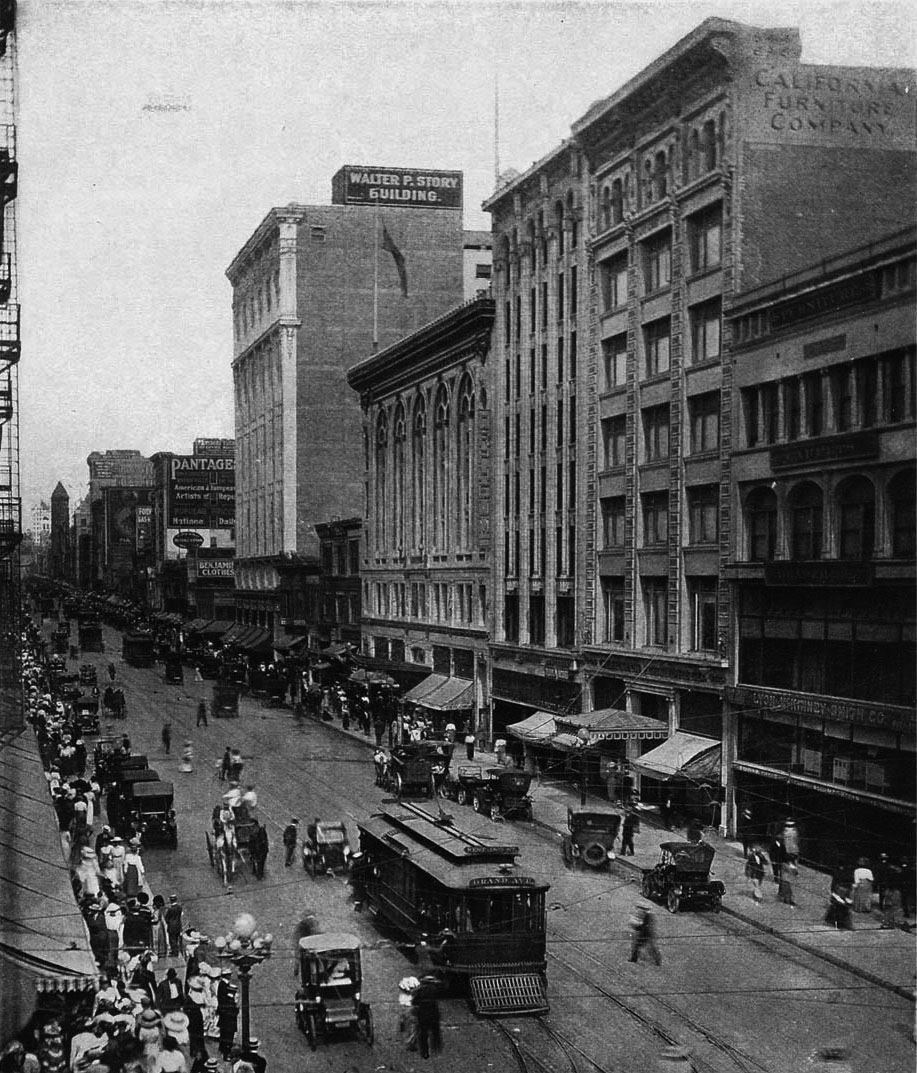
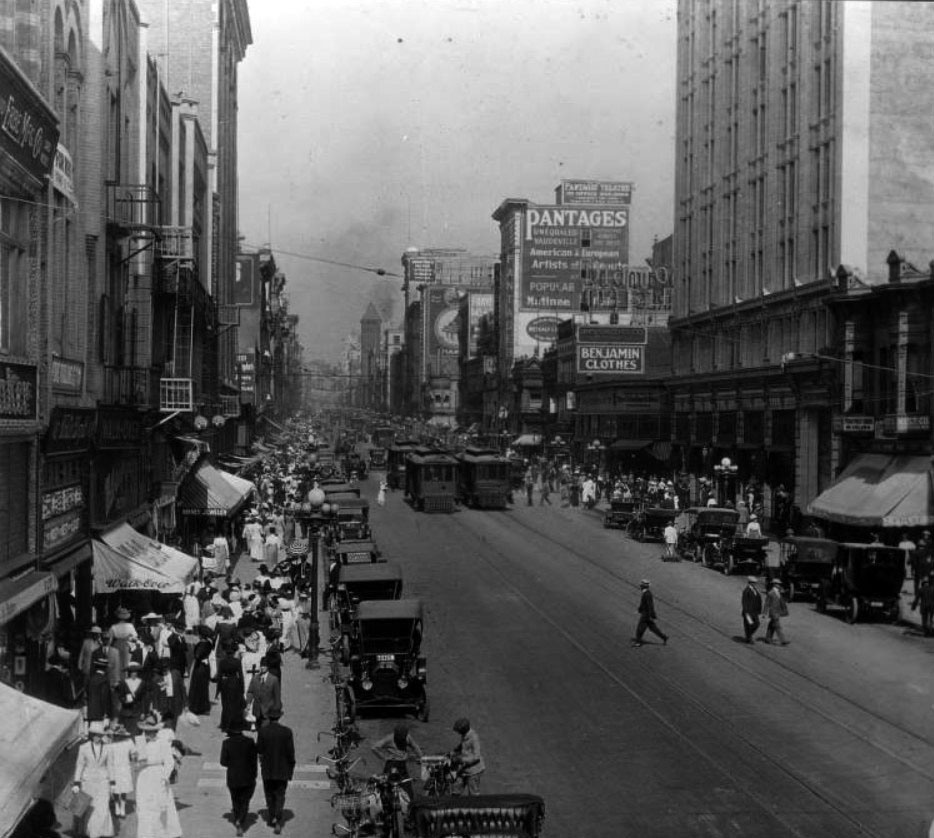
| (ca. 1910)^ - View of busy Broadway looking north from 7th Street. Visible on the right hand side of the street are: California Furniture Company, located at 644-646 S. Broadway; Orpheum Theatre No. 3, located at 630 S. Broadway; and the Walter P. Story Building, located at 610 S. Broadway. Farther north on the same side of the street one can also see the Pantages Theatre. Large crowds of people are visible on the sidewalks, and streetcars and trolleys are lined up along Broadway. A policeman directs traffic at the intersection. |
Historical Notes By 1910, Los Angeles' population was 319,200, three times what it was in 1900 (102,500).*^ |
 |
|
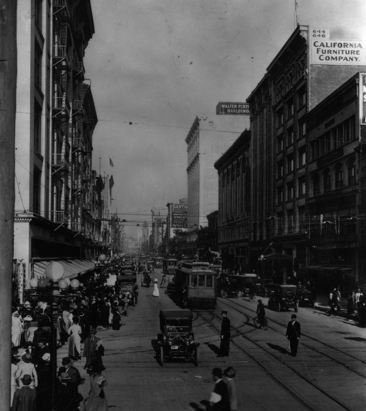
| (ca. 1910)^^ – View looking north on Broadway from 7th Street showing a busy street scene. Streetcar tracks can be seen embedded in the middle of the road, and two streetcars can be seen in the background at center. Early-model automobiles are parked along both sides of the road. Broad concrete sidewalks can be seen lining the street, and many pedestrians are visible along the walkways. Tall buildings line both sides of the street. At upper-right stands the Walter P. Story Building (SE corner of Broadway and 6th). In the distance can be seen the Pantages Theatre (534 S. Broadway), and further back, Los Angeles City Hall (226 S. Broadway). |
 |
|
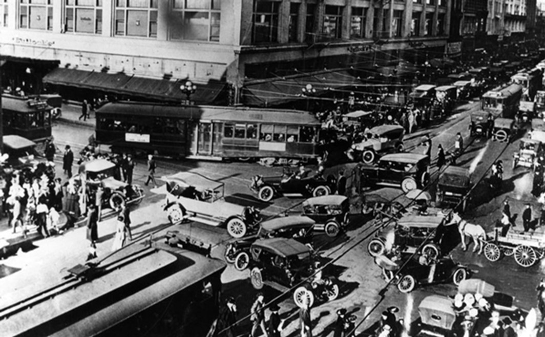
| (ca. 1918)^ - Streetcars, automobiles, horse-drawn carriages, and pedestrians clog the intersection of Broadway and 7th Street. |
Historical Notes More of LA's 'Busiest Intersection' in the 1st half of the 20th Century: Broadway and 7th Street (1920s - Downtown's 'Busiest Intersection') Broadway and 7th Street (1928+ - Downtown's 'Busiest Intersection') Broadway and 7th Street (1937 - 1939; Then and Now; Downtown's 'Busiest Intersection') Broadway and 7th Street (1940s - Downtown's 'Busiest Intersection') Broadway and 7th Street (1950+ - Downtown's 'Busiest Intersection') |
Broadway and 6th Street
.jpg) |
|
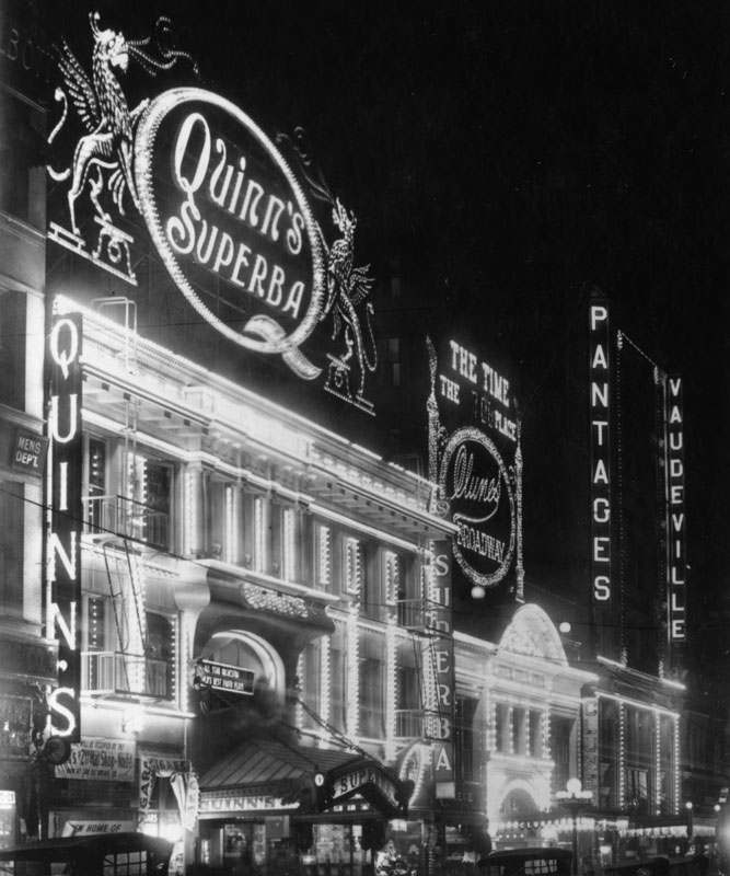
| (1916)*^#* – Night view of an illuminated Broadway looking north from near 6th Street. Three theatres are seen on the 500 block of Broadway at center of photo: Pantages, Clune's Broadway, and Quinn's Superba. The street on the right is Mercantile Place which would become future home of the Arcade Building (1924). |
 |
|
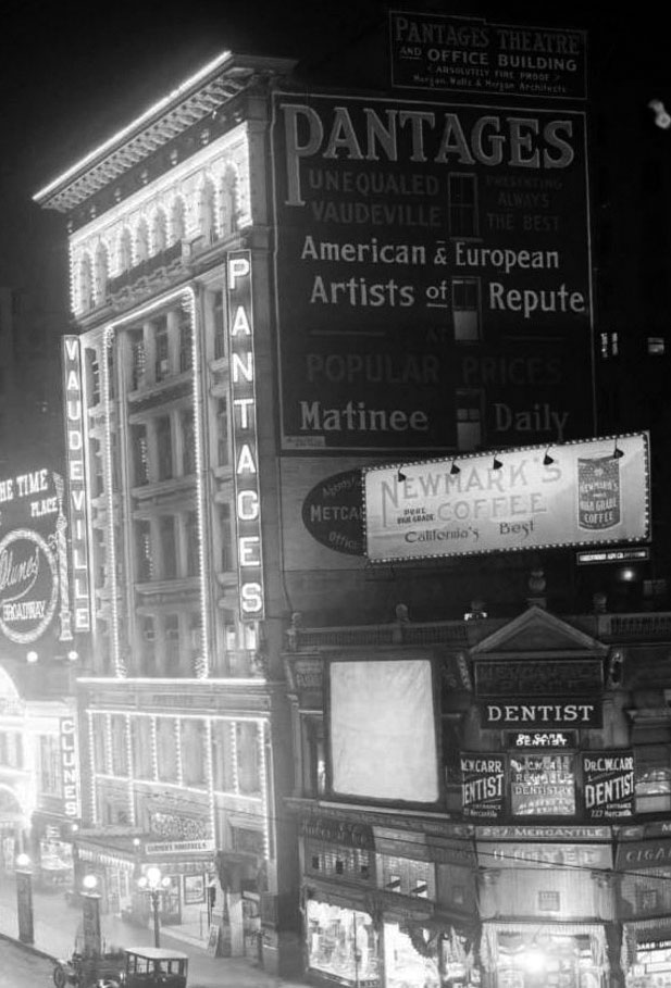
| (1916)*^#* - Night view of the Pantages Theatre at 534 N. Broadway. Sign on side of building reads: "PANTAGES - Unequaled Vaudeville - American and European Artists of Reupte". The building with the dentist office on the right is where the Arcade Building would be built in 1924. |
Historical Notes After Pantages Theatre moved to its new location at 7th and Hill streets in 1920, this theater was renamed Dalton's. Eight years later, it was renamed Arcade in honor of the popular Arcade Building. |
 |
|
| (ca. 1915)^ - Exterior view of the front of Quinn's Superba Theatre, with a view down the street where signs can be seen for Clune's Broadway and the Pantages. |
Historical Notes Quinn’s Superba Theatre was located on the site where the Roxie Theatre is today on Broadway in Downtown Los Angeles. It was next to Clune's Broadway (later Cameo) and the Pantages. The Pantages Theatre (1910), Clune's Broadway (1910), and Quinn's Superba (1914), along with the 1911 Orpheum Theatre (now the Palace) and Tally's New Broadway (1910), put Broadway on the map as the new entertainment street in Los Angeles. |
 |
|
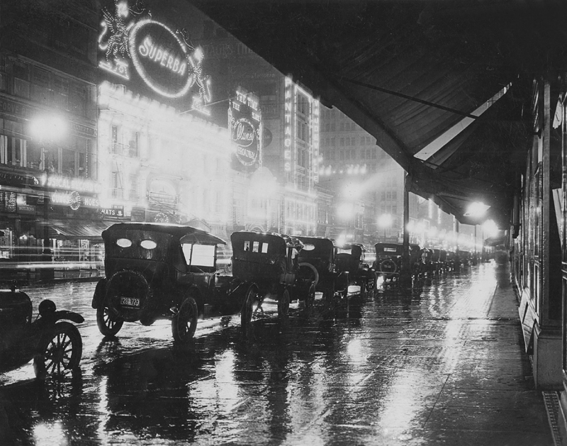
| (1920)*^ - A rainy night image looking south on Broadway between 5th and 6th streets. Across the street can be seen Quinn's Superba, Clune's, and the first Pantages Theater. |
Historical Notes The Superba Theater was later sold and converted to a coffee house before being razed in 1931 to make way for the Roxie, which was the last theater built on Broadway. |
* * * * * |
 |
|
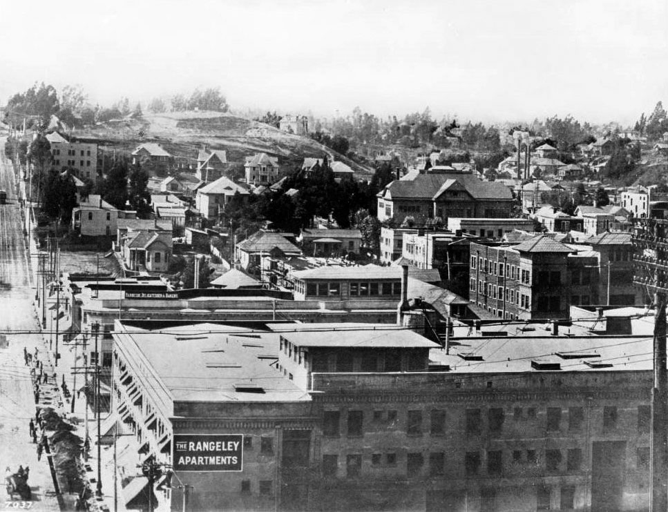
| (ca. 1906)^^ - View of 3rd Street looking west from the hill on Grand Avenue (above the 3rd Street Tunnel). Pedestrians navigate the unpaved Third street to the far left, with the Rangeley Apartment Building visible in the right foreground. The building behind Rangeley bears a sign that reads "Barbeque, Delicatessen & Bakery". |
Historical Notes The Rangeley Apartments was located on the northwest corner of 3rd and Cinnabar Streets (Cinnabar runs across the bottom just out-of-frame). The far side of the Rangeley is Flower Street and the next corner is Figueroa. The St. Regis, at 237 S. Flower, is seen right center with the flatish corner turret. Next door to the left is just a glimpse of the top of the hipp-roofed Bozwell, at 245 S. Flower, with the single cupola and next to it (still going to the left) is the Rollin Apartments with the outsized rooftop solarium at 247 S. Flower (NW corner of Flower and 3rd). #^ |
Main Street
.jpg) |
|
| (1905)*^ – View looking North on Main Street from Fifth Street showing Five Globe Standard Llewellyn streetlights lining both sides of the street. The building with the turret on the right is the Main Street Savings Building, NE corner of Main and Winston streets. In the left foreground is an electric streetcar heading toward the Arcade Depot. |
Historical Notes The most common of the incandescent multiple globe electroliers of the early 1900s were those manufactured by the Llewellyn Iron Works of Los Angeles. The firm became so identified with this style of street light that any multiple globe electrolier became commonly known as a Llewellyn. The Llewellyn Iron Works, founded in 1889‐1890, was one of the largest metal working facilities in Los Angeles (Click HERE to see more Early LA Streetlights). |
 |
|
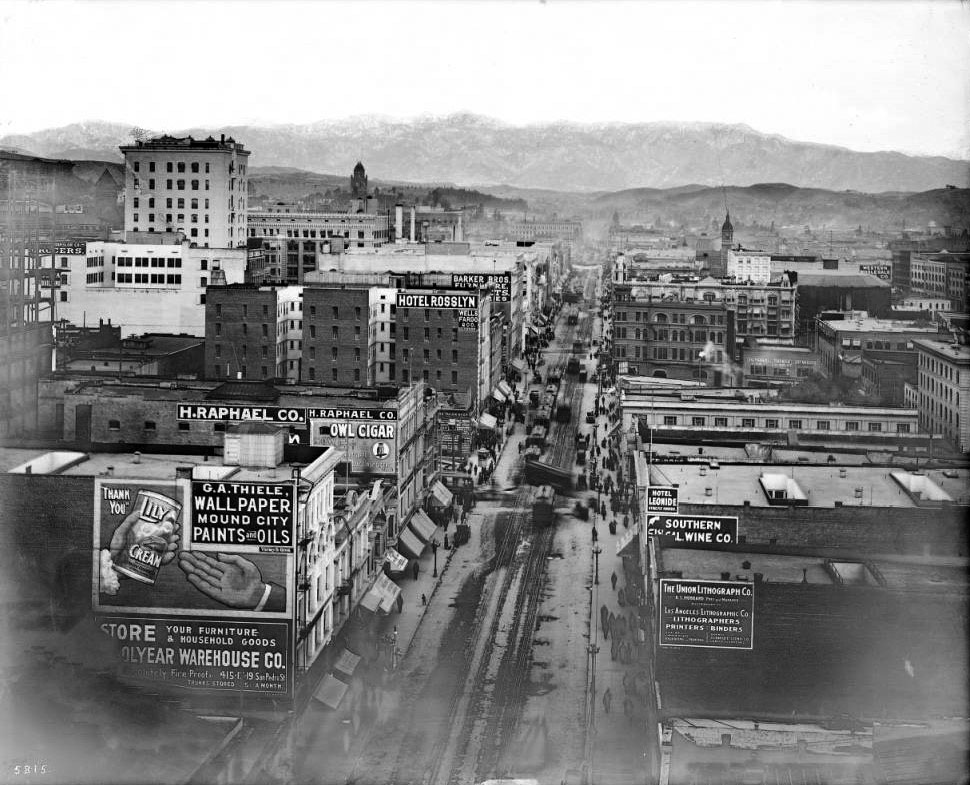
| (ca. 1906)^^ – View looking north on Main Street which is thriving with commercial buildings. Prominent buildings include the Lexington Hotel (left), the Rosslyn Hotel (right of Lexington Hotel), and the Barker Bros. Building (right of Hotel Rosslyn). On the right is the Main Street Savings Bank Building located on the N/E corner of Main and Winston streets. Many pedestrians can be seen walking down the sidewalks or crossing the street. Streetcars can be seen carrying their passengers down the street. Along the sidewalks are many parked horse-drawn carriages and early-model cars. |
 |
|
| (1907)^^ - View looking north along Main Street from the Pacific Electric Building at 6th Street, with snow-capped San Gabriel Mountains in the background. Photo date: January 1, 1907. The cityscape is thriving with mostly commercial buildings. Notable buildings include Hotel Rosslyn (center) and the Union Lithograph Co. (foreground at right). |
Historical Notes The Hotel Rosslyn seen here was previously the Lexington Hotel. The original Rossylin was a smaller building just to the north of where the Lexington stood. In 1906, the Rosslyn expanded to include the six-story Lexington building. The result was a 280-room hotel. The Rosslyn would eventually build two larger structures just to the south (left) of the Lexington building (on the N/W and S/W corners of 5th and Main). |
 |
|
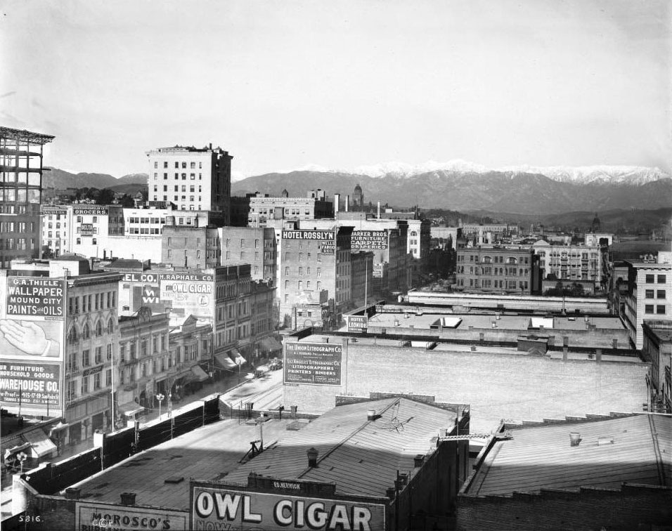
| (ca. 1907)^^ – Panoramic view of Los Angeles looking north on Main Street from the Pacific Electric Building. The cityscape is thriving with mostly commercial buildings. Notable buildings include Hotel Rosslyn (left) and the Union Lithograph Co. (foreground at left). Hotel Rosslyn stands at center. Snow-capped San Gabriel Mountains are visible in the distance. |
Historical Notes The Rosslyn would later build two modern 12-story hotel buildings on the N/W and S/W corners of Main and 5th streets. The first building was built in 1913, the second in 1923. Click HERE to see the new Rosslyn Hotel and the Rossyln Annex. |
Hill Street and Bunker Hill
 |
|
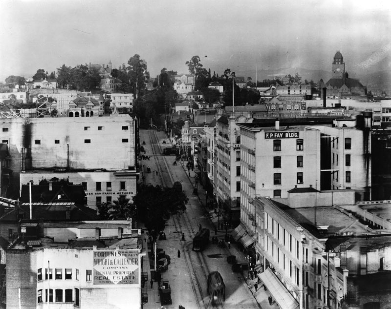
| (1907)^ - View north up Hill St. with Bunker Hill in the background. Pedestrians, cable cars, horse and buggies and delivery trucks and wagons are busy in this afternoon scene. On the right is the F.P. Fay Building, demolished in 1990. |
Spring and 3rd Streets
 |
|
| (ca. 1907)^^ - View looking north on Spring Street from below Third Street. The Lankershim Building (1887-1990s) is at right on the S/E corner of 3rd and Spring. The Simpson Building (1893-1963) is on the N/E corner, the Ramona Hotel (1886-1912) is on the S/W corner, and the Douglas Building (built in 1898) is on the N/W corner. The early model car at lower left has a sign that reads: "For Hire". |
Historical Notes The Douglas Building is the only structure in the original view that has survived into the 21st century. The Hotel Ramona was torn down in 1912 to make way for the 13-story Washington Building which still stands today. The Stimson Building, considered by some to be the city’s first skyscraper, was damaged by fire in 1962 and demolished the following year, replaced by a parking lot. The Lankershim Building, later renamed the Title Insurance Building, seems to have been demolished around the same time. Its former footprint is now part of the Ronald Reagan State Office Building complex. #^*# |
Broadway
 |
|
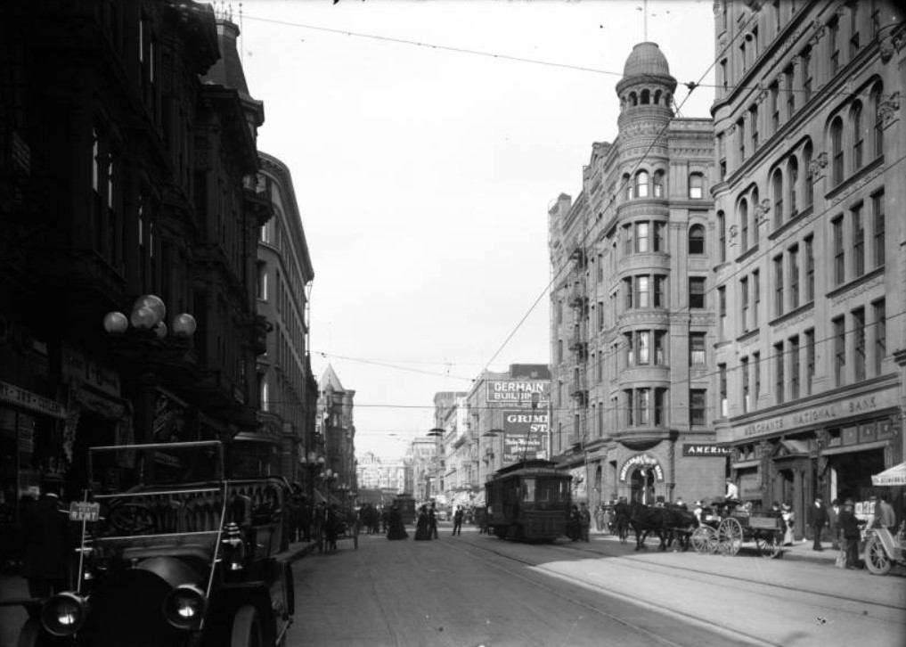
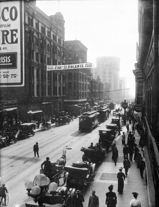
| (1907)^ - View of Broadway with cars, trolleys, and horse drawn wagons all sharing the road. The sign above the street reads: "UTAH vs. ST. VINCENTS at Fiesta Park". St. Vincents defeated Utah by a score of 11 to 5. Click HERE to read about the game in the next morning's Sunday edition of the Los Angeles Herald. |
 |
|
| (1907)^^ - View looking north on Broadway near 5th Street at dusk or dawn. Beautiful 7-lamp streetlights are illuminating the nearly vacant street. |
Historical Notes In May 1905, the first streetight ornamental post system in the city was introduced on Broadway between First and Main Streets. This installation consisted of 135 posts each equipped with six small glass globes, enclosing 16 candle-power amp, and one large glass globe, enclosing a 32 candle-power lamp. This system operated until 1919 when it was demolished to make way for a more modern system.** Click HERE to see more in Early L.A. Streetlights. |
|
|
| (ca. 1907)^^ - View looking north on Broadway from mid-block between 4th and 5th streets. There is considerable more street activity than previous photo. Note the GIANT lady's shoe on top of the building on the northwest corner of Broadway and 4th. Another interesting detail is the banner across the street, looking up Broadway. The banner reads: "VOTE FOR OWENS RIVER JUNE 12" |
Historical Notes In 1907, Los Angeles voters unanimously approved a $23 million bond issue for the construction of an aqueduct to bring Owens River water 233 miles south to Los Angeles. Click HERE to see more in Water in Early Los Angeles. |
* * * * * |
Los Angeles Aqueduct
 |
|
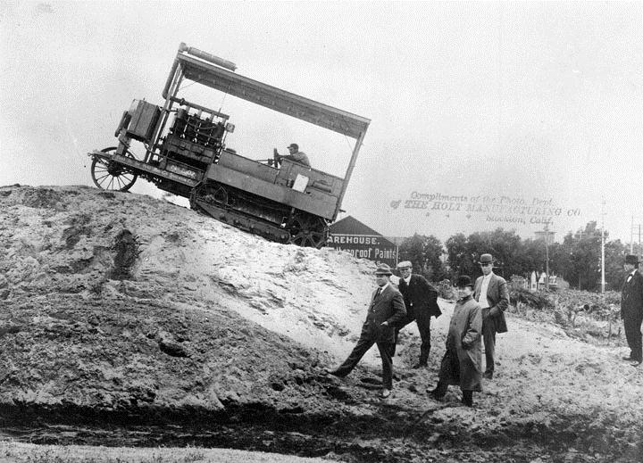
| (1907)* - The first Caterpillar tractors ever built were used to help complete the 5.5 mile Elizabeth Lake Tunnel section of the Los Angeles-Owens River Aqueduct. |
Historical Notes “It crawls like a caterpillar.” And caterpillar is its name to the present day. The descriptive remark is attributed to William Mulholland while watching the first formal demonstration of the new type of tractor just purchased for hauling materials across the desert during the building of the aqueduct. It was hoped that this would be a mechanical substitute for the mule – a departure from traditional construction methods that could lower costs and speed the progress of the great water way to Los Angeles. However, things didn’t turn out that way as the mule showed more durability.** |
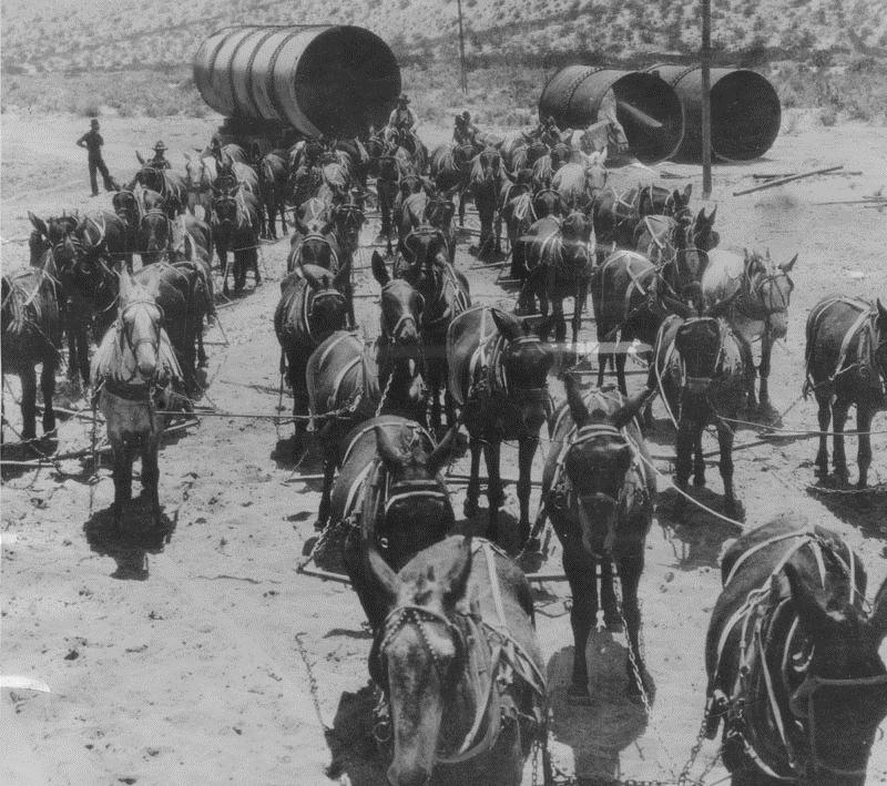 |
| (1912)* - Transportation was largely by mule power when the Los Angeles Aqueduct was under construction. This photo shows a 52-mule team hauling sections of aqueduct pipe. Work on the aqueduct was started on September 20, 1907. |
Historical Notes Mule teams were initially deemed too expensive to use for short-distance hauling, so the aqueduct builders invested in a recent technological development, the caterpillar tractor. After an initial trial period with one tractor, the city government bought 28 more. Eventually maintenance and repair proved too costly, so the city crews reverted back to using mules.** |
Click HERE to see more in Construction of the Los Angeles Aqueduct |
* * * * * |
 |
|
| (1907)^ - Tree-lined but unpaved Lake Street seen north from 12th Street. Children are seen playing in the middle of the dirt road. |
Before and After
 |
|
| (1907--2011)^***^ - Panoramic view of Lake Street looking north from 12th Street. |
 |
|
| (1907)^ - Looking west on Venice Boulevard (then known as 16th Street) from Western Avenue. |
* * * * * |
Westlake Park
 |
|
| (1907)^ - View looking northeast toward Westlake Park (later McArthur Park) from 7th Street. A tree-lined walkway with benches is seen on the edge of the park. Trolley tracks run down an unpaved 7th Street. Oil derricks are seen in the hills across the lake. In the far background stand the Hollywood Hills. |
Historical Notes The park, originally named Westlake Park, was built in the 1880s, along with a similar Eastlake Park, whose lake is artificial. Westlake Park was renamed MacArthur Park on May 7, 1942; Eastlake Park was renamed Lincoln Park in 1917.*^ |
 |
|
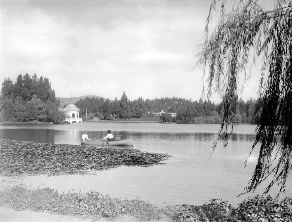
| (ca. 1908)^#*^ - Postcard view showing groups of people in row boats and sail boats at Westlake Park. |
Historical Notes Both Westlake and Eastlake (as well as Echo Park) were built as drinking water reservoirs connected to the city's systems of zanjas (small conveyance channels/trenches). When the city abandoned the non-pressurized zanja system for a pressurized pipe system, these smaller, shallow reservoirs located at low points no longer provided much benefit. They were then converted into parks.*^ |
 |
|
| (ca. 1909)^*## – Postcard view of Westlake Park. Title on the card reads: A Winter's Day in West Lake Park. |
Historical Notes Westlake Park was renamed MacArthur Park on May 7, 1942. Click HERE to see more Views of Westlake Park (MacArthur Park) in the 1920s + |
* * * * * |
Silver Lake Reservoir
 |
|
| (1907)#*#* - View showing men operating horse-drawn ploughs grading the land adjacent to the newly constructed Silver Lake Reservoir located in Ivanhoe Canyon just northwest of downtown Los Angeles. |
Historical Notes To create the dam, William Mulholland first encased a wall of riveted steel plates in three feet of concrete. He then turned hydraulic jets upon the floor of Ivanhoe Canyon, sluicing away a deep trough and flinging the detritus uphill upon the concrete to create a reinforced earthen dam. Once completed, the new reservoir ensured a constant supply of water for Los Angeles. Its 767 million gallons—pumped from the ground beneath the Los Angeles River near Griffith Park—could quench the city’s thirst for three weeks uninterrupted if all other sources suddenly turned dry. Silver Lake also doubled as a scenic and recreational asset. A stock of black bass attracted fishing, and the then-unfenced lakeshore invited Angelenos to stroll around their drinking water supply. By 1912 the city’s parks department had planted more than 2,000 eucalyptus trees on the slopes of Ivanhoe Canyon, and a utilitarian water storage facility had become a prized public space.**#^ |
Click HERE to see more in Early LA Water Reservoirs |
Eastlake Park (Lincoln Park)
 |
|
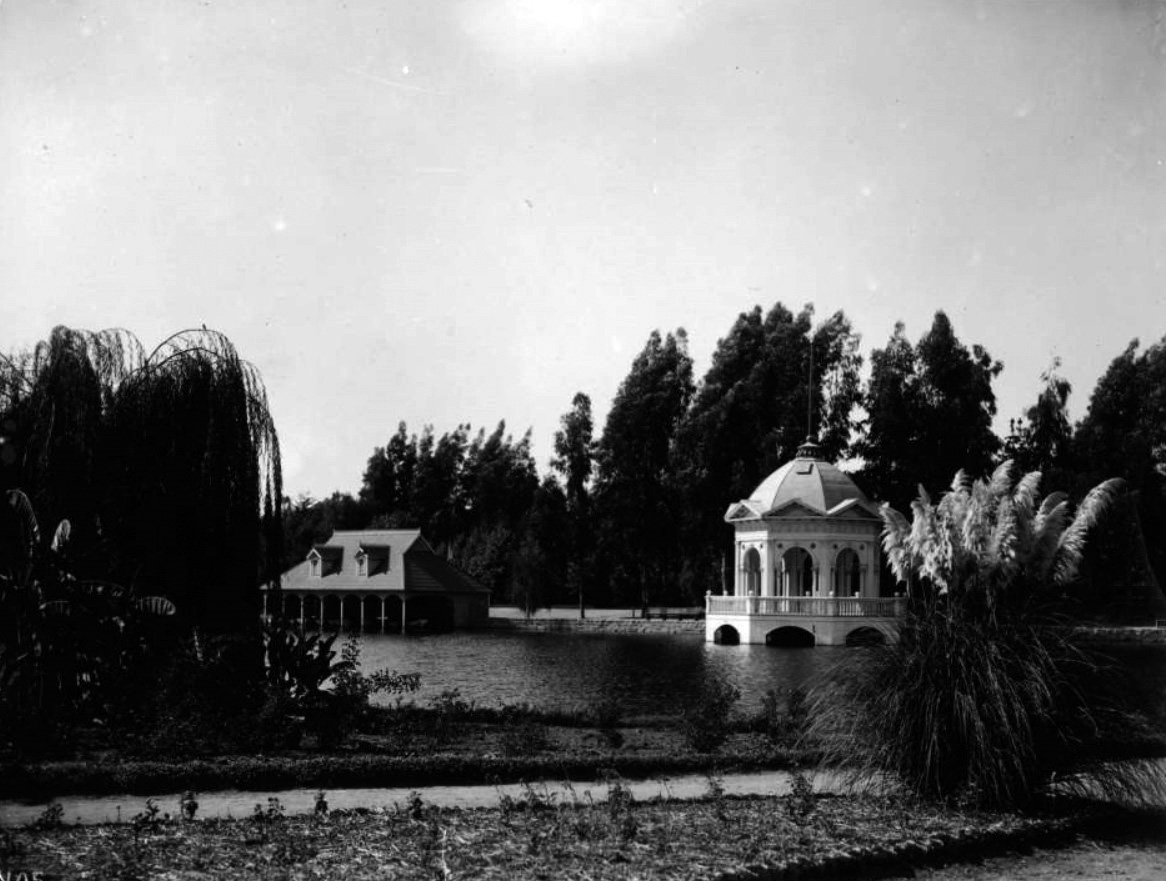
| (ca. 1900)* – Photo showing two women wearing long-sleeved blouses and hats in a small canoe on a large lake at Linocoln Park. In the background at left, a large cylindrical structure with a domed roof is visible. A smaller building can be seen at right. |
Historical Notes Lincoln Park was originally created by the City of Los Angeles in 1881, from land donated by John Strother Griffin. It was one of Los Angeles' first parks. It was originally called East Los Angeles Park. By 1901 it had become a major amusement center for the people of Los Angeles, and it was at this time that the name was changed to Eastlake Park. On May 19, 1917, the park was renamed Lincoln Park after Lincoln High School.^ |
 |
|
| (ca. 1900))* – Two women wearing long-sleeved blouses and hats in a small canoe on a lake in what is now known as Linocoln Park. The park was created in 1881 and originally called East Los Angeles Park. Photo by C.C. Pierce; AI enhancement and colorization by Richard Holoff |
 |
|
| (ca. 1900)^^ - View showing Eastlake Park (later Lincoln Park). A boat house stands on the lake in background while a lightly-colored, extravagant gazebo stands on the water's edge at right. Flowers line a pathway in the foreground while tall trees stand across the far side of the lake. |
Historical Notes Originaly Eastlake Park, Westlake Park, and Echo Park, were built as drinking water reservoirs connected to the city's systems of zanjas (small conveyance channels/trenches). When the city abandoned the non-pressurized zanja system for a pressurized pipe system, these smaller, shallow reservoirs located at low points no longer provided much benefit. They were then converted into parks.*^ Click HERE to see more in Early LA Water Reservoirs. |
 |
|
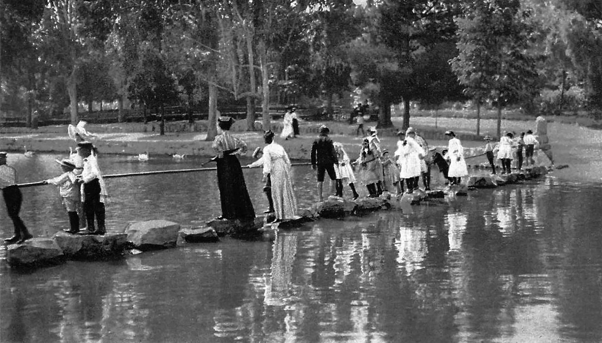
| (ca. 1904)^#*^ – Postcard view showing people standing on stepping stones, while holding onto a rail, that crosses part of Eastlake Park (now Lincoln Park). |
 |
|
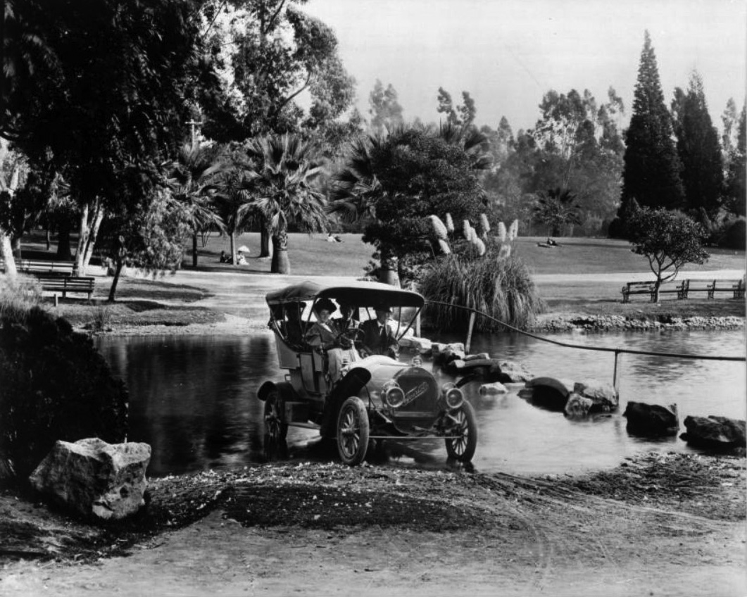
| (ca. 1908)^^ – View showing a 1908 "Tourist" automobile driving through a stream in Eastlake Park (later Lincoln Park). The lightly-colored automobile is being driven by a woman with a man seated next two her and two women in the back. Across the stream, more park patrons can be seen enjoying an open expanse of lawn. |
Historical Notes Lincoln Park (previously Eastlake Park) is located at the intersection of Valley Boulevard and Mission Road. |
 |
|
| (ca. 1910)^#*^ – Postcard view showing a couple in a boat on Eastlake Park. On back of the postcard is a marketing slogan for Los Angeles that reads "On the Road of a Thousand Wonders." |
 |
|
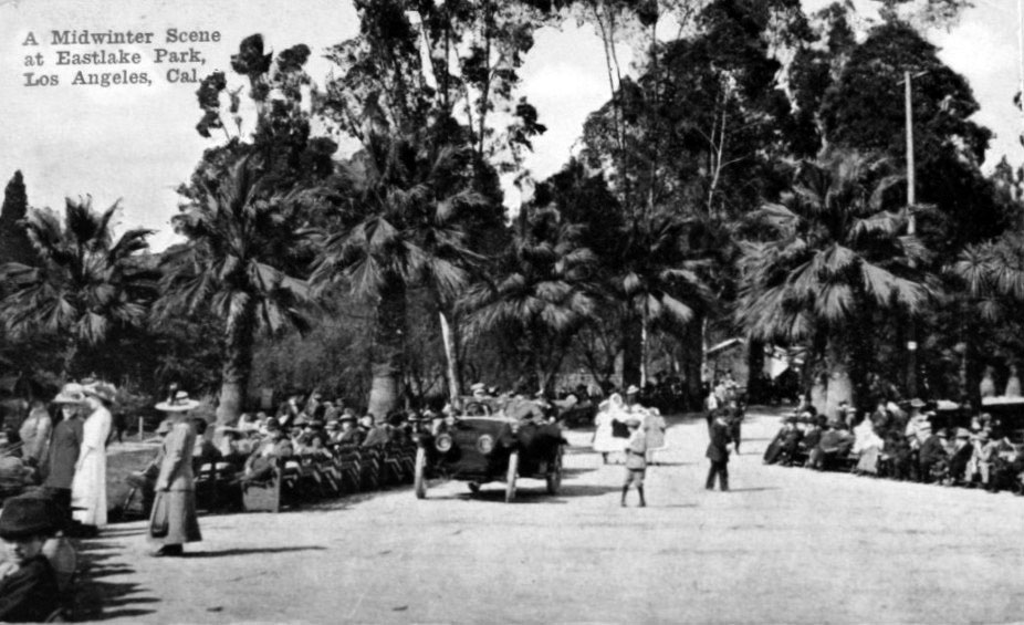
| (ca. 1912)##+ – Postcard view of “A Midwinter Scene at Eastlake Park”. |
 |
|
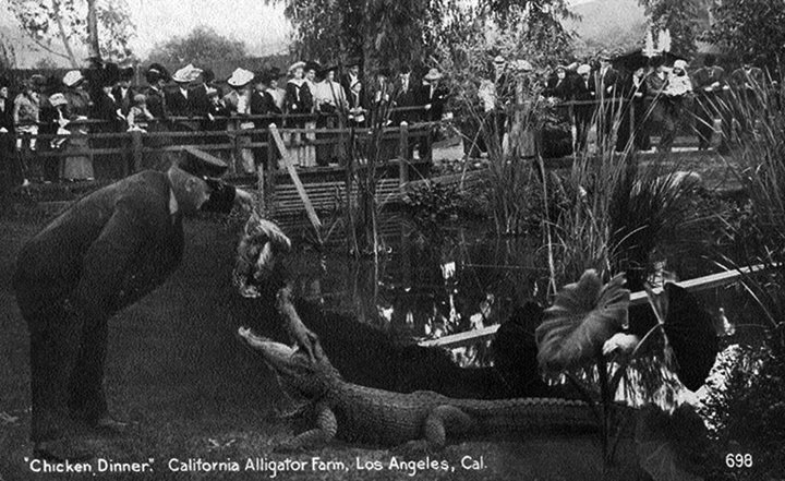
| (ca. 1907)^#** - Postcard view showing a park employee feeding a whole chicken to an alligator at the Los Angeles Alligator Farm across from Eastlake Park (later Lincoln Park) in Lincoln Heights. |
Historical Notes The Los Angeles Alligator Farm was a major city tourist attraction from 1907 until 1953. Originally situated across from Lincoln Park, at 3627 Mission Road, it moved to Buena Park, California in 1953, where it was renamed the California Alligator Farm.*^ |
Click HERE to see more in Early Southern California Amusement Parks |
Griffith Park
 |
|
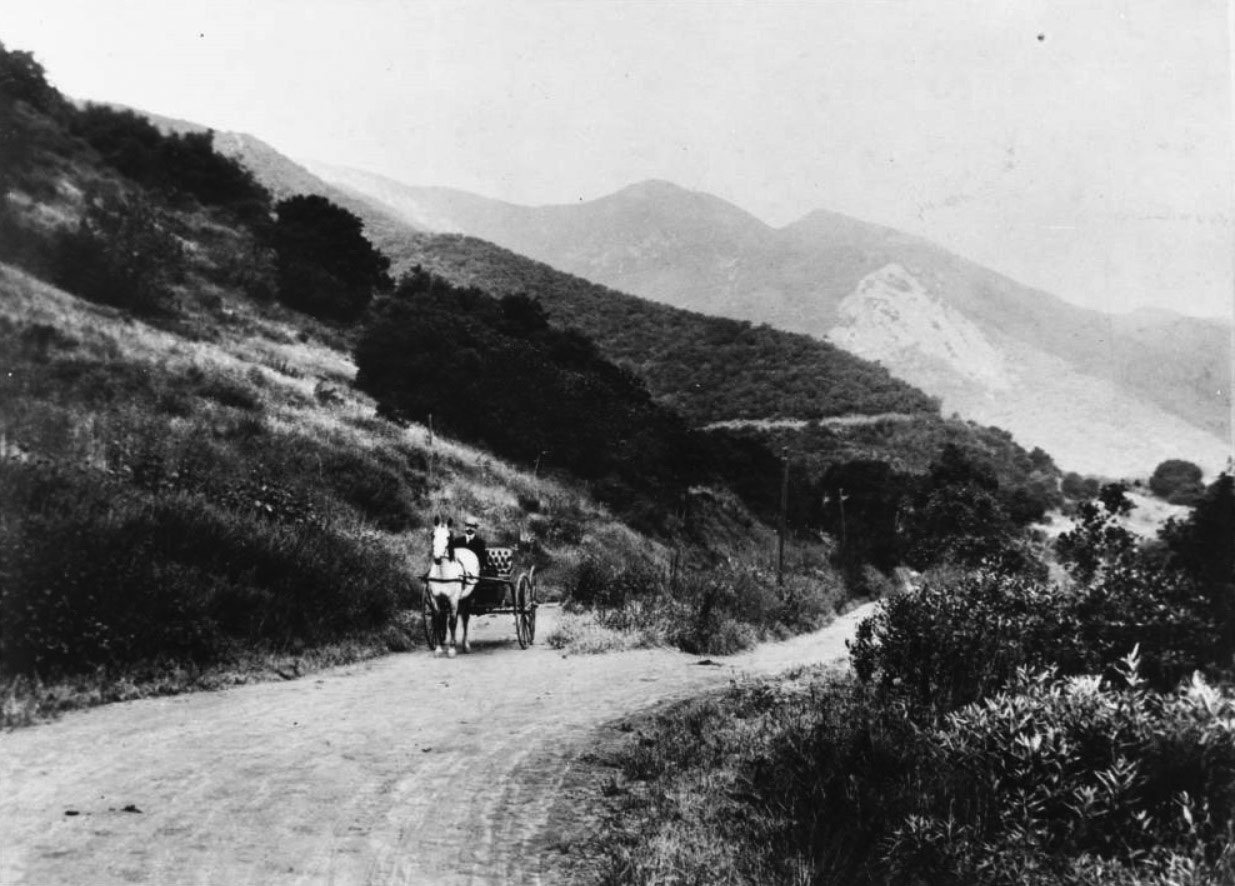
| (ca. 1908)^^ - View of Griffith Park along a mountain drive, showing a man in a horse-drawn carriage. Behind is a narrow stretch of unpaved road heading up into the hills and mountains of Griffith Park. |
Historical Notes Griffith Park was born on December 16, 1896, when Griffith J. Griffith donated 3,015 acres of Rancho Los Feliz to the City of Los Angeles. During a time when luxury resorts dotted the slopes of the nearby San Gabriel Mountains, Griffith -- who grew up poor in Wales -- insisted that his park was meant for those of more modest means. "It must be made a place of recreation and rest for the masses," Griffith told the council when announcing his donation, "a resort for the rank and file, for the plain people." Some chroniclers later characterized the donation as a Christmas gift to the city. Harris Newmark later wrote that Griffith "so generously filled the stocking of Los Angeles with his immensely important gift of Griffith Park, said to be, with its three thousand and more diversified acres, magnificent heights, and picturesque roadways...the second largest pleasure ground in the world." The gift may have been evidence of Griffith's charitable spirit, but Griffith Park almost certainly owes its existence to the fact that the mountainous land would not be developable for many decades. As Eberts argues in his history of the park, Griffith was paying taxes on land that had little market value. Griffith, in fact, carved out a small, flat portion of the park that did have development potential -- today, the location of the Harding Memorial Golf Course -- to keep for himself. Whatever his motives, Griffith's gift instantly gave Los Angeles one of the largest city parks in the world -- on paper. But it would be many years before the Griffith Park known to Angelenos today began to take shape. At first, the city, which owned the parkland but would not annex it until 1910, seemed mainly interested in securing the water rights associated with the land; Rancho Los Feliz was one of the few other legal entities that could legitimately lay claim to the water of the Los Angeles River.**# |
 |
|
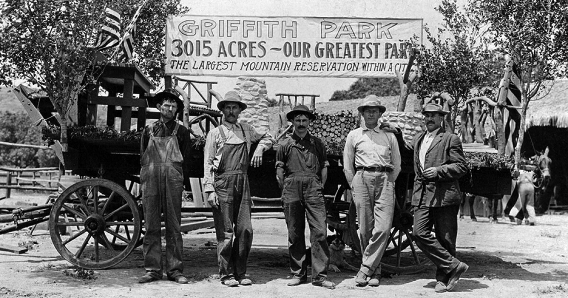
| (n.d.)^ - A group of men stand before a wagon and a hand-painted banner, "Griffith Park, 3015 acres — Our greatest park. The largest mountain reservation within a city." Source: UCLA, Library Special Collections, Charles E. Young Research Library |
Historical Notes Those 3,015 acres were donated to the city by Griffith J. Griffith along with adjacent water rights. Originally, those acres were part of a larger land grant that was awarded to José Vicente Feliz, one of the Spanish soldiers who watched over the 46 people who came from México to establish Los Ángeles. |
 |
|
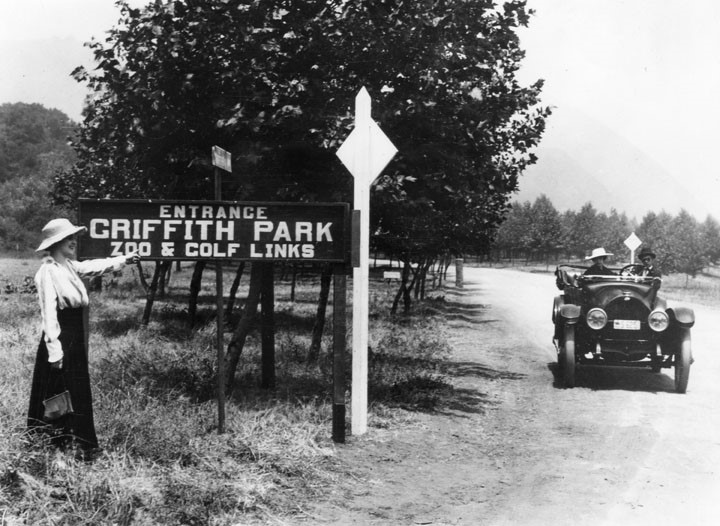
| (1920s)^ - Woman on far left hand side points to sign indicating `Entrance-Griffith Park-Zoo & Golf Links' with an automobile seen exiting to the right of the photo. |
Historical Notes The first zoo in Los Angeles was the Eastlake Zoo in East Los Angeles, which opened in 1885. The Griffith Park Zoo opened in 1912 with a grand total of 15 animals. The new zoo was built on the site of Griffith J. Griffith's defunct ostrich farm. In the mid 1920s, film producer William Nicholas Selig donated many of the animals from his studios, which he had attempted to convert into an animal theme park, to the new zoo.*^ |
Highland Park
 |
|
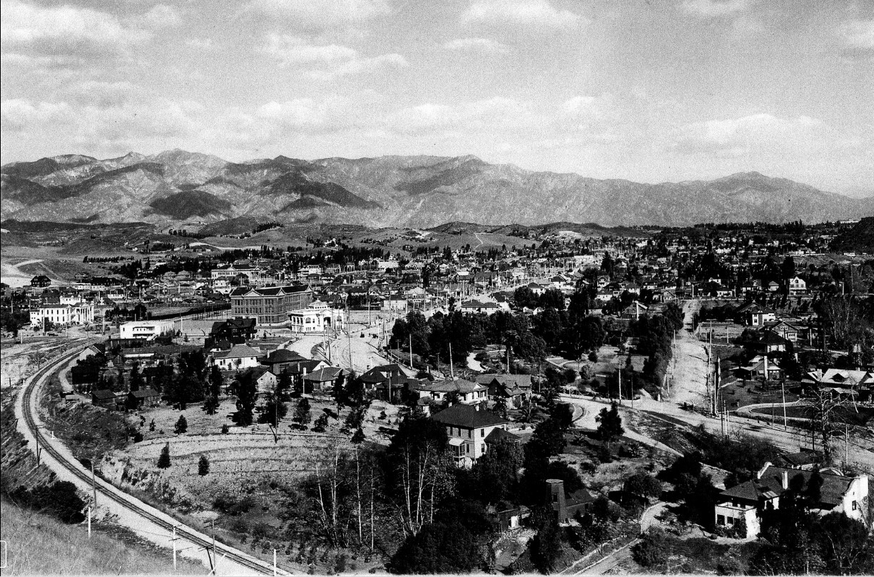
| (ca. 1905)#^ - Panoramic view of Highland Park with the San Gabriel Mountains in the distance. On the left, the railroad tracks make a turn and then head northeast toward South Pasadena. At center, Figueroa Street also turns and parallels the tracks. The white building at center-left is the Occidental College Library building. It sits at the point where Figueroa makes its turn. |
 |
|
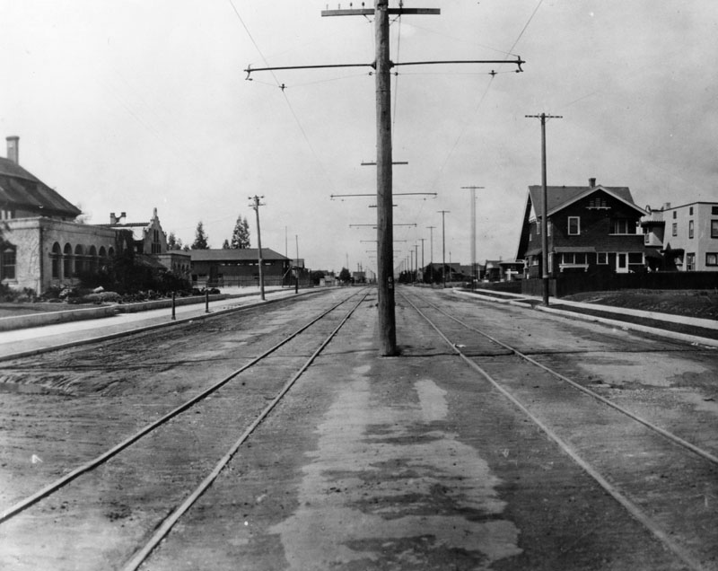
| (1906)^ - North Figueroa Street (formerly Pasadena Avenue) and Avenue 57 in Highland Park, looking north. Two electric cars marked "Sunset Junction" are seen. |
Historical Notes North Figueroa was originally named Pasadena Avenue (the main road to Pasadena) and South Figueroa was called Pearl Street. Before that it was called Calle de las Chapules--the Street of Grasshoppers--because pedestrians used to leap about while sour-faced policemen whistled and chased the crowds from one corner to the other.^*^ |
 |
|
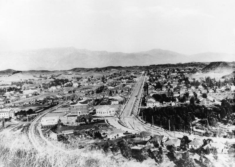
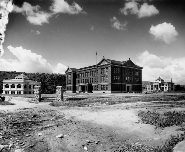
| (1908)^ - Panoramic view of North Figueroa Street in Highland Park near the intersection of Avenue 50. It was called Pasadena Avenue at the time. Monte Vista Avenue parallels it to the left. The three-story building in the center of the photo was the original location of Occidental College. |
Historical Notes Occidental College was founded on April 20, 1887, by a group of Presbyterian clergy and laymen, including James George Bell. The college’s first term began a year later with 27 men and 13 women students, and tuition of $50 a year. Initially located in Boyle Heights, the college moved to a new campus in Los Angeles’ Highland Park neighborhood in 1898. Despite a strong Presbyterian presence on its campus, Occidental cut ties to the church in 1910. In 1912, the school began construction of a new campus located in Los Angeles’ Eagle Rock neighborhood.*^ |
 |
|
| (Early 1900s)^ - Thee early buildings at Occidental College. To the left is the Chas. M. Stimson Library building. The college was built in 1898 on Pasadena Ave. (now Figueroa) between Ave 51 & Ave 52 in Highland Park. The Stimson Library Hall of Letters was the first building built. |
Mount Washington Railway
 |
|
| (1909)^ - View of the 1909 Opening Day of the L.A. and Mt. Washington Railway Co. cable car ride up to Mount Washington. The cable car transported visitors to the summit. |
Historical Notes Mount Washington was founded in 1909 as a subdivision laid out by real estate developer Robert Marsh. Marsh built the Mount Washington Hotel at the summit of Mount Washington, and the Los Angeles and Mount Washington Railway Company was soon established as a funicular railway up the hill as an alternative to constructing roads up the area's steep hillsides. The railway operated until January 1919.*^ |
 |
|
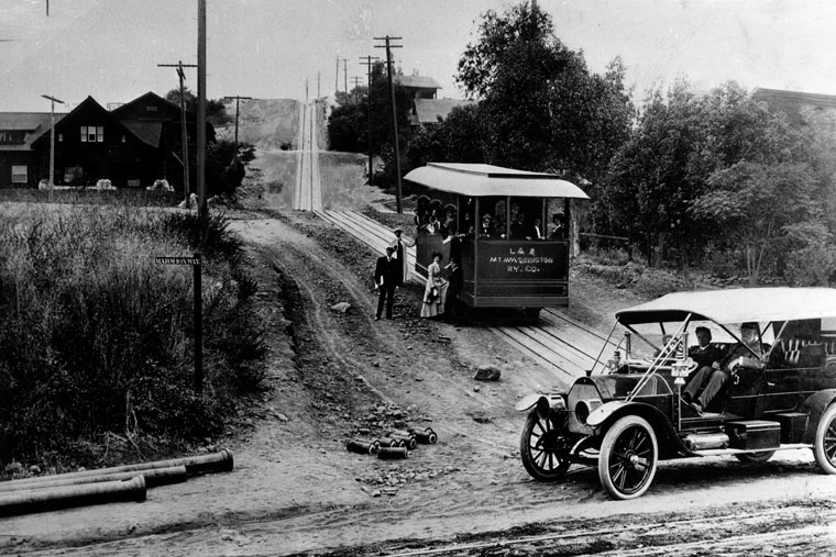
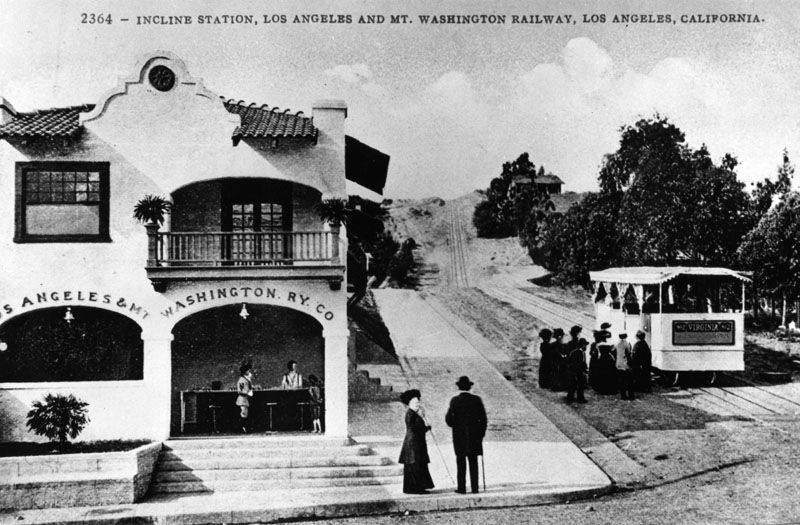
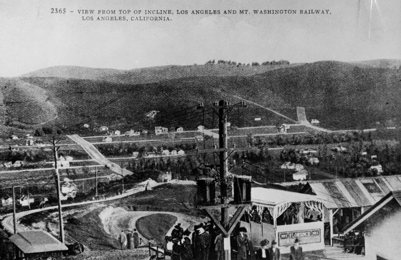
| (ca. 1910)^ - The Los Angeles and Mount Washington Railway Incline Station is a confection stand and waiting room for passengers of the Railway. The Railway was located on the southwest corner of Avenue 43 and Marmion Way and was in operation from early 1909 until January 9, 1919. |
Historical Notes The railway, which opened to the public on May 24, 1909, scaled the western slope of Mount Washington. For a nickel, passengers could disembark from a Yellow Car at the intersection of Marmion and Avenue 43 and ride the funicular to the top of Mount Washington. There, they could stay at a grand hotel or explore the vacant housing lots awaiting a home.**# |
 |
|
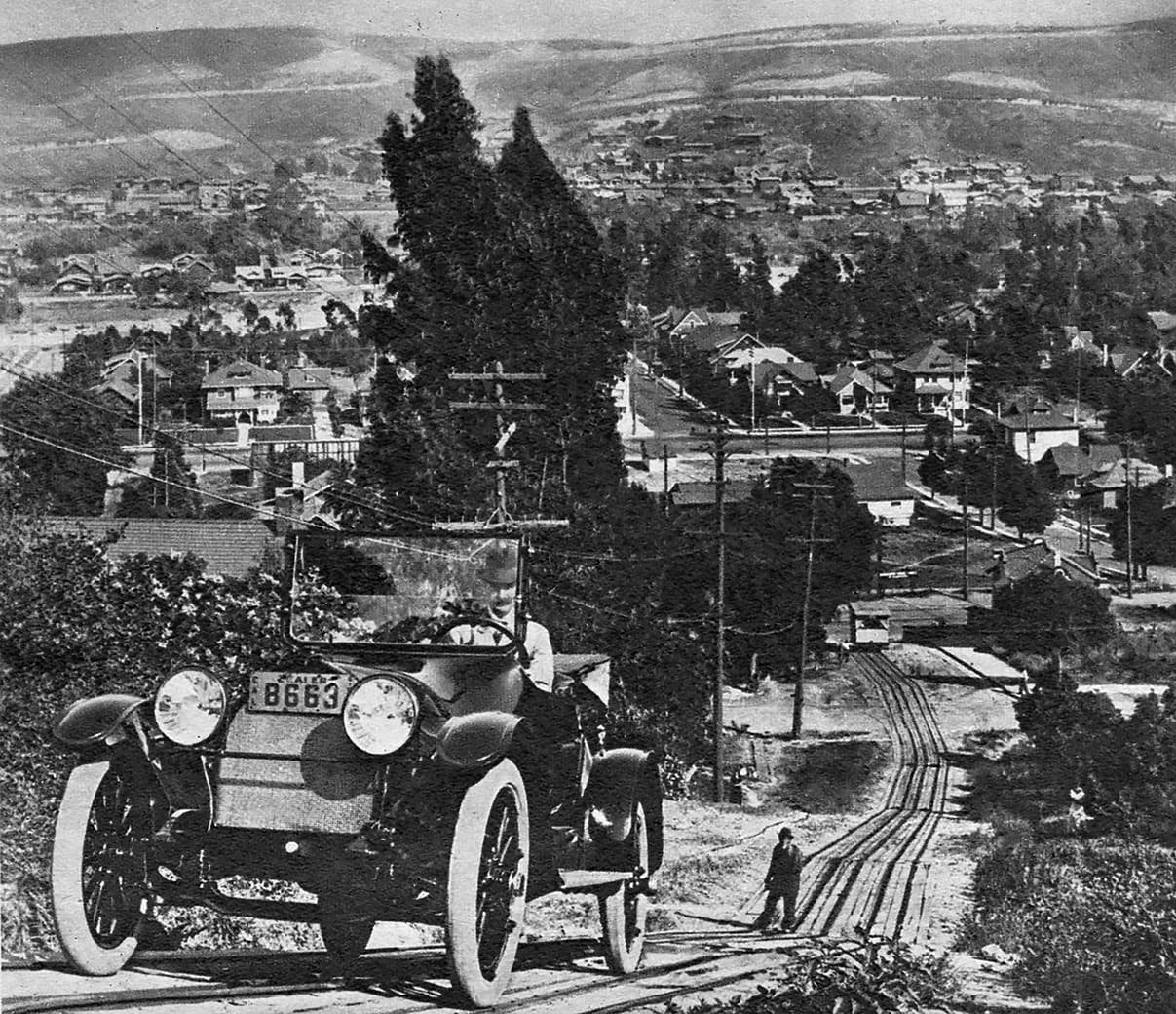
| (1915)^ – "Automobile climbs Mt. Washington incline! A motoring feat in 1915." From the LA Times Midwinter, 1950. |
 |
|
| (1915)^ - Postcard view looking eastward from top of the Mt. Washingtion Railway Incline. One of the original two cars seen to the lower left of photo, being used for storage of tools and machinery. View is from the location of Mount Washington Hotel. |
Historical Notes Although it had transformed Mount Washington, the railway did not operate for long. In 1918 city inspectors declared the railway unsafe, citing a worn cable. Instead of replacing the cable, Marsh closed the railway and challenged the inspectors' authority, arguing in state court that his proper regulator was the state railroad commission. Marsh lost his challenge, and despite the protests of local residents the funicular never reopened.**# |
 |
|
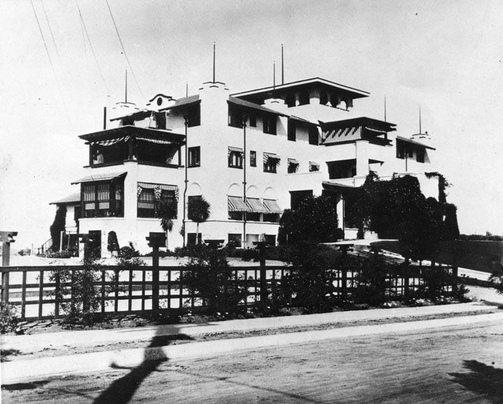
| (ca. 1915)^ - View showing the Mount Washington Hotel that sits on top of the Mt. Washington Railway Incline. |
Historical Notes The Mount Washington Hotel building remains standing today, having been purchased by the Self-Realization Fellowship in 1925. It was declared Historic Monument No. 845 by the City of Los Angeles on August 16, 2006 (Click HERE to see complete listing).*^ |
Then and Now
 |
|
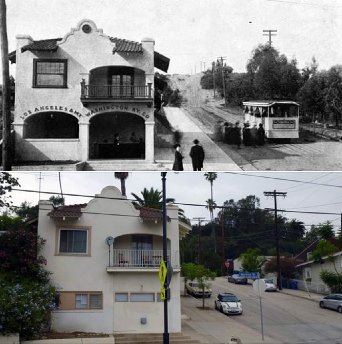
| Mt. Washingtion Railway Incline Then and Now, southwest corner of Avenue 43 and Marmion Way.* |
* * * * * |
 |
|
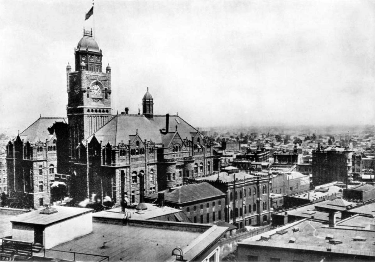
| (ca. 1906)^^ - View showing the Los Angeles County Courthouse and Jail looking west. The flat rooftops of high rise buildings fill the foreground while the gothic architecture of the courthouse stands to the left, its clock tower reading approximately ten minutes after nine o'clock and an American flag waving from its peak. |
Historical Notes The Court House was built from 1887-1891. It was damaged in the 1933 Long Beach earthquake, and declared unsafe for occupancy. Demolition started in 1935 (roof and two upper floors removed), and concluded 1936. Among the others, the photograph features the following buildings and structures: (John Anson) Bullard Block (1896-1926) can be seen between Main and Spring, Market and Court Streets; U.S. Hotel (1862-1939) is visible at left of upper Bullard on south-east corner of Main and Market Streets; Amestoy Building (1887-1958) is visible left of the U.S. Hotel, at north-east corner of Main and Market Streets.^^ |
.jpg) |
|
| (1907)^#^ – Left panel of a panoramic view of Los Angeles from the Hotel Trenton at 427 S. Olive Street. The towers of both the County Courthouse and City Hall can be seen in this frame. Caption reads: Owens River Day - Source: Library of Congress. |
.jpg) |
|
| (1907)^#^ – Right panel of a panoramic view, looking south, of Los Angeles from the Hotel Trenton. To the right stands the Philharmonic Auditorium on the northeast corner of 5th and Olive streets. Central Park is across the street. In 1918 Central Park was renamed Pershing Square. Source: Library of Congress. |
 |
|
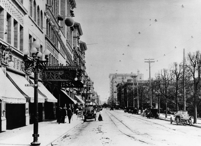
| (1907)^ - View looking west from the corner of 5th and South Olive Street. The main entrance to the Philharmonic Auditorium is on the left (northeast corner) with Pershing Square on the right. Note the ornate streetlight on the left with a street sign attached to its post reading: S. OLIVE ST. |
 |
|
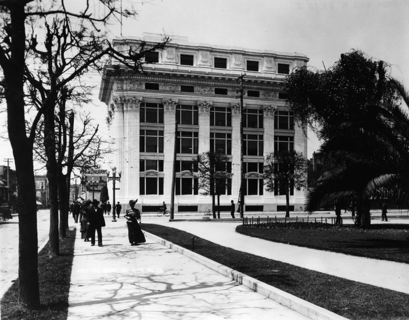
| (1908)^ - View of West 6th Street from Central Park (later Pershing Square), with the Pacific Mutual Building seen on Olive Street. |
Historical Notes The Pacific Mutual Building, located at 523 W. 6th Street, was built between 1908 and 1912. From 1916 to 1926 the building was modified and expanded to include: a north side addition, another 12-story structure, a garage building, and a west side addition. In essence, it became three interconnected buildings by 1926.^ |
 |
|
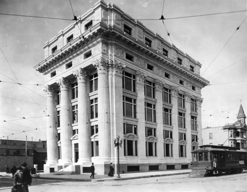
| (ca. 1908)^ - A close-up view of the original Pacific Mutual Building, the tallest on the northwest corner of Olive and 6th Streets across the street from Pershing Square. |
Historical Notes The Pacific Mutual Building still exists today but would be difficult to recognize when compared to the way it looks above. Over the years it would see a series of modifications and additions. In 1974, the building underwent an extensive restoration by Wendell Mounce and Associates, with Bond and Steward, which brought it back to its Beaux Arts revival. And in 1985, the entire building was renovated again by the Westgroup, Inc.^ The Pacific Mutual Building is listed as Historic-Cultural Monument No. 398. Click HERE to see complete listing. |
 |
|
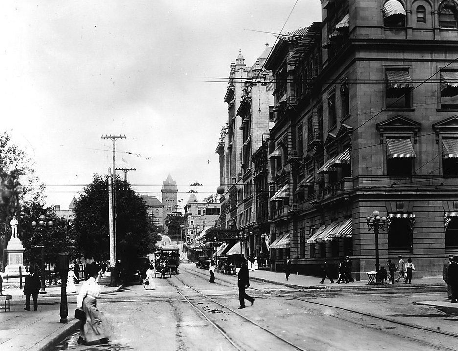
| (1908)^#^ - Looking west on 5th street at the intersection of 5th and Hill. The California Club is on the northwest corner on the right while Pershing Square is visible on the left. The State Normal School, on the present site of the L.A. Public Library, Central Branch is seen in the background. Men and women are seen crossing the streets. |
.jpg) |
|
| (1908)^#^ - Close-up of the previous photo showing more details. Three women and a man are crossing 5th Street. A horse-drawn carriage is followed by an early truck followed again by a streetcar. Cars and horse-drawn carriages are parked at the curb. State Normal School tower shows prominently in the background. |
.jpg) |
|
| (1908)^#^ - Close-up view of the northwest corner of 5th and Hill streets showing pedestrians moving about and interacting with one another. An ornate 5-bulb streetlight in full detail can be seen standing on the corner. |
Click HERE to see more in Early L.A. Streetlights |
* * * * * |
Los Angeles and 1st Streets
 |
|
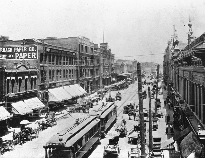
| (1907)^^ - Photograph of carriage traffic on Los Angeles Street at First Street. Streetcar tracks can be seen embedded in the middle of the road, and a large streetcar can be seen in the foreground at center. Horse-drawn buggies and carriages can be seen parked along both sides of the street. The Zellerbach Paper Company building can be seen at left. |
 |
|
| (ca. 1910)^^ – View looking north on Los Angeles Street from First Street. The street is filled with pedestrian and carriage traffic. |
Then and Now
 |
|
| (1910 vs 2022)* – View looking north on Los Angeles Street from First Street. |
Then and Now (Blended View)
 |
|
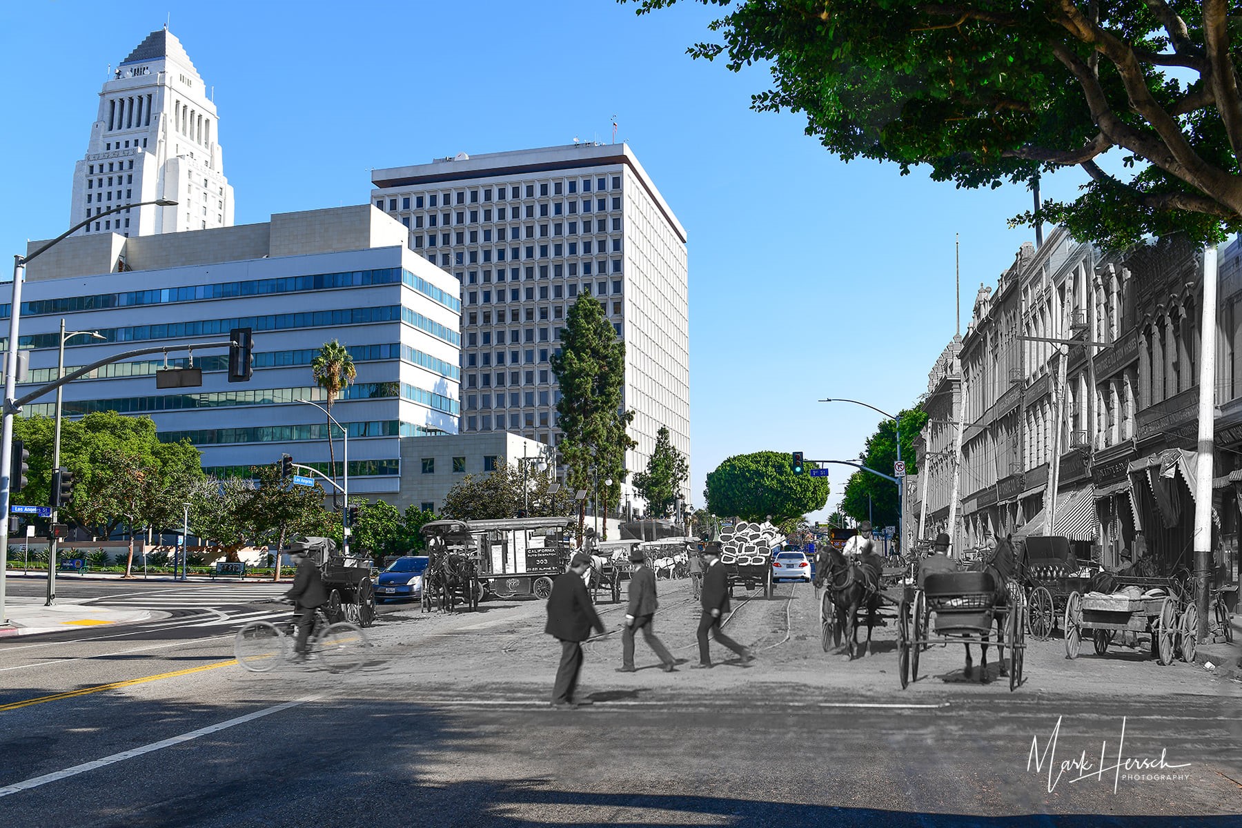
| (1910 v. 2020)^ - A composited image, blending a 1910 photo looking north on Los Angeles Street from 1st Street with a contemporary image. Composite Photo by Mark Hersch |
 |
|
| (ca. 1910)^ – View looking north on Los Angeles Street. John Wigmore and Sons' sign clearly gives their address at 108 N Los Angeles. To the left of John Wigmore and Sons is Bishop & Company, a candy and crackers manufacturer. |
 |
|
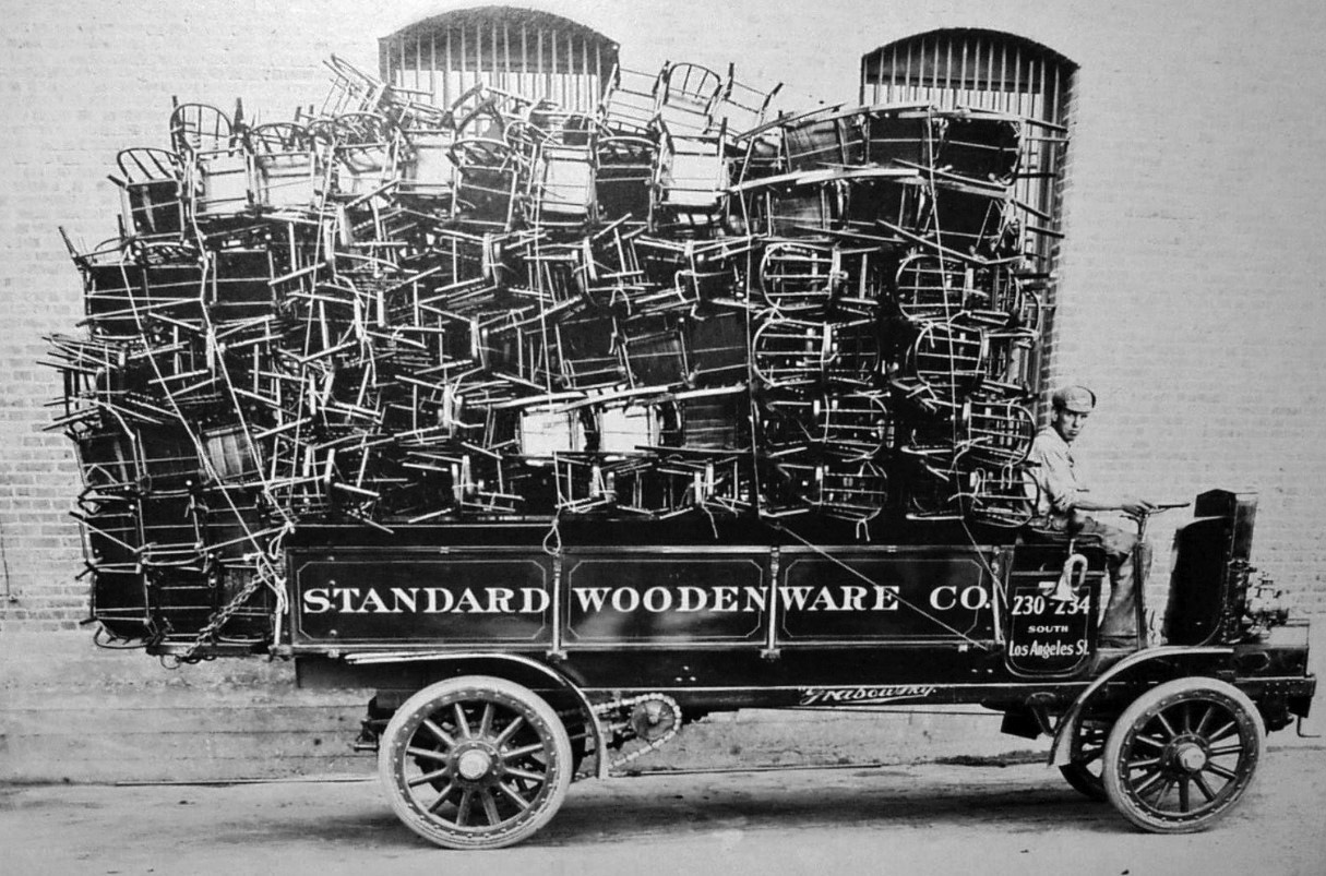
| (ca. 1911)* – View showing a delivery truck of the Standard Woodenware Company, filled to capacity. |
Historical Notes The Standard Woodenware Company, once located at 230-234 South Los Angeles St., made and sold brooms and wooden furniture, wholesale. It was also a company that suffered a history of fires. Their Los Angeles Street plant caught fire in 1904, suffering heavy damages. The plant was rebuilt, but caught fire again in 1906, this time set by arsonists. By 1911, the Standard Woodenware Company made plans for a new plant. USC claims that at least one of Woodenware's plant buildings was located at 1126 S. Santa Fe Ave. (the circa-1911 building is still standing); however, in 1916, the newspapers claim that their plant at 1828 Traction Avenue caught fire. The company remained in business at least until 1922. |
Los Angeles and 3rd Streets
 |
|
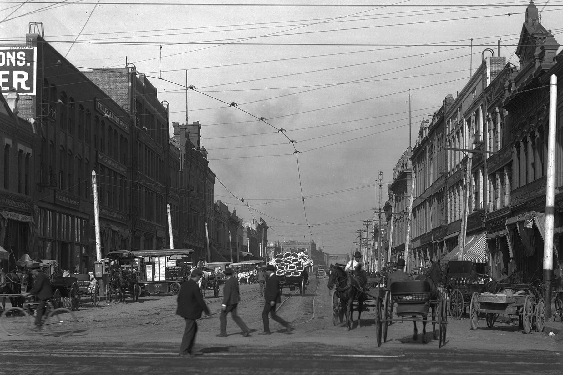
| (ca. 1910)^ – View looking north on Los Angeles Street between Second and Third streets. The street is filled with horse-drawn carriages parked along the curbs. Several carriages can be seen strolling down the street. |
 |
|
| (ca. 1910)^ – View looking north on Los Angeles Street between Second and Third streets. The street is filled with horse-drawn carriages parked along the curbs. Several carriages can be seen strolling down the street. Image enhancement and colorization by Richard Holoff. |
 |
|
| (ca. 1918)^ - View looking north on Los Angeles Street from Third Street. There are two sets of streetcar tracks running down the middle of Third Street through the dirt intersection. Los Angeles Street is crowded with horses, carriages, automobiles, and pedestrians. A lone bicyclist is headed into the traffic at right. |
Then and Now
 |
|
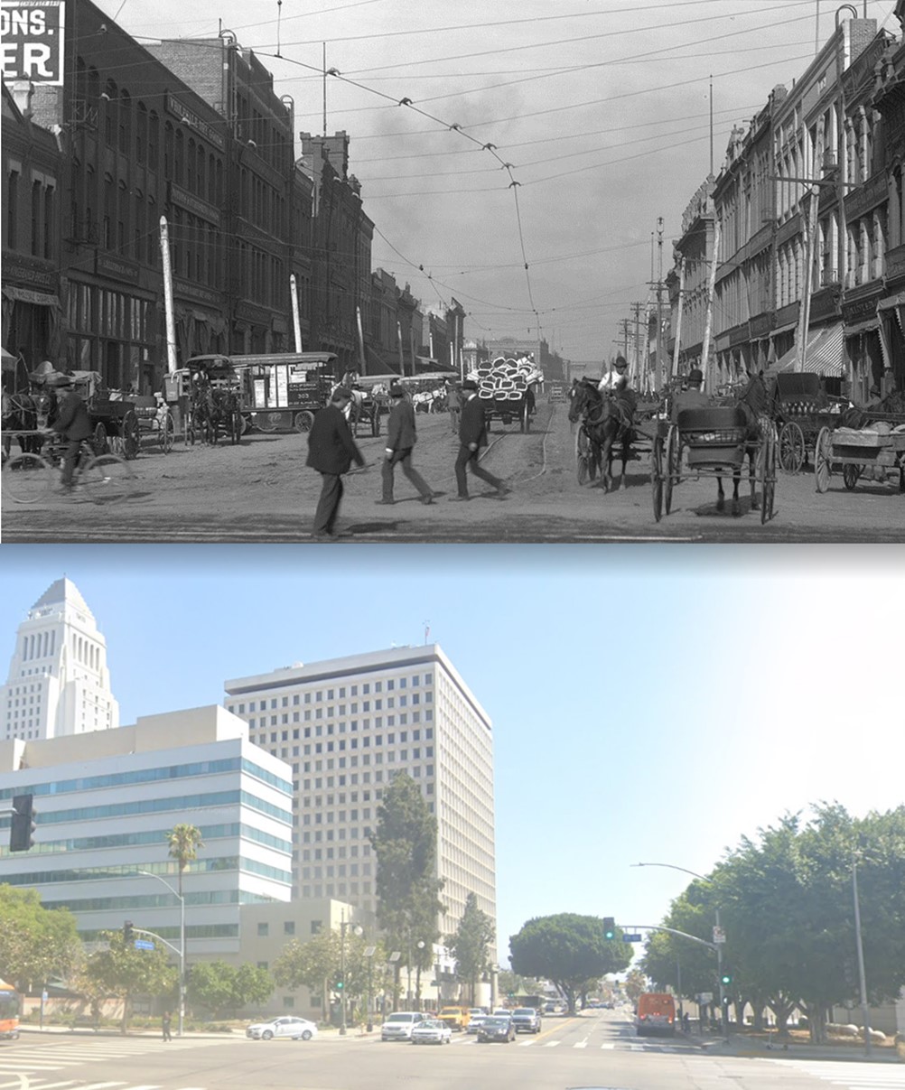
| (1910 vs 2022)* – Looking north on Los Angeles Street towards 2nd Street. |
Then and Now
 |
|
| (1918 vs 2022)*- View looking north on Los Angeles Street from Third Street. |
* * * * * |
Hill Street Tunnel
 |
|
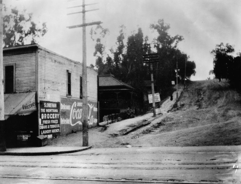
| (1908)^ - Looking south at Hill Street from Temple before the Hill Street Tunnel was bored. The Montana Grocery (S. Kinderman, grocer) advertises fresh fruit, cigars & tobacco, laundry and "Delicious Coca-Cola". Although the streets are unpaved, streetcar tracks are visible in the foreground. |
Historical Notes The Hill Street Tunnel was bored through a part of Bunker Hill in 1909 by Los Angeles Pacific (a predecessor of Pacific Electric). It connects Hill Street from First to Temple. In 1913, a second tunnel was bored for streetcar traffic. |
 |
|
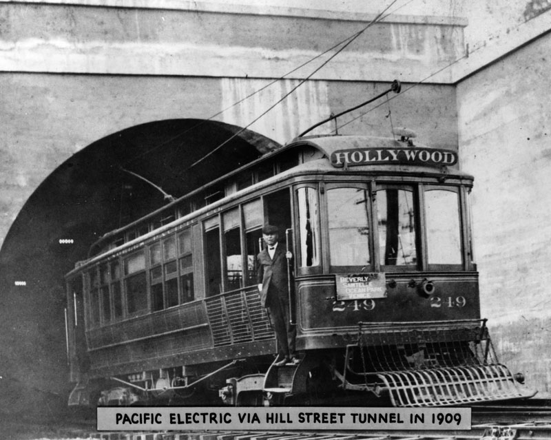
| (1909)^ - Pacific Electric Railway Hollywood car via the Hill Street Tunnel in 1909. Its sign says, "Beverly, Sawtelle, Ocean Park, Venice." Click HERE to see more in Early Views of Hollywood. |
Historical Notes This subterranean shortcut shaved tens of minutes off travel time between Hollywood and downtown Los Angeles. On September 15, 1909, local citizens celebrated its opening with a Tunnel Day joyride down Sunset Boulevard, motorcars and horse-drawn carriages racing alongside the Los Angeles Pacific’s streetcars.* |
 |
|
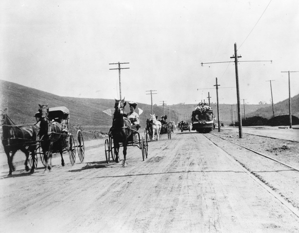
| (1909)^^ - Carriages and street cars moving west along Sunset Boulevard on Tunnel Day, Los Angeles, September 15, 1909. Four horse-drawn carriages are pictured to the left of the unpaved road while an automobile and a streetcar are pictured making their way down the road in the right background. Utility poles line it to either side in through the center. Hills are visible in the background. |
Historical Notes Picture file card reads: "Before the tunnels, the electric line operated to Hollywood via Spring Street, Main Street and the Plaza, but with the arrival of the tunnels this changed. Also, the gauge was broadened. The view is looking east of Vendome. Sunset swings to the left behind the hill where the new Silver Lake crossing bridge is now being built." |
 |
|
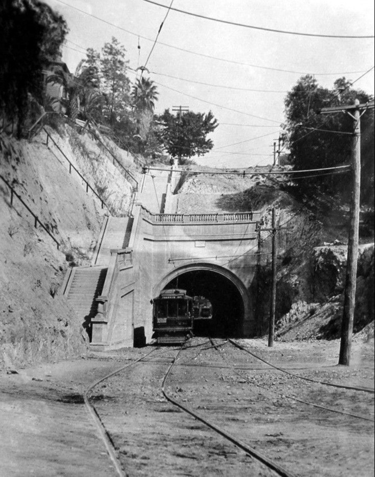
| (ca. 1910)* - View looking at the South portal of the Hill Street Tunnel from 1st Street. A second tunnel was bored through in 1913. |
Click HERE to see more of the Hill Street Tunnel |
* * * * * |
 |
|
| (1908)^ - Photo taken on the corner of Grand Avenue (with trolley lines running through it) and 9th Street. The corner shop, Great Western Steam Carpet Cleaning Works, offers carpets cleaned and re-laid for .07 cents per yard. On the right of the shop is a white building with a steeple, possibly a church. In the middle of the photo, an elaborate tower can be seen, possibly another church building. And on the left of the photo, the B'nai B'rith Congregation sits majestically on the corner lot of 9th and Hope streets. |
 |
|
| (ca. 1908)^ - A Central Avenue/Southern Pacific Station electric streetcar at the corner of Tenth Street and Grand Avenue, with an early pay-as-you-enter system. |
Los Angeles Skyline
 |
|
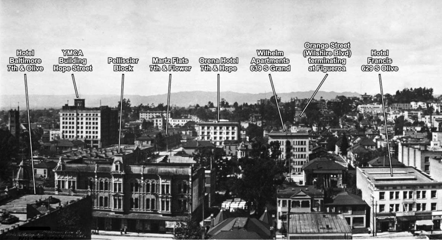
| (1909)#*^ – Panoramic view looking northwest from Hill and 7th streets. From left to right can be seen: Hotel Baltimore, YMCA Building, Pellisier Block, Martz Flats, Orena Hotel, Wilhelm Apartments, and Hotel Francis.*#^ |
.jpg) |
|
| (1909)^#^ – Left panel of a panoramic view looking west from the roof line over 2nd and Spring streets. City Hall is on the left at 226 S. Broadway. The stylish California Bank Building can be seen on the southwest corner of 2nd and Broadway. Photo Source: Library of Congress |
.jpg) |
|
| (1909)^#^ – Right panel of a panoramic view looking northwest from the roof line over 2nd and Spring streets. Two buildings stand out because of their distinguished-looking towers. In the far distance Los Angeles High School sits on top of Fort Moore Hill, located on north Hill Street between California (now the 101 Freeway) and Sunset Blvd (now Cesar E. Chavez Ave). Closer in is the Los Angeles County Courthouse, located on the corner of Temple and Broadway. Photo Source: Library of Congress |
* * * * * |
 |
|
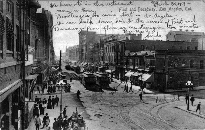
| (1909)*^^* – Postcard view of Broadway looking south at 1st Street, dated March 30, 1909. The message reads: "We have ate in this restaurant many a time. Broadway is the main street in Los Angeles - we can walk down here to the corner of First and Broadway from where we are staying in 10 minutes. Bye Bye, Linda". |
 |
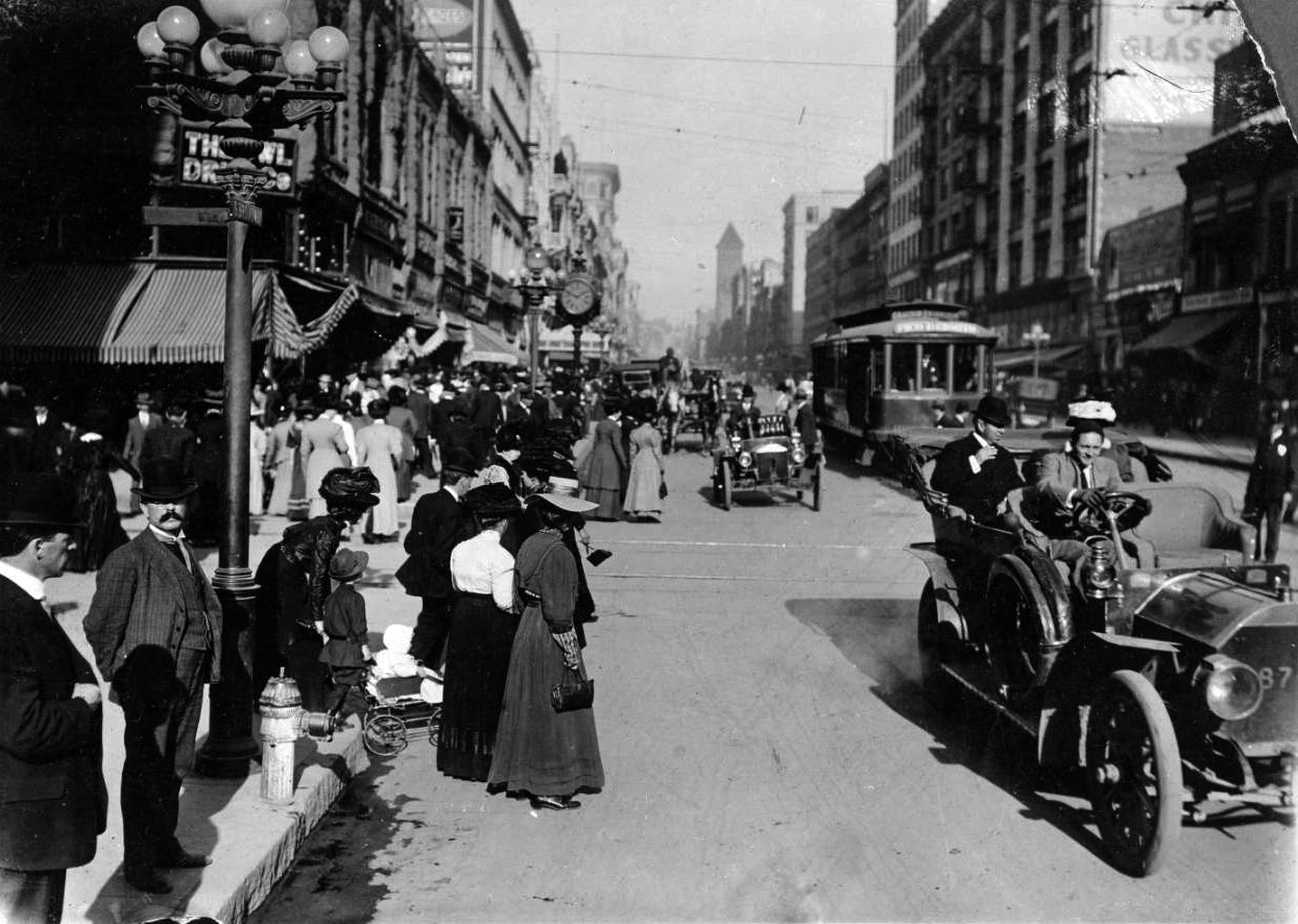
|
| (1909)^ - A view of Broadway looking north towards 4th Street. A Huntington Los Angeles Railway Co. street car waits in the street as cars, horse & wagon and bicycles go by. The sidewalks are crowded with pedestrians. |
Historical Notes For more than 50 years, Broadway from First Street to Olympic Boulevard was the main commercial street of Los Angeles, and one of its premier theater districts as well. It contains a vast number of historic buildings and is listed on the National Register of Historic Places. Before World War II, Broadway was considered by many to be the center of the city, where residents went to ornate movie palaces and shopped at department stores. Some historically significant buildings include the Bradbury Building and the Julia Morgan-designed Los Angeles Examiner Building.*^ |
Bliss
 |
|
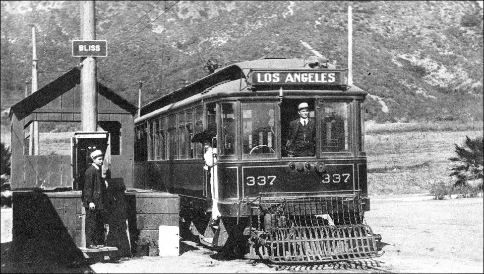
| (1909)* - All Aboard! Bliss to Los Angeles Line, 1909. Note the woman with the long white dress and huge hat. Also, the grill at the front (aka 'Cow Catcher')—it was a protective measure to prevent anyone (or anything) from falling underneath. |
Historical Notes Bliss was named for Bliss Ranch, owned by brothers John Dallett Bliss and Robert Parker Bliss from about 1894 to 1900, when LB Brand bought the property. He then sold a tract to Huntington for Pacific Electric. The Bliss stop was at the base of the Verdugo mountains, just after the Casa Verdugo stop. |
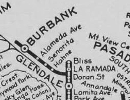 |
(Early 1900s)+^^ - Old rail map showing the Bliss Station located north of Glendale. | |
Ocean Park
 |
|
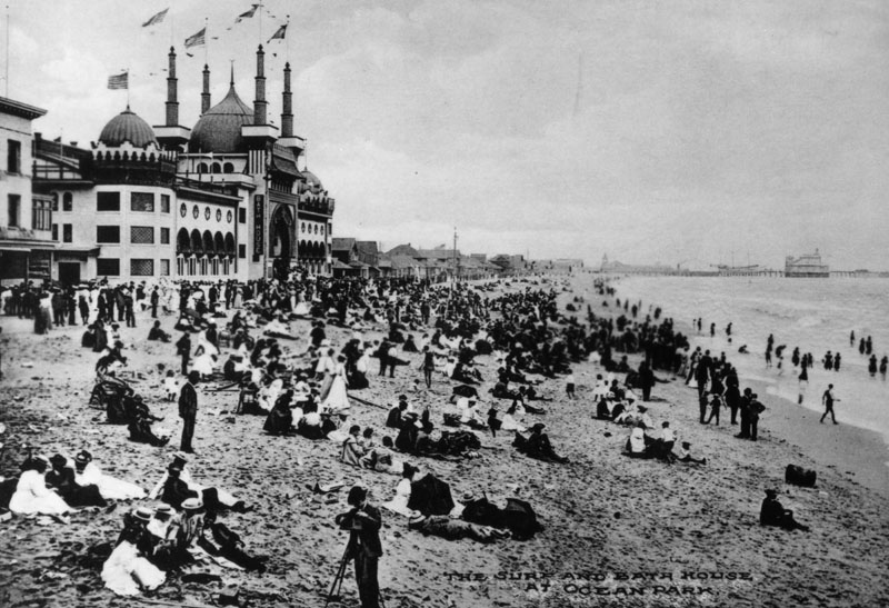
| (ca. 1910)^ - View of a crowded shore in front of the Ocean Park Bathhouse at Ocean Park Beach. A photographer is seen standing by his camera and tripod in the foreground. |
Historical Notes When it was built in 1905, the Ocean Park Bath House was one of the most elaborate structures on Santa Monica's beach. It was Moorish in style, 3 stories high with 5 domes. An ad from 1906 claimed it had the largest swimming pool in the US. #*^* |
 |
|
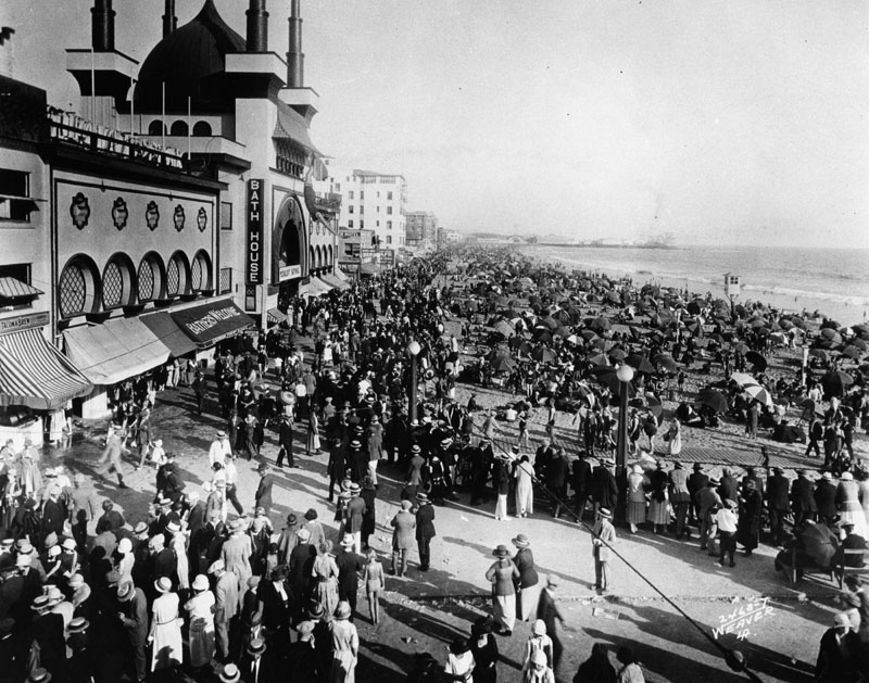
| (ca. 1910)^ - Heavy crowd day on the beach and in front of the Ocean Park Bath House. |
Historical Notes Looking more like a movie set, the Ocean Park Bath House was one of the most talked about buildings of its day-and a great draw for the beach area. The lavish indoor plunge (heated for those who didn’t take to cooler ocean swimming) was built by A.R. Fraser. #^^* In 1903 Alexander Rosborough Fraser built the Ocean Park Casino, and in 1905 erected the Ocean Park Bath House. In 1906 he built the Ocean Park Auditorium, the Masonic Temple and the Decatur Hotel. In 1911 “Fraser’s Million Dollar Pier,” was completed, extending 1000 feet over the ocean and housing a multitude of amusements, including a beautiful dancing pavilion. Destroyed by fire in 1912. Fraser built numerous improvements in Ocean Park, and is responsible for the construction of the concrete promenade which joins Ocean Park with Venice. #^** |
 |
|
| (1910)^ - View shows two automobiles driving on the l400 block of 3rd Street in Santa Monica (now the Third Street Promenade). |
 |
|
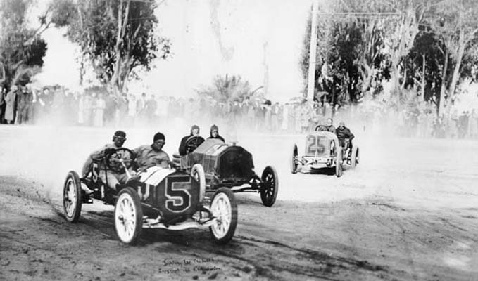
| (ca. 1912)^ - Two-man race cars take a turn at a race in Santa Monica. The course covered San Vicente Boulevard, Ocean Avenue and Wilshire Boulevard (then named Nevada Avenue). |
Historical Notes Auto racing became popular in Santa Monica. Drivers would race an 8.4-mile loop made up of city streets. The Free-For-All Race was conducted between 1910-1912. The United States Grand Prix was held in Santa Monica in 1914 and 1916, awarding the American Grand Prize and the Vanderbilt Cup trophies. By 1919, the events were attracting 100,000 people, at which point the city halted them.*^ |
Click HERE to see more in Early Views of Santa Monica. |
* * * * * |
West Los Angeles
 |
|
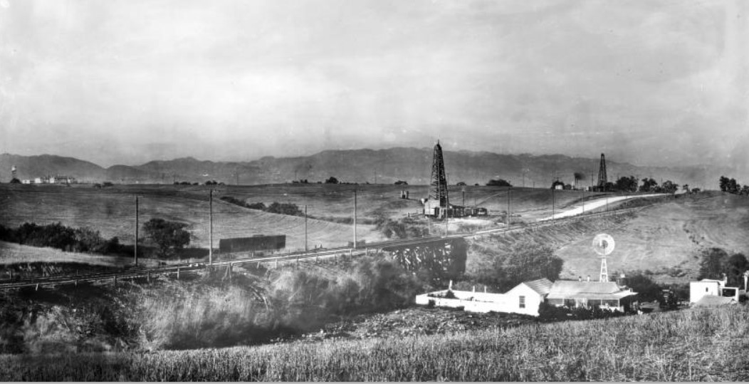
| (ca. 1908)^^ - Panoramic view looking northeast toward the Santa Monica Mountains from near Beverly Glen and Santa Monica Boulevard. Two oil siphons can be seen along the left side of the road in the distance, while a small farm homestead shows its barn, stables and windmill just beyond the hill in the right foreground. |
Coldwater Canyon - Beverly Hills
 |
|
| (ca. 1910)^- Looking north up Coldwater Canyon at the Haines lemon farm and the Sheffler residence. The Rodeo Land and Water Company later developed the canyon as one of the prime residential areas in Beverly Hills north of Sunset Boulevard. |
Historical Notes Coldwater Canyon is a canyon running perpendicular to the Santa Monica Mountains. The canyon is traversed by Coldwater Canyon Drive and Coldwater Canyon Avenue (linked by a short section of Mulholland Drive), which connect the city of Beverly Hills with the community of Studio City in the San Fernando Valley.* |
 |
|
| (ca. 1910)^- Looking north up Coldwater Canyon at the Haines lemon farm and the Sheffler residence. The Rodeo Land and Water Company later developed the canyon as one of the prime residential areas in Beverly Hills north of Sunset Boulevard. (AI enhancement and colorization by Richard Holoff) |
Historical Notes The Rodeo Land and Water Company later developed the canyon as one of the prime residential areas in Beverly Hills north of Sunset Boulevard. The legacy of the Rodeo Land and Water Company is intertwined with the history of Beverly Hills. The successful development and promotion of the area helped establish Beverly Hills as a premier residential destination, known for its affluence and celebrity residents. |
 |
|
| (1911)* - View of a large home situated on the top of the hill, overlooking Coldwater Canyon. The home is identified as once belonging to a Kirk Johnson. |
Historical Notes In the early 20th century, the area underwent significant development, and Coldwater Canyon became a prominent route. The expansion of Los Angeles and the development of Beverly Hills as an upscale residential area contributed to the importance of Coldwater Canyon as a transportation artery. |
* * * * * |
Early Aviation
 |
|
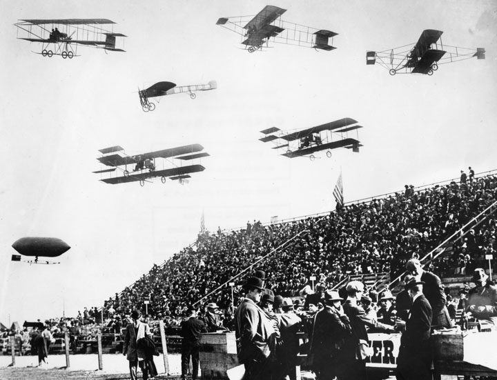
| (1910)^ - A composite view of six biplanes and one blimp-shaped airship flying over a large crowd of spectators at the Los Angeles International Air Meet at Dominguez Airfield. |
Historical Notes The Los Angeles International Air Meet (January 10 to January 20, 1910) was among the earliest airshows in the world and the first major airshow in the United States. It was held in Los Angeles County, California at Dominguez Field in present day Carson, California. Spectator turnout numbered approximately 254,000 over 11 days of ticket sales. The Los Angeles Times called it "one of the greatest public events in the history of the West”.*^ The Dominguez Hills airshow site has been designated as California Historical Landmark No. 718. |
 |
|
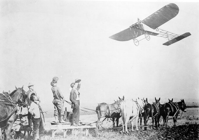
| (1910)^ - Spectators (or farmers) watch as Louis Paulhan flies a Bleriot monoplane at the nation's first Air Meet at Dominguez Field. |
Click HERE to see more in Aviation in Early L.A. |
* * * * * |
 |
|
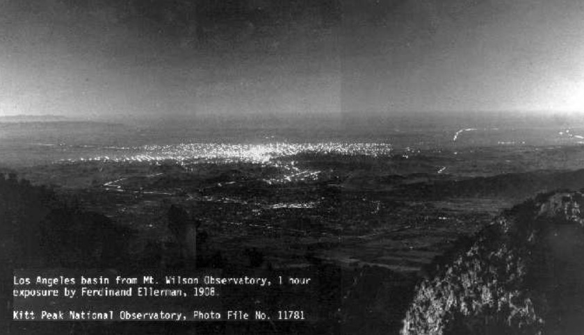
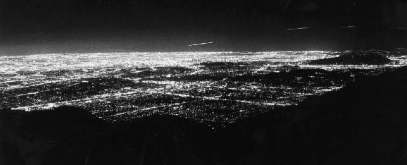
| (1908)^^^^* - Panoramic view showing Pasadena and Los Angeles as seen from Mount Wilson (elevation of 5000’) showing some of the main streets and roads which exists today and an extensive view of outdoor electric lights. The brightest lights are in downtown Los Angeles, some 20 miles distant. |
 |
|
| (1988)^^^^* - View from Mt. Wilson 80 years later (from approximately the same location as the 1908 photo). This was a 15-second exposure showing the dramatic growth of outdoor lighting throughout the greater Los Angeles basin. The intersection of Lake Avenue and Colorado Boulevard in the City of Pasadena in the foreground, with the Los Angeles Civic Center area in the middle of the photograph. Click HERE to see more in Early LA Streetlights. |
 |
|
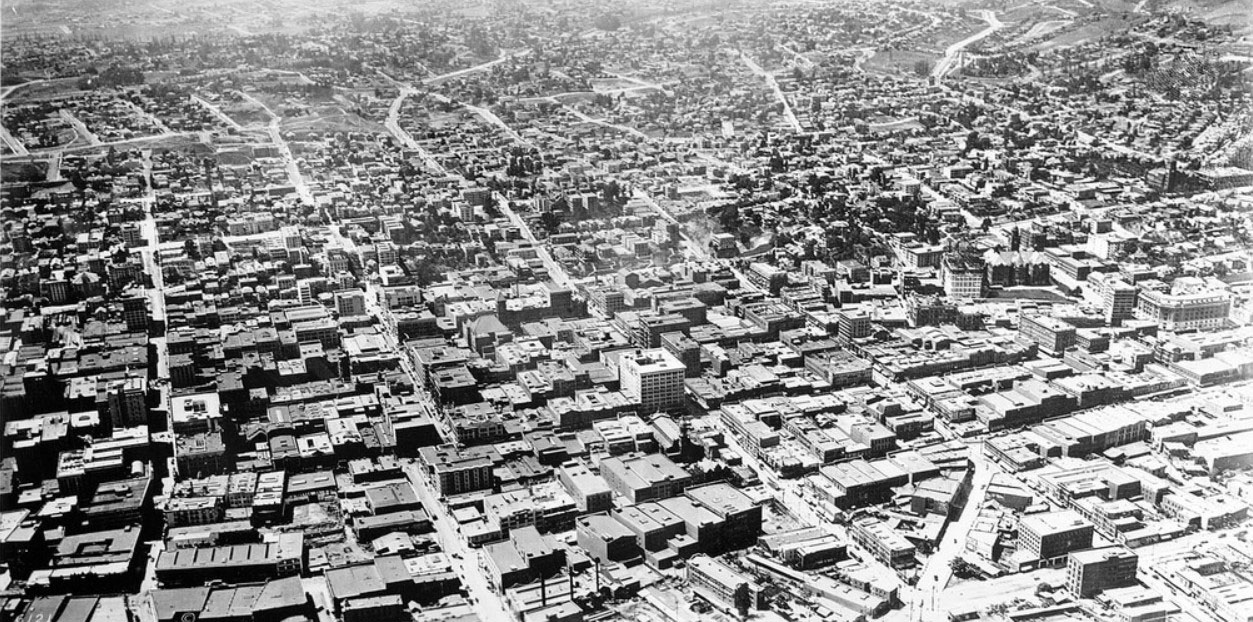
| (ca. 1910)^^ – Panoramic view of growing Los Angeles looking northwest, likely from a captive balloon. At center-right can be seen the Hall of Records still under construction without a roof. Further right (right-center) stands the International Bank Building next to the Federal Building. #^ |
 |
|
| (ca. 1910)^ - Temple Street at the junction of Spring and Main Streets. At left is the International Bank Building across the street from the Federal Building. An early open car and a trolley car are seen on the street. |
Historical Notes The International Bank Building stood at 226 North Spring Street, the intersection of Temple and Spring, (sometimes referred to as Temple Square) across from the Main Post Office and was featured in several postcards from the 1920s.*^ |
* * * * * |
LA Times Building (2nd Location)
 |
|
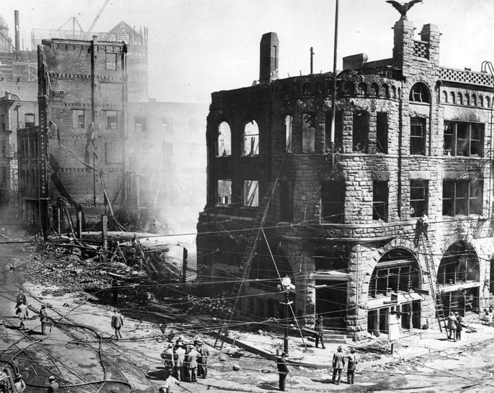
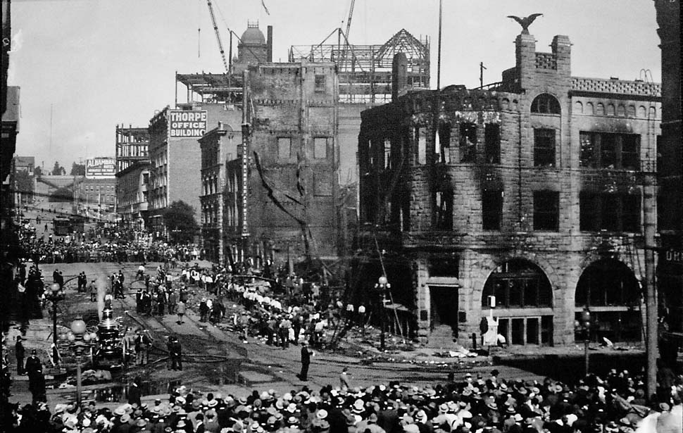
| (1910)^ - Bombed-out building of the Los Angeles Times at First Street and Broadway. This was the LA Times' 2nd Building. |
Historical Notes On October 1, 1910 at 1:07 am, a bomb exploded in an alley adjacent to the LA Times building known as "Ink Alley". The south wall facing Broadway Street collapsed, the blast weakened the second floor, which also collapsed under the weight of its machines, onto the first floor, in turn, falling into the basement. A fire resulted due to the natural gas lines that were located beneath the bombing site, and barrels of ink ignited. The explosion and subsequent fire destroyed the building, trapping and killing 20 employees who were working the night shift printing that day's edition, and many more were seriously injured. Charged in the crime were two brothers, James B. ("J.B.") and John J. ("J.J.") McNamara, members of the Iron Workers Union; they were arrested in April 1911. A third man, Ortie McManigal, was also implicated and would later agree to testify against the McNamara brothers.^ |
 |
|
| (1910)^#^ - Panoramic view showing the aftermath of the Times Building bombing. |
Historical Notes Noted attorney Clarence Darrow was hired by the American Federation of Labor to defend the two brothers charged in the Times Building bombing; their trial was set to begin October 11, 1911. Darrow initially believed the McNamaras to be innocent, but upon learning of their guilt arranged a plea bargain to spare them the death penalty. James McNamara got a life sentence, and John received a sentence of 15 years. Following their trial, they were sent to San Quentin State Prison. James B. was transferred to Folsom State Prison for a time, and then sent back to San Quentin for medical reasons, where he soon died of cancer on March 9, 1941. His brother John J. died in Butte, Montana two months later, on May 8, 1941.^ |
 |
|
| (1912)#+ – View looking southwest on New High Street showing the newly completed LA Times Building (3rd Times Building) located on the N/E corner of 1st and Broadway. To the right is the Hall of Records (built in 1906). |
Historical Notes The 3rd Los Angeles Times Building opened on Oct. 1, 1912 — on the second anniversary of the bombing of the 2nd LA Times Building. |
 |
|
| (ca. 1925)^ - Aerial view of the Civic Center looking north from First and Broadway, with the Los Angeles Times building in the foreground (N/E corner of 1st and Broadway). The Broadway Tunnel can be seen in the distance (center-top). The Hall of Records (center-right) sits between the diagonally running New High Street and Broadway. |
Historical Notes Click HERE for more on the history of the LA Times and its 4 different buildings since 1881. |
* * * * * |
Main, Spring, and 9th Street
 |
|
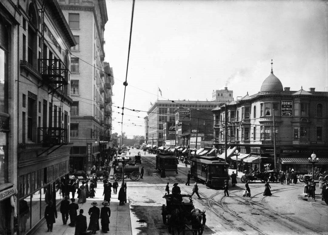
| (1900)^^ – View looking north on Spring Street from 9th Street, with Main Street on the right (out of view). Horse-drawn carriages make their way down the paved street, and a streetcar can be seen in the far distance approaching the camera along its tracks. Pedestrians are visible to the left, on the sidewalk next to a large pile of soil that stands in front of the entrance to a three-story brick shop building. Similar buildings line the street to either side, riddled with signs. A lot full of trees is cordoned-off by a wrought iron fence farther in the foreground along the left sidewalk. Legible signs include: "The English Steam Dye Works / Dry Dyeing & Cleaning Processes", "Barker Bros. Furniture [...]", "Williams Bros. General Merchandise / Wood Coal Hay Grain", and "Wm. H. Hoegee [...]". |
 |
|
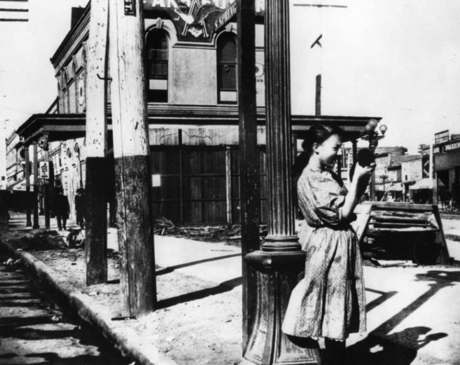
| (1906)^ - The traffic island in the middle of the street divides Spring St. (on the left), and Main St. (on the right). This view looks north from 9th Street. A young girl, holding possibly a black puppy or kitten stands next to an ornate streetlight post. Behind her, a partial company name is visible, it reads: "Anheuser" with a picture of an eagle, wings spread open, and the capital letter "A". This building possibly being the Los Angeles headquarters of what would later become Anheuser-Bush, Inc. |
Historical Notes Anheuser-Bush, Inc. originated in St. Louis, Missouri; the first brewery opened in 1852 and was incorporated in 1875. Today, Anheuser-Busch is the largest brewing company in the United States. |
.jpg) |
|
| (ca. 1910)^ - Looking north towards Spring (left) and Main (right) from 9th St. The traffic consists of mainly horse and buggies interspersed with electric Yellow Cars and bicycles. Business signs include, left to right, Powell's Bakery; Wilson Whiskey, That's All!; The English Steam Dye Works; Los Angeles Furniture Co.; and Anheuser-Busch. The circular tower with flag (center of photo) is the Copeland Building, aka Armory Building, located on the NW corner of Spring and 8th streets. |
Historical Notes Click HERE to see more Early Views of the Intersection of Main, Spring, and 9th Street (1873 - Present). |
* * * * * |
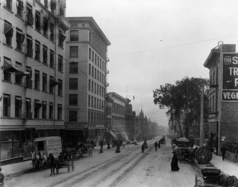 |
|
| (1910)^ - A horse-drawn Bekins Van & Storage (shippers of household goods) vehicle is parked at the curb on Hill Street looking south from 3rd. A millinery shop (2nd building from left) is at the corner. Several carriages are parked and pedestrians are crossing the cable car tracks in the middle of the street. |
 |
|
| (1907)*^^^* - View showing a horse-drawn flusher used for street cleaning at the early part of the century. |
Historical Notes Until the 1870’s, there were no graded streets in Los Angeles. Every citizen was his own sweeper. On Saturdays, residents swept and cleaned up the street in front of their property. On April 15, 1872 the position of superintendent of streets and highways was created and Jasper Babcock was appointed at a salary of $50 a month.*^^^* |
 |
|
| (1910)^#^ - View showing a steamroller on a Los Angeles street adjacent to a horse-drawn flusher. The sign on the back of the flusher reads: Studebaker Patent Sprinkler |
Historical Notes In 1910 the Los Angeles Bureau of Street Maintenance and Inspection was created.*^^^* |
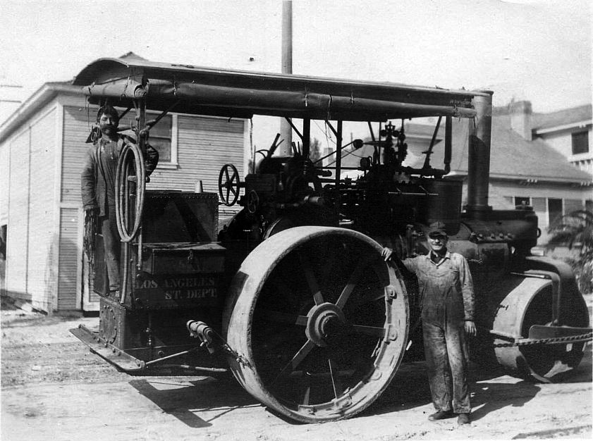 |
|
| (1910)^#^ - View showing one worker standing in the back of a steamroller and another leaning on its rear wheel. The sign on the side of the steamroller reads: Los Angeles Street Department. |
Historical Notes In 1998, the Bureau of Street Maintenance changed its name to the Bureau of Street Services.*^^^* |
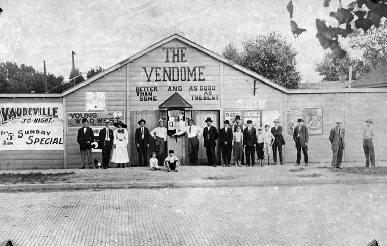 |
|
| (ca. 1910)^ – Group of people are posed outside an early day Los Angeles movie house called "The Vendome". Writing at front reads, "The Vendome, better than some and as good as the best." Banner on left reads, "Vaudeville tonight, Big 5 cents show, Sunday Special." |
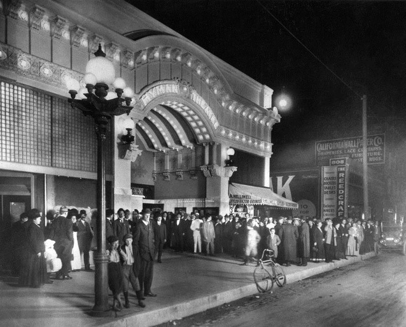 |
|
| (1910)^ - An evening crowd gathers under the marquee of the Hyman Theater on the southeast corner of 8th and Broadway. A lone bicycle leans on the curb in front. |
Historical Notes The theater was built in 1910 by Los Angeles theatrical promoter Arthr S. Hyman. Within just one year, 1911, the theater became the Garrick, a motion picture theater. The original facade was designed by the Los Angeles architect firm, Train & Williams. In 1921 it was remodeled to a design by architect George Edwin Bergstrom. The building was replaced by the Tower Theatre in 1927.^ |
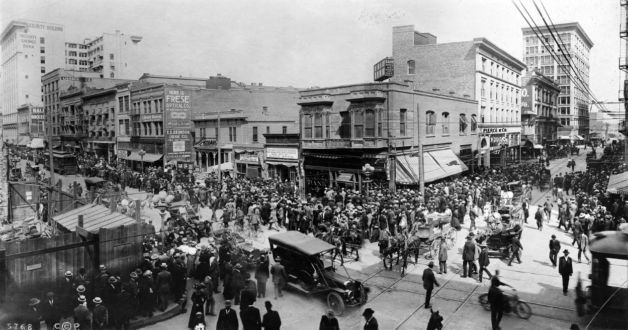 |
|
| (1910)#^ – View showing a huge crowd and long lines in front of the All Night And Day Bank on the corner of Spring Street and Sixth Street. What we're seeing here is a "run" on the bank. |
Historical Notes The following May 4, 1910 Los Angeles Herald article explains the event depicted in the photo above: AFTER almost forty hours of continuous siege, the "run" on the All Night and Day bank, corner Sixth and Spring streets, was broken last night, and long before midnight the last of the depositors In the original "line-up" had been paid in full, and the bank has settled down to its regular routine of business. The run, which began before 8 o'clock Monday morning, and which lasted until about 9 o'clock last night, was as remarkable yesterday as it was on the first day, inasmuch as many interesting features characterized the financial "bombardment," and the day's procession through the crowded bank was replete with sidelights…. Click HERE to see entire article. |
.jpg) |
|
| (ca. 1910)^^ - View looking west down 4th street from the corner of 4th and Main streets. The Greek-like columned Farmers and Merchants Bank stands at left on the southwest corner and the Van Nuys Hotel is at right on the northeast corner. The busy street is full of people and vehicles. Almost all of the people are dressed professionally and all of them are wearing hats. People can be seen conversing with each other, walking down the sidewalk, crossing the street, riding their bicycles, or driving their early automobiles. Streetcar rails run down the middle of the road and utility wires dangle overhead. |
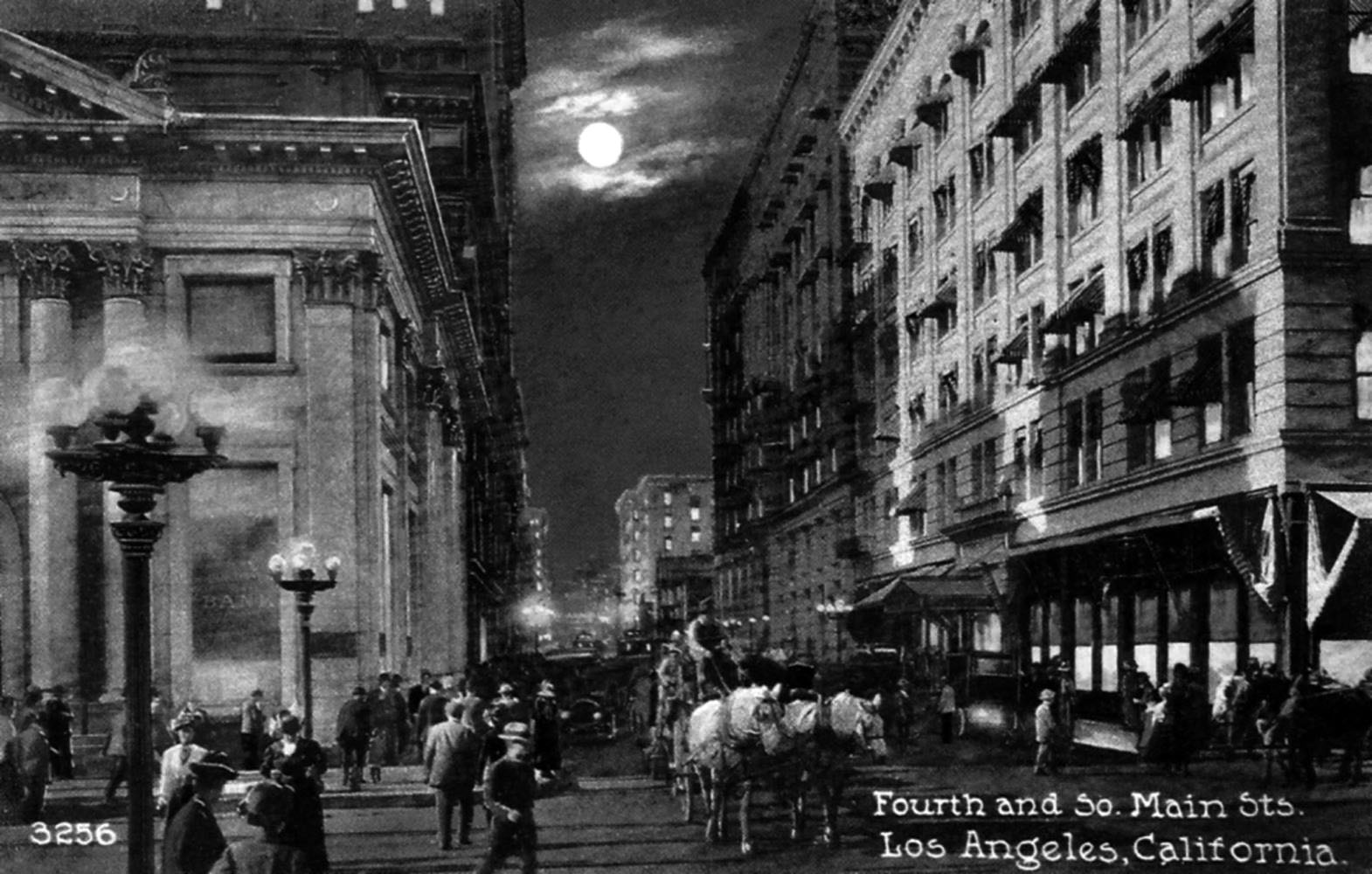 |
|
| (ca. 1910)^#*^ - Postcard view showing the intersection of 4th and Main streets looking west with the Farmers and Merchants Bank at left (S/W corner). Note the ornate street lamps on the corners. |
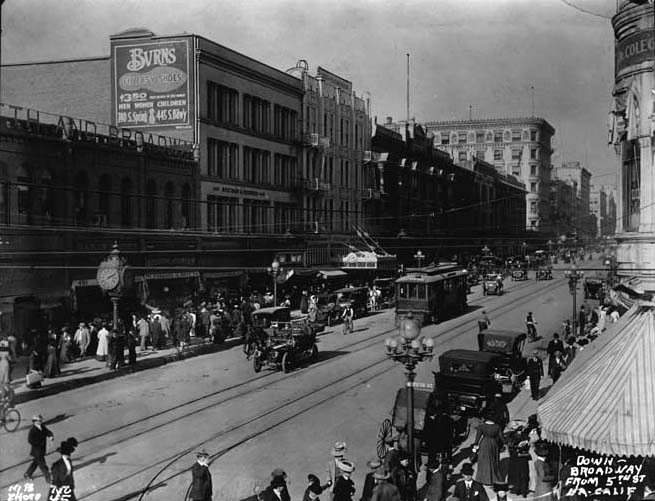 |
|
| (1910)^*# - View looking north on Broadway from 5th Street. Horse-drawn carriages share the street with autos and streetcars. Note the post-mounted street clock by the curb at center-left of photo. |
Broadway and 4th Street
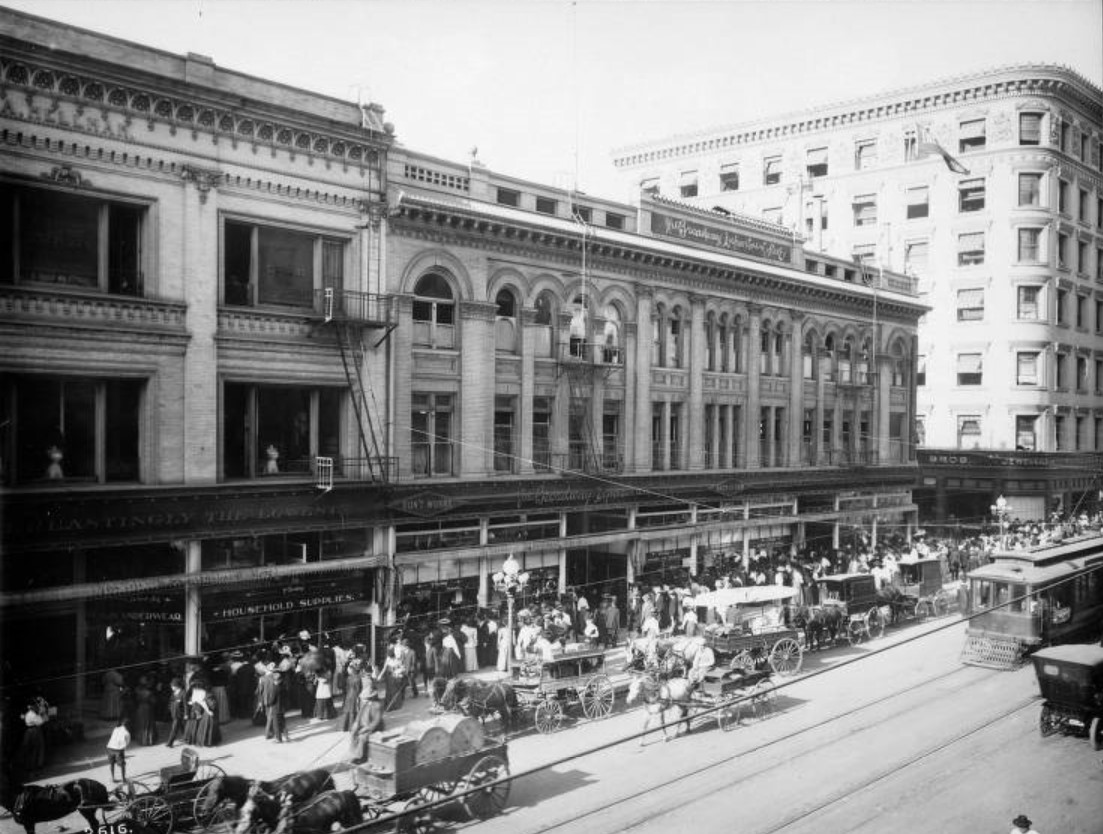 |
|
| (1910)*^#^ - View looking at the west side of Broadway just south of 4th Street. The Broadway Department Store (its first in LA) stands on the southwest corner with throngs of people seen on the sidewalk. Horse-drawn wagons and carriages share the street with a trolley car and an early model auto. |
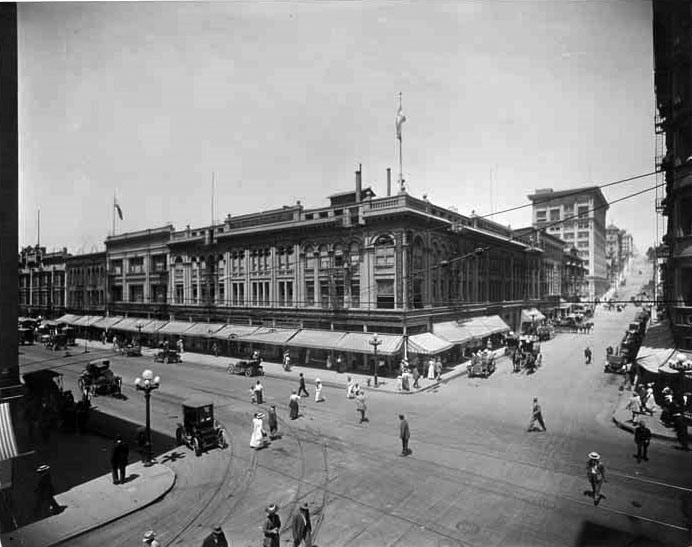 |
|
| (ca. 1910)^*# - View looking at the southwest corner of 4th and Broadway. The Broadway Department Store, complete with awnings stands at the corner. People are seen crossing the intersection in all direction. Note the odd shaped vehicle in the lower left. It is an all-electric car built by Baker Motor Vehicle Company. |
Historical Notes From 1910 to 1915 the popularity of the electric car peaked and shortly thereafter gasoline powered vehicles took their place. Electric cars were expensive costing between $2,550 and $3,000 in 1914. #^#^ |
 |
|
| (2014)##^^ – Google street view showing the Junipero Serra Building, previously the Broadway Department Store Building, S/W corner of 4th and Broadway. |
Historical Notes The current 11-story building on the S/W corner of 4th and Broadway was built in 1913. Click HERE to see more in "The Broadway". |
Then and Now
.jpg) |
|
|
| (ca. 1910)^*# - View looking at the southwest corner of 4th and Broadway. | (2014)#^^ - View looking at the southwest corner of 4th and Broadway |
.jpg) |
|
| (ca. 1910)^ - View of the east side of Hill Street between 4th and 5th. The Occidental Hotel is seen with horse buggies and early automobiles in front. The mixed-use building has commercial stores on the ground floor with hotel rooms above. "E. Wilson" is engraved on building just below the roof line. |
Historical Notes In 1914, the relatively humble building was dwarfed by the 11-story Hotel Clark, which rose on the adjacent plot on its north side. The Occidental Hotel was eventually acquired and demolished by its neighbor and replaced by a two-story annex in 1937. #^*# |
| (ca. 1910s)##^^ – Postcard view showing the free shuttle from La Grande Station to the Occidental Hotel. |
Historical Notes Back of postcard reads: "Occidental Hotel. Rates, $1.00 to $2.50. Through the "Block" from Hill Street, to Broadway. Main Entrance, 428 So. Hill Street Los Angeles." ##^^ |
 |
|
| (ca. 1910)^^ - Auto showroom in 1910 showing the latest Dodge model. |
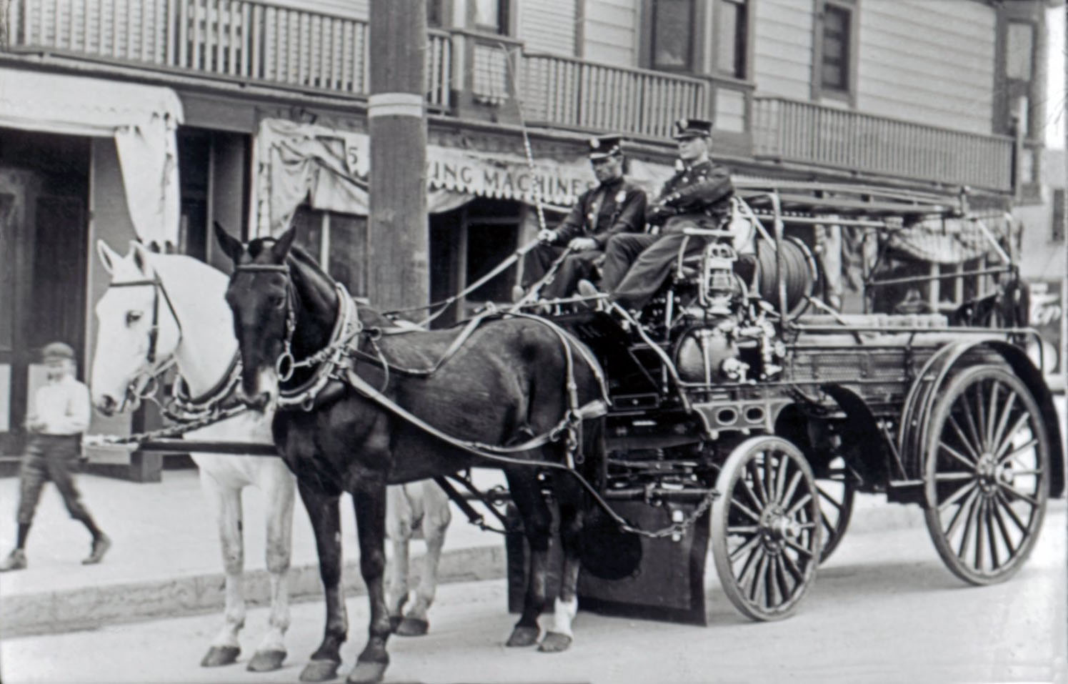 |
|
| (1911)^^^# - Resting, but ready for Action! Two fireman sit on a horse-drawn fire ladder wagon as a boy walks by admiring the horses. |
Historical Notes Not seen here, however, Dalmatians were often used as a coach dog. These 60 lb dogs were used to guard the ladder wagon from theft and to keep the horses calm during the excitement of the fire. The fire-ladder wagon was loaded with attractive brass items that were easy pickings for boys looking for a souvenir.^#^ |
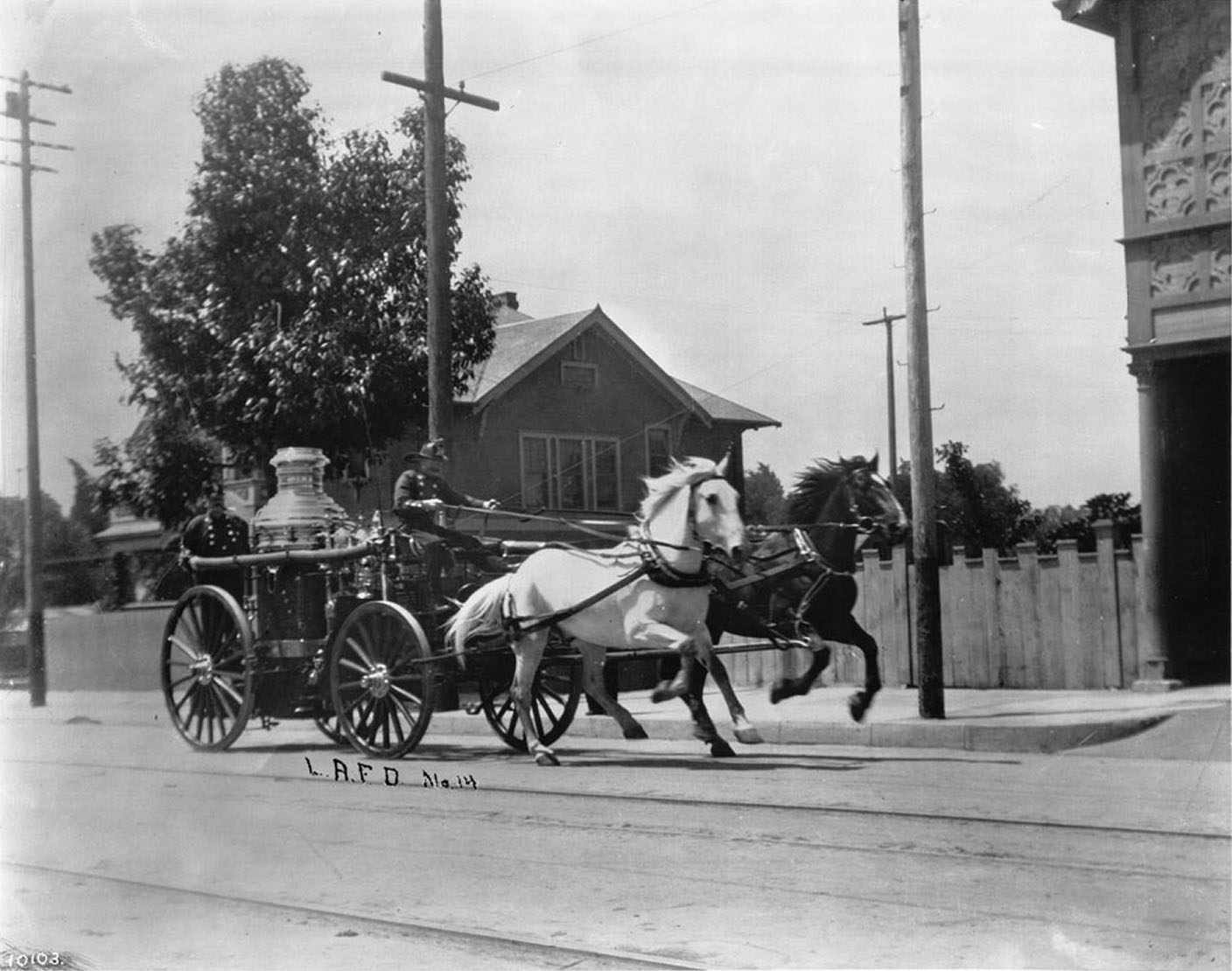 |
|
| (ca. 1910)^^- View of horse-drawn Engine No.14 running past the Engine House at 3401 S. Central Ave. |
Historical Notes On a cool day 50 MPH was easy for these horses when pulling the 6000 lb steamer pump. They would always use the best horses for the pump engine. Horses of the Morgan breed were most typically used. Often when the old fire engine horses were retired out to pasture, from blocks away they would hear the fire bell and run to the station house, ready to pull the wagon. The bell meant "get ready to be in harness". This was how loyal they were.^#^ |
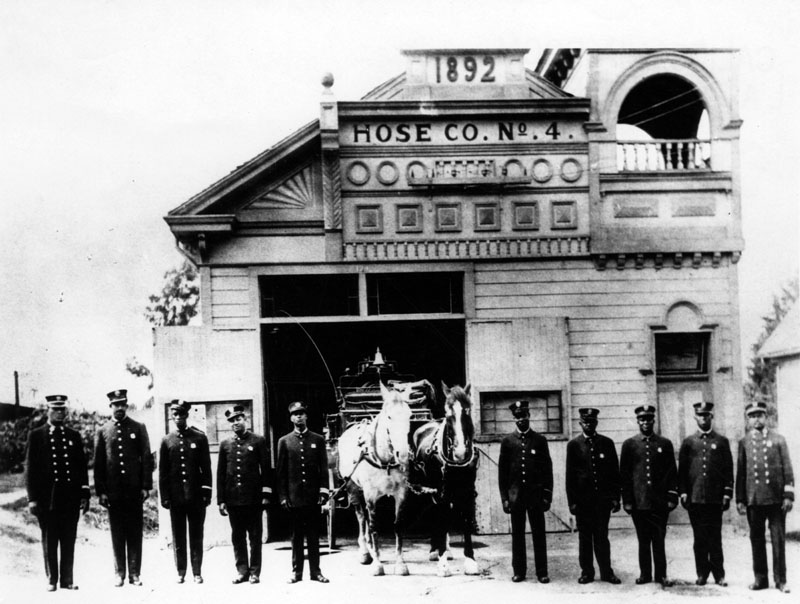 |
|
| (ca. 1910)^ - Hose Company No. 4 opened on February 22, 1900 and was originally located on Jefferson Street, between Thirty-Second and McClintock Streets. |
Historical Notes In 1906-07, Hose Co. No. 4 closed and moved to its new location (pictured) at 137 S. Loma Drive (previously Belmont), which had formerly been occupied by Chemical Engine Co. No. 2, known as "The Hill". In 1924, Hose Co. No. 4 closed, and Engine Co. No. 58 opened in this same building.^ |
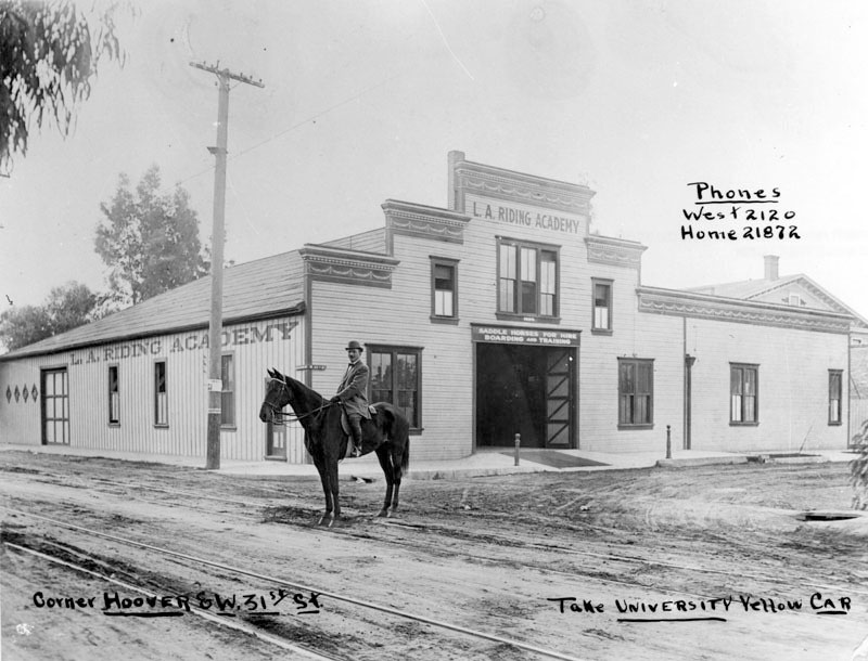 |
|
| (Early 1900s)^ - A man on horseback stops on the streetcar tracks outside of the L.A. Riding Academy, located on the corner of Hoover and W. 31st Street. Above the entrance, the sign reads, "saddle horses for hire" and "boarding and training." Writing on the image includes transportation instructions, "take University Yellow Car", on the bottom right of the image and the telephone numbers "West 2120" and "Home 21872" in the upper right corner. |
* * * * * |
La Brea Tar Pits
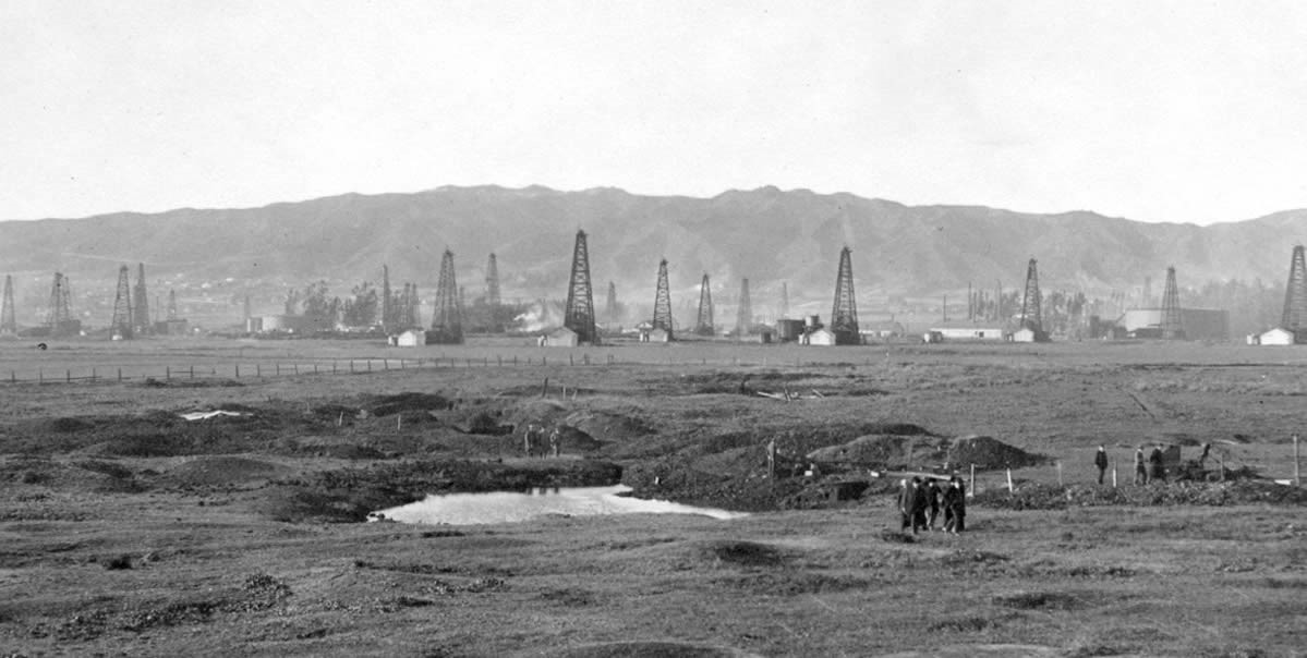 |
|
| (ca. 1910)* - View looking north from where Wilshire Boulevard is today, showing a group of men standing by a small pond of tar in an area known as La Brea Tar Pits, Hancock Park. Oil derricks belonging to the Hancock Family can be seen beyond the pond. Further north are some oil derricks belonging to A.F. Gilmore Oil Co. |
Historical Notes The La Brea Tar Pits are a group of tar pits around which Hancock Park was formed, in urban Los Angeles. Natural asphalt (also called asphaltum, bitumen, pitch or tar—brea in Spanish) has seeped up from the ground in this area for tens of thousands of years. Over many centuries, the bones of animals that were trapped in the tar were preserved. La Brea Avenue was named in 1869 with the Spanish word for tar, which was found in nearby pits and used for waterproofing the sod roofs of the adobe houses in the Plaza. The street was part of the 4,439-acre Rancho La Brea, which in 1860 was purchased by Maj. Henry Hancock for $2.50 an acre. |
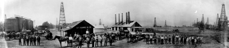 |
|
| (ca. 1910)^ - Panoramic group photo taken in front of the A. F. Gilmore Oil Co. building. View also shows the oil field and oil well drilling rigs in the background. This was at the vicinity of where 3rd Street and Fairfax Avenue exists today. |
Historical Notes In the 1890s, dairy farmer Arthur F. Gilmore found oil on his land in the vicinity of the La Brea Tar Pits. The field was named after the Salt Lake Oil Company, the first firm to arrive to drill in the area. The discovery well was spudded (started) in 1902. Development of the field was fast, as oil wells spread across the landscape, with drillers hoping to match the production boom taking place a few miles to the east at the Los Angeles City field. Peak production was in 1908. In 1912, there were 326 wells, 47 of which had already been abandoned, and by 1917 more than 450, which had by then produced more than 50 million barrels of oil. |
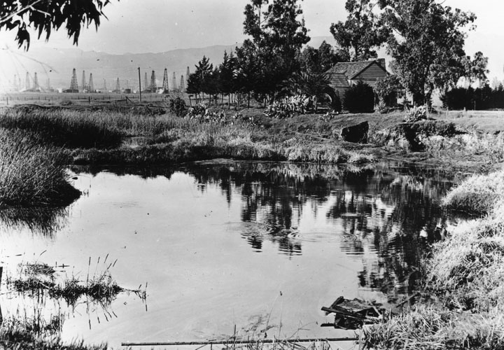 |
|
| (ca. 1910)^ - Standing on the edge of a small pond of tar we can look across it to the old Hancock Ranch House. Off to the left in the distance are the oil fields. |
Historical Notes As a lawyer, Henry Hancock worked for the Rocha family to aid them with their efforts to prove their claim to Rancho La Brea. The Rochas finally won their claim, but like so many other rancheros, their legal expenses left them broke. In 1860 Jose Jorge Rocha, the son of Don Antonio Jose Rocha, deeded Rancho La Brea to Henry Hancock. Hancock began to sell asphalt produced from the famous tar pits that gave the rancho its name. This was the beginning of the Hancock Oil Company. In 1885 Hancock’s widow leased part of the rancho to eastern oil men who went bust by 1888. But in 1902, Mrs. Hancock leased part of the rancho to the Salt Lake Oil Company, which proved a great success. Henry Hancock’s son, George A. Hancock, who had learned the oil business working for Salt Lake, established his own company in 1906. By February 1907, he had over 70 wells producing nearly 300 barrels a day, making the Hancocks one of California’s wealthiest families. The Hancock family built Hancock Park, a large upscale apartment community. The Hancock Oil Company was sold to Signal Oil in 1958. The 1965 Signal was sold to Humble, and both the Hancock and Signal brands vanished. |
 |
|
| (1910s* – View of the La Brea Tar Pits looking north with the Hancock Oil fields in the background. |
Historical Notes In the 1870s, Henry Hancock found the skeletal remains of a dinosaur as well as one Indian woman within the tar pits. The area that contains the skeletal collection and the Tar Pits is what is now called Hancock Park. |
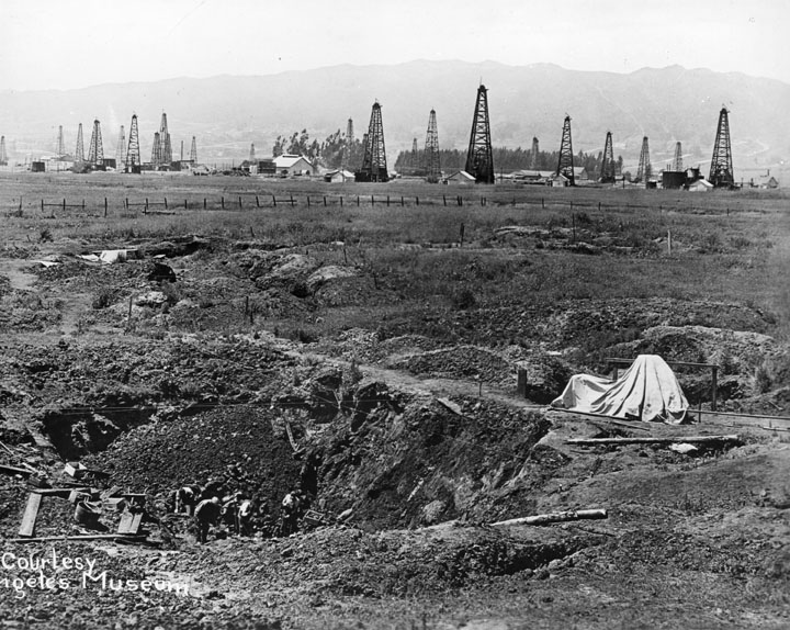 |
|
| (1911)^ - A view of the Los Angeles Museum excavations for pleistocene animal remains at Rancho La Brea. This picture shows the progress in the field after 2 years of work. Beyond lay the Hancock Oil fields and the Hollywood Hills. Several men are working down in the pit. |
Historical Notes After Henry Hancock's death (1873), his widow, Ida Hancock, opened the La Brea tar pits to scientific excavation, closing it to poachers and granting university researchers exclusive rights to uncover the treasure trove of ancient skeletons smothered in the thick "brea." |
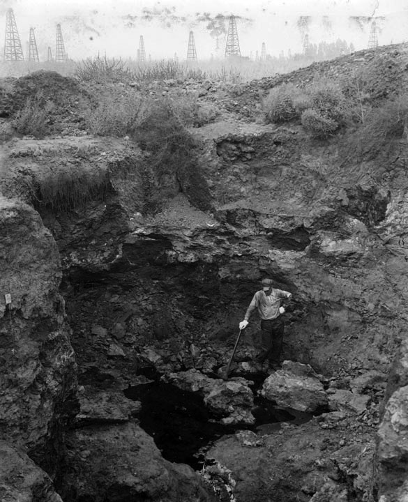 |
|
| (ca. 1911)^ – Close-up view showing a worker holding a pickaxe at the bottom of one of the tar pits located on Rancho La Brea. |
Historical Notes The La Brea Tar Pits was not only a place to find the remains of very old animals, but its tar was also used, in the 1800s, for roofing and housing material. |
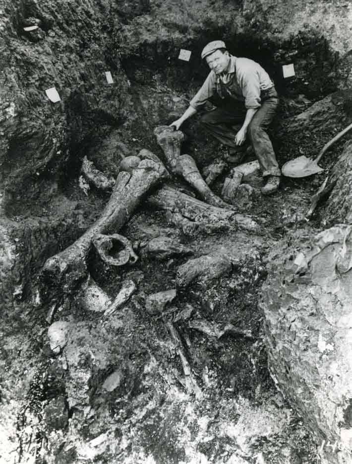 |
|
| (1920)* – A worker uncovering several large dinosaur bones from one of the tar pits. |
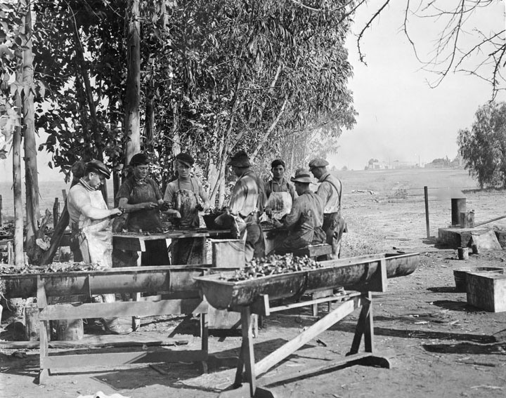 |
|
| (1911)^ – View showing men cleaning bones from tar pit. After the bones have been removed from the pit they are cleaned in order to removed excess oil and asphalt. To help in the cleaning they are immersed in hot kerosene. |
Historical Notes Union Oil geologist W. W. Orcutt is credited with first recognizing fossilized prehistoric animal bones preserved in pools of asphalt on the Hancock Ranch in 1901. These would be the first of many fossils excavated from the La Brea Tar Pits. In commemoration of Orcutt's initial discovery, paleontologists named the La Brea coyote (Canis orcutti) in W. W. Orcutt's honor.*^ W.W. Orcutt would go on to retire at his ranch in the northwest San Fernando Valley. In 1965, the Orcutt Ranch estate and gardens was designated Los Angeles Historic-Cultural Monument No. 31. |
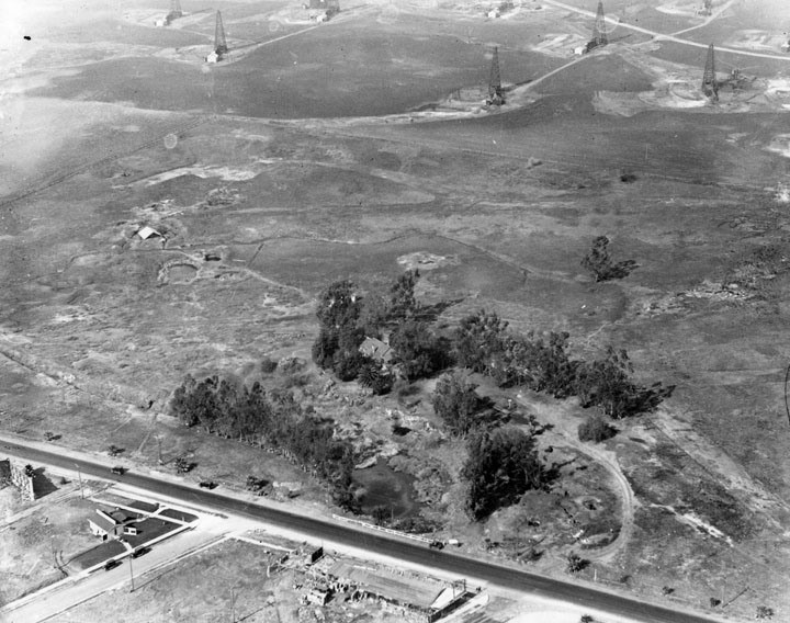 |
|
| (ca. 1920)^ - Aerial view of the La Brea tar pits and oil derricks. Seen from the air you have to look carefully at the foreground (across the road from the buildings) to see the pits among the trees, along with a building in the trees. A few pits can be seen in open area. At the top of the picture are a few of the derricks from the oil field. |
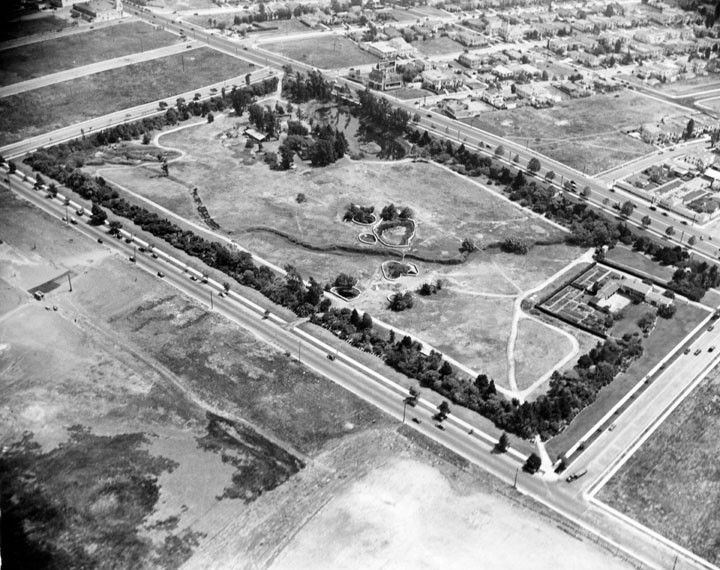 |
|
| (1924)^ – Aerial view looking southeast showing the La Brea Tar Pits and new housing development. Wilshire Boulevard runs diagonally at upper-right, Curson Ave is in the upper-left and 6th Street runs diagonally at bottom. |
Historical Notes After its peak (1908-1917), oil production declined rapidly. Land values rose, corresponding to the fast growth of the adjacent city of Los Angeles, and the field was mostly idled in favor of housing and commercial development. The early wells were abandoned; many of their exact locations are not known, and are now covered with buildings and roads. |
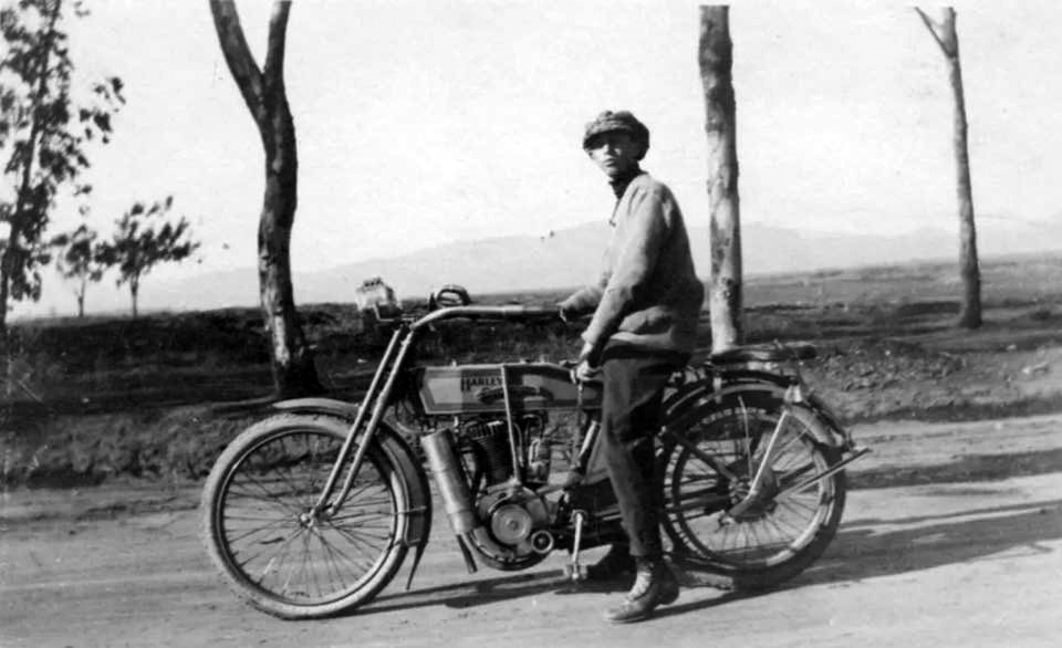 |
|
| (1910)* - View looking north showing a young man from the San Fernando Valley sitting on his Harley on Wilshire Bouelvard with the Hollywood Hills in the distance. |
Historical Notes In 1903, William Harley and his childhood friend, Arthur Davidson founded Harley-Davidson, Inc. (H-D), or Harley, in Milwaukee, Wisconsin. Production in 1905 and 1906 were all single-cylinder models with 26.84 cubic inches engines. In February 1907 a prototype model with a 45-degree V-Twin engine was displayed at the Chicago Automobile Show. These first V-Twins displaced 53.68 cubic inches and produced about 7 horsepower. This gave about double the power of the first singles. Top speed was about 60 mph. Production jumped from 450 motorcycles in 1908 to 1,149 machines in 1909. Harley is one of two major American motorcycle manufacturers to survive the Great Depression (along with Indian) |
* * * * * |
Please Support Our CauseWater and Power Associates, Inc. is a non-profit, public service organization dedicated to preserving historical records and photos. We are of the belief that this information should be made available to everyone—for free, without restriction, without limitation and without advertisements. Your generosity allows us to continue to disseminate knowledge of the rich and diverse multicultural history of the greater Los Angeles area; to serve as a resource of historical information; and to assist in the preservation of the city's historic records.
|
For more Historical Los Angeles Views click one of the following:
For Other Historical Views click one of the following:
See Our Newest Sections:
To see how Water and Electricity shaped the history of Los Angeles click one of the following:
Water:
Power:
* * * * * |
References and Credits
* DWP - LA Public Library Image Archive
^ LA Public Library Image Archive
^*The Valley Observed: Street Name Origins; Timeline of Valley History
*# blogdowntown: Third Street Tunnel
#* About.Com: History of Electric Vehicles
#^*San Fernando Valley Relics - valleyrelics.com: Universal Studios Tour Opening Day
#**California Historical Society Digital Archive
#*^Library of Congress: Panoramic view over Central Park, ca. 1911
*##LA Times: Dig Into History You'll Find Snake Oil..Victor Girard Kleinberger ; Building the LA Aqueduct
^##Metropolitan Transportation Library and Archive
*#*Historical Los Angeles Theatres: The Philharmonic Auditorium; Downtown Theatres
*^#LincolnHeightsLA.com: Legion Ascot Speedway
^*#California State Library Image Archive
+^^Facebook: Garden of Allah Novels
*#^History of Hermosa Beach - Maureen Megowan
^#*City of Redondo Beach HIstory
^^*Early Downtown Los Angeles - Cory Stargel, Sarah Stargel; Hollenbeck Hotel
***Los Angeles Historic - Cultural Monuments Listing
**^Historicechopark.org: Echo Park Lake
*^*California Historical Landmarks Listing (Los Angeles)
*^^Nuestra Señora la Reina de los Ángeles: losangelespast.com
+^^ComptonCity.org: History of the City of Compton
^^^Aerofiles - US Aviation Firsts
**^^History of the Rosslyn Hotel
***^Oviatt Library Digital Archives
**^*Historical LA Theatres: The Philharmonic Auditorium
****Windward Avenue - virtualvenice.info
*##*Chatsworth Historical Society
*^#^Huntington Digital Library Archive
^*#^Studiotour.com
**#^LA Magazine: How Ivanhoe Canyon Became Silver Lake
*#*^HistoryLosAngeles.blogspot.com: Lankershim Hotel
^*##Calisphere: University of California Image Archive
^^*#UCLA Library Digital Archive
^^#^Faceebook.com - Great Photos from Los Angeles' Past: 1903 Sunset Blvd.
^#*^Facebook.com - Bizarre Los Angeles
^^^#Los Angeles Fire Department Historical Archive
^^**Gary Kennemer Collection: Palm Tree Truck
^#**Facebook.com - City of Angels: Alligator Farm; Lankershim Hotel
*^^*Vintage Los Angeles - Facebook.com: Bliss Station; Broadway and 1st Postcard
#*#*UC Riverside Image Archive
#^#^Zotzelectrical.com: Baker Motors
##^^City of Angels: 1910s - Facebook.com
##++Facebook.com - Beverly Hills Heritage
#^*#Urban Diachrony - Occidental Hotel; Intersection of 3rd and Spring Streets
#^^*Oceanpark.wordpress.com: Ocean Park Time Line
#^**Ocean Park History: oceanpark.wordpress.com
#^*^Pinterest.com: Old Hollywood
#*^*Santa Monica Beach Stories
#^#*A History of the San Fernnando Valley: lahistoryarchive.org
#+++Yahoo.com: Beverly Hills Hotel
#^*^#Laurel Canyon Association
***^^Will Rogers Memorial Park
**^*^Pacific Electric Historical Society
^***^Ow.ly: Lake and 12th - Before and After
^^*^^La Brea Tar Pits - Need Supply Co.
^^^^*Bureau of Street Lighting Image Archive
*^^^*LA Bureau of Street Services: bss.lacity.org
^^^*San Fernando Valley Relics: Facebook.com
^^##^LincolnHeightsLa.com: Selig Zoo
**# KCET - Lost Tunnels of Downtown LA; Three Forgotton Incline Railways; A Brief History of LA Bridges; A Brief History of Palm Trees; LA Flood of 1938: Cement the River's Future; Griffith Park
^#^Noirish Los Angeles - forum.skyscraperpage.com; Windsor-Wilshire Streetlight; Sixth and Spring Streets (CHS); Fire Station Horses and Dogs; 1907/1909 LA Panoramic; 1910 Broadway; Lookout Mtn. View; Steamroller; LA Times Building Bombing
*^ Wikipedia: H.J. Whitley; Occidental College; Beverly Hills; Beverly Hills Hotel; Los Angeles Railway; Pershing Square; Broadway Tunnel: Isaac Van Nuys; Sawtelle; Port of Los Angeles; Tournament of Roses Parade; Angels Flight; Occidental College; Mt. Washington, LA; Broadway, LA; Hancock Park; La Brea Tar Pits; Los Angeles City Oil Field; Deadman's Island (San Pedro); Moses Sherman; Rose Bowl Game; Hollywood Hotel; Hollywood HIgh School; California Club; San Pedro; Salt Lake Oil Field - Gilmore Oil Field; Westwood; 2nd Street Tunnel; Hermosa Beach; Los Angeles Memorial Coliseum; Redondo Beach Pier; Redondo Beach; West Hollywood; Pacific Palisades; 1910 L.A. International Air Meet at Dominguez Hills; Hancock Park; Marlborough School; Farmers and Merchants Bank; North Hollywood; Sunset Boulevard; Coldwater Canyon; Compton; North Hollywood; City of San Fernando; History of Los Angeles Population Growth; Selig Polyscope Company; Nelson Story; Los Angeles Philharmonic; International Savings & Exchange Bank Building; Engine House No. 18; Los Angeles Alligator Farm; James Boon Lankershim; Universal City; Church of the Open Door; MacArthur Park; History of the San Fernando Valley; Fremont Hotel; Lafayette Park; Laurel Canyon; Lincoln Park (Eastlake Park)
< Back